



Tvrziště (Velké Albrechtice) Motte
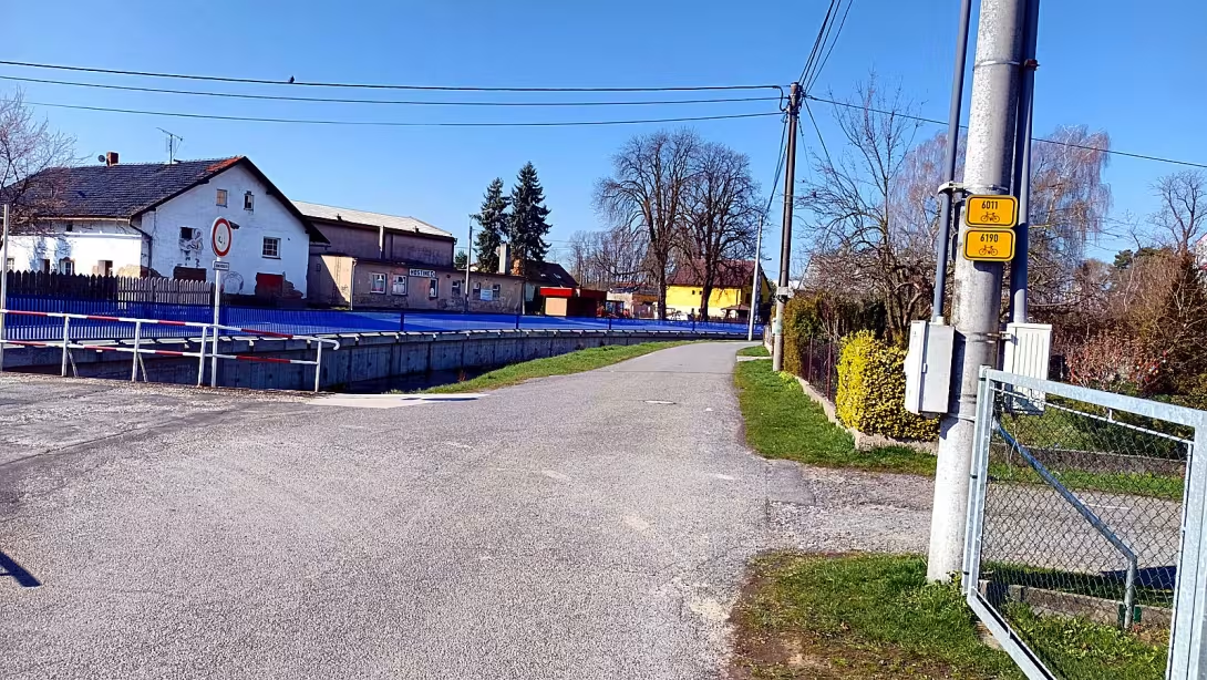
Objekt se nedochoval — na místě dnes nestojí. Následující text popisuje jeho historii, ne současnou návštěvu.
The water fort in the village of Great Albrechtice, the district of Nové Jicin, is an archaeological site dated from the turn of the 13th and 14th centuries. This historic location is located on the island in the middle of the pond and bears witness to the medieval settlement.
We have little concrete information about the creation of the building, but the sources suggest that the fortress was built at the turn of the 13th and 14th centuries. The first written mention of it dates back to 1424 in the papers of the lords of Kravař who managed the white estate, which was the village of Albrechtice.
The fort was built as a water building on an island in the middle of a pond. The total area of the complex was 6996 m ². Although the building itself no longer exists, the archaeological survey by Gustav Stumpf confirmed the existence of a populated site in 1921. The objects found include fragments of medieval ceramics, in particular loštic cups, containers and tile fragments from the 15th century.
The fate of the fortress was linked to many noble generations. After the lords of Kravař since 1437, a part of the village was owned by the other princes Václav II, Wilhelm I and Arnešt. In 1438 it was stopped by the brothers Mikuláš and Václav Zajíček from Hoštálkovice. Later, the village was owned by various nobles such as the Fulstejns, Jan of Doloplaz, Mladota of Potštát and Merta of Prusinovic. Between 1447 and 1464, a part of the village was held by the brothers Smil and Oldřich Kobylková from Kobylí, who shared ownership with Margaret of Kobyli and Albrechtic. Subsequently, Toman from Kovalovice bought the share and in 1464 it was owned by Markéta from Kobylí together with his husband Bohuslav Kokorský from Kokor. Anezka from Domashýc was also based here before 1476. In 1486 Bohuslav sold Kokorský manhood to Bílovec, which stopped the fort from fulfilling its original function because there was no more estate.
Major events include the invasion of the village by the stealth knight Jan of Messenpek and on Rožnov, which occurred sometime before 1447. Václav of Kravař then sued this knight in the Moravian court.
Today, the site of the archaeological site is owned by the village of Great Albrechtice. The building is registered in the monument catalogue of the National Heritage Institute and is subject to protection since 1958. The island itself is not accessible to the public, it is accessible only around the pond, where it exercises fishing rights of the Fishing Association of the Great Albrechtice o.s. Locality is also part of the search games.
This archaeological site represents a silent witness to the medieval settlement of the region. It is advisable to stop around and realize the history that took place here.
Historical milestones
- 1424
- The first mention of a water fort in the sheets of gentlemen of the Kravař.
- 1921
- An archaeological survey conducted by Gustav Stumpf.
- 1958
- Memorial protection of the site since May 3rd.
Architectural development
The fortress was built as a water building on the island in the middle of the pond. The archaeological findings of the 20th century confirmed the existence of medieval ceramics, loštice cups and tiles from the 15th century. The total area of the complex was 6996 m ².
Historical events
1424: First written mention of the fort in the sheets of the lords of the Kravař. 1447: Assault of the village by the thieving knight Jan of Messenpek. 1486: Sales of manhood by Bohuslav Kokorsky to the White Tower and the subsequent demise of the fortress.
Owners
Lords of Kravař (until 1424), princes of Opava (from 1437), brothers of Zajíček (from 1438), brothers of Fulštejn (from 1467), Jan from Doloplaz, Mladota from Potštát, Merta from Prusinovic, family of Kobylk, Toman from Kovalovice, Bohuslav Kokorský from Kokor, Anežka from Domashovec, followed by the estate of Bílovík (after 1486).
Points of interest
The water fort was built on an island in the middle of a pond. The archaeological survey in 1921 confirmed the existence of a populated area. - The objects found include fragments of medieval ceramics and tile fragments from the 15th century. - The building is registered in the historical catalogue and is protected since 1958. The island itself is inaccessible to the public.
Guide
Show guide text
This text was created by artificial intelligence and has not been editorially reviewed. It may contain inaccuracies.
Welcome to the place where time stops and where water meets deep history. You are standing at an archaeological site in the village of Great Albrechtice, a place that once carried a much louder and more important name. Even though your eyes look at a peaceful landscape today, try to imagine in your mind what happened here. You may now only see the calm surface or the remains of the old world, but under your feet and around you lies a story that has lasted for centuries. This area, known as the fortress, was once an impressive water fortress that dominated the surrounding area. Even if you can't see the high walls or the solid gates that welcome you, the atmosphere of this place still carries the echo of ancient power and meaning.
Let us now move together deeper into the past. To understand why this place is so special, we have to go back to when it started to build here. The history of this fortress dates back to the turn of the 13th and 14th centuries. At that time, the surroundings were not as quiet as you know them today, and the need for safety was absolutely vital to the people at the time. Imagine the strategic idea that led the builder. This fortress wasn't built on a solid ground. It was placed on an island in the middle of a pond. This choice was very thoughtful. The water around the island served as a natural protection, a barrier the enemy could not easily overcome. Being in the middle of the water meant being safe and having a view of the whole surrounding region.
The first clear clues that tell us about this place are from a thousand and four hundred twenty-two. In the then papers, which were owned by the gentlemen of the Kravař, there was a first mention of this water fort. This gives us certainty that the place already had its solid foundation and its role within the world at that time. This fortress was not only a military point, but it served as a residence for various noble families. Imagine the people who lived here, their daily life, their joy and their fears, while looking at the water surrounding their home. This fortress was the heart of their world until gradually, at the end of the 15th century, it began to perish.
Now pay attention to what you see around you. Although there are no structures here today that you could just explore, the very location and character of the place tells you about the architecture of the past. Notice how this place is connected to water. Even though the ruins and remains are now only within the framework of archaeological research, you can feel the proximity to the pond that was so important to the indigenous people. The architecture of this fortress was directly dependent on its location. It had to be resistant to moisture and at the same time able to use an island position for defence. Even if you don't see concrete stone shapes or roofs today, try to see the overall structure of this place. It is a place where human thoughts of safety and strength have interconnected with natural conditions.
However, in order to find out the real details of what really happened here, we need to look at the work of people who took care of this place much later. One of the most important names associated with this place is Gustav Stumpf. In the year one thousand nine hundred twenty one, this man conducted an archaeological survey that changed our view of this fortress. It was thanks to his work and efforts that we could learn that this place was not just an empty area, but a truly populated place where life took place. Thanks to him, we know that real evidence of the existence of humans is hiding beneath the layers of the earth.
The things found during these surveys include small but extremely valuable objects. Imagine the joy of an archaeologist finding fragments of medieval ceramics in the ground. These pieces of containers that people used to eat or store supplies allow us to touch the past almost directly. There were also fragments of tiled elements from the 15th century. These tile balls tell us that there were spaces in the fort that were decorated or heated, which suggests a certain level of life and comfort that the noble families required here. These tiny objects are like pieces of a puzzle, which gradually consist of a whole picture of an old life.
In addition to the work of archaeologists, there is also the name John of Messenpek and on Rožnov. Although we do not have detailed reports of his specific actions in this place, his name reminds us that this fortress was part of a wider network of power ties and noble families that were based here. Every such name in history is a key to understanding how the territory was controlled at that time and how the nobles moved between their homes.
You may now wonder why this place remains so important today, when there are no walls left. The answer lies in protecting him. Since the third of May of the year a thousand nine hundred fifty-eight this place has been protected. It is listed in the catalogue of the National Heritage Institute, which means that its historical value is recognised and protected for future generations. This place is not just a pile of soil or empty water space, it's a preserved fragment of our common history.
There's one interesting thing you might find interesting. Imagine the isolation the island's location provided. At a time when there were no modern ways of communication and transport, water was the best ally and the greatest enemy. The fortress was built to use water to its advantage, but it also had to face its forces. This constant game between human efforts to be safe and untamed is what makes this place so fascinating. It's where the human will tried to create a solid base in the middle of the liquid world.
Now that you've learned more about what happened here, who lived here, and how this place was rediscovered, I suggest you take a deep breath and just take a moment to look at the surroundings. Feel the silence, feel the closeness of the water and try to connect all the names and data we have just discussed in your mind. Even if it's very visible, it's very invisible.
Thank you for sharing this story with us. We hope that this short journey over time has brought you new views of this place. Please continue to explore the surroundings and enjoy the beauty of this historic landscape. Goodbye.
Businesses nearby
Do you run a restaurant, accommodation, shop, museum, rental, wellness or other visitor service near this monument? Show yourself directly to the people heading to it — this is how they will see you in the app and on the web:
Events nearby

Zdroj akcí: otevřená data měst a obcí ČR (Národní katalog otevřených dat) a kalendář akcí Národního památkového ústavu.
Nearby
Rybník v obci Velké Albrechtice.
Visualizations and artistic views


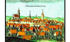
The visualisations are generated by artificial intelligence and serve as inspiration.
Photos from the area
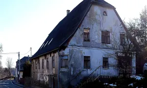
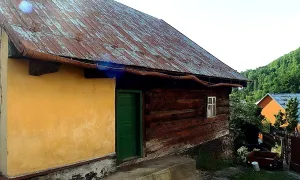
Real photos taken near the monument


Zdroj a licence jsou uvedeny u každého snímku.
Tips from visitors
No tips yet. Be the first!
Log in and add your tip.
Sources and literature
Photos: Kankovaa / CC BY-SA 3.0 — Wikimedia Commons. The author and licence also appear when you hover over the image.
Faktickým podkladem tohoto textu byl článek na Wikipedii, jehož autory jsou přispěvatelé Wikipedie. Článek je dostupný pod licencí CC BY-SA 4.0.
Location on the map
More monuments – Moravskoslezský kraj
Show all in the region
Příběhy a pověsti
Legendy, pověsti a příběhy spjaté s touto památkou

Fotografie návštěvníků
Zatím žádné fotografie. Buďte první, kdo přidá fotografii z návštěvy!
Log in a přidejte svou fotografii nebo hodnoťte.
Za ověřenou návštěvu v aplikaci získáte víc bodů — poznáme podle GPS, že jste na místě.
Reviews and comments