



Rudný revír Eliášské údolí Mine
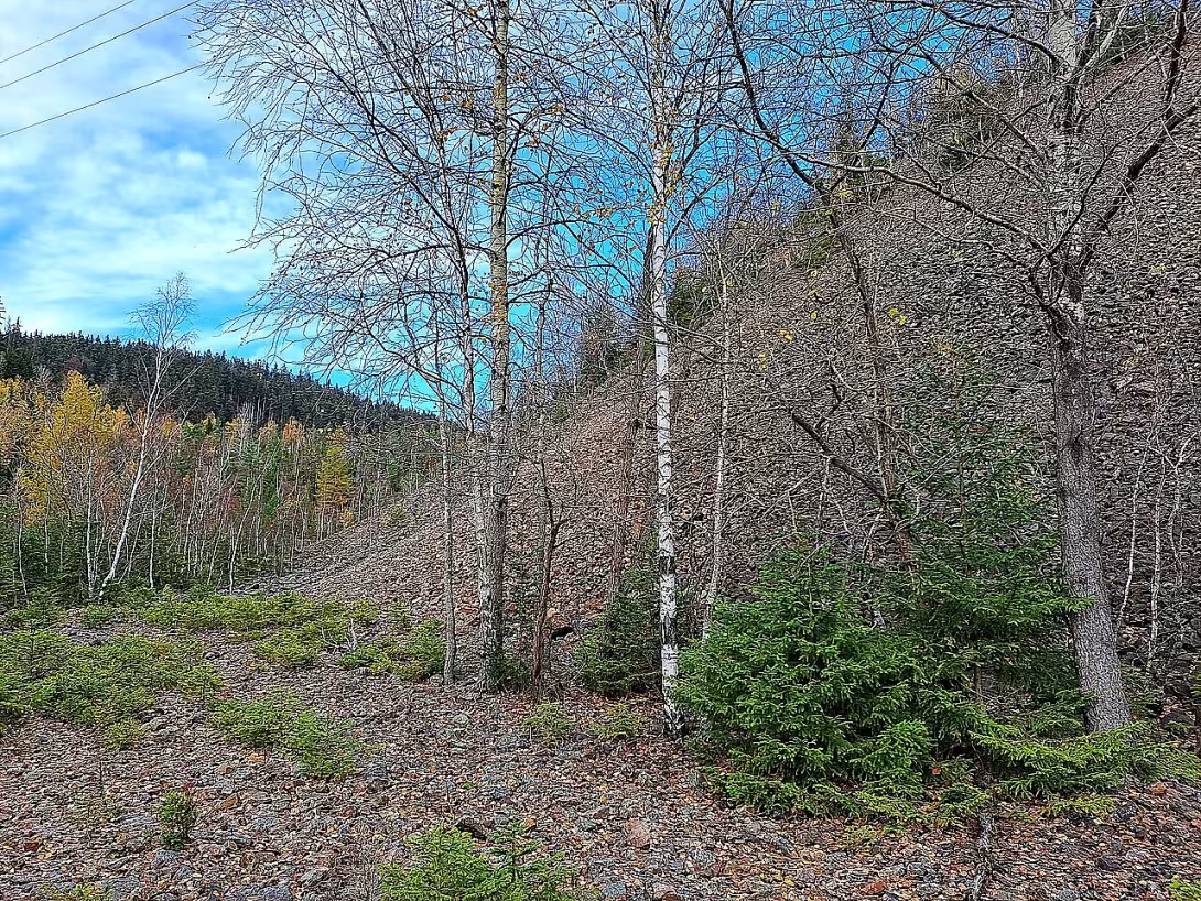
The Elias Valley is a former red area in the Erzgebirge Mountains in the territory of the historic upper town Jáchymova in the Karlovy Vary Region. It is a conservation area which combines the remains of silver and uranium mining. Since 2019, it has been included in the UNESCO World Heritage List as part of the Erzgebirge / Krušnohoří Mining Region.
The area is situated northwest of Jáchymova between the settlements of Příšek, Zálesí and Cihelna. The mining in the valley, which the older miners called Lower Niklasberg, began in the 1920s. At that time, veins were discovered with silver, cobalt and vision redness. Different types of mining structures were created in the development of the area, from small stacks to large mines. The largest silver-ore mine in the area was Elias' bow pit. A specific mine was Antonín, which represented the only object in this region to mine iron ore.
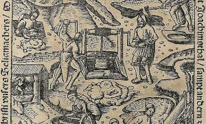
In order to ensure efficient operation of heavy wheels and mine pumps, water management in the form of Heinz Pond, now known as Hot Pond, was established around 1540 on the river of Elias. Another milestone in the development of the area was the establishment of the Rudolf shaft in 1736 which was later renamed Werner and after 1945 to Equality. In the 19th century, after the silver was exhausted, uranium ore was extracted and radioactive water was used for therapeutic purposes in Werner Mine.
A key change in the form of extensive uranium mining occurred after 1945. The pits of Elijah and Eve's apple trees were returned to service. A new Jirina shaft was created at the Elijah pit, the Adam and Eve shafts downstream of the stream and shaft No. 14 at the Equation Pit. In 1948, under the abandoned mine, Antonín started digging down the Eduard mine. Production during this period was associated with hard working conditions. Between 1946 and 1949, German prisoners of war worked here, which were subsequently replaced by political prisoners. In the vicinity of the mines, detention camps and later penal labour camps were therefore set up.
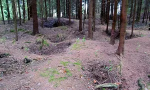
From the point of view of architecture, the valley preserved mainly relics of the installation landscape. From the 16th century, intersecting systems of gin and roll remained. The technical monument is Heinz's pond and adjacent water trenches. The buildings from the period of modern uranium mining remained the minimum, namely the central compressors' torso and the unique remnants of walls and structures. A significant landscape element is the huge draught of uranium shafts.
After mining in the first half of the 1960s, most of the mining and labour camp buildings were destroyed. In the 1970s, a biathlon site was built at the noise drain at the Eduard mine, which later grew into a leisure activity complex.
The current state of the region defines its ecological and mineralogical value. The droppings are a site of rare minerals, such as pitch, bismuth, annabergite or namibit. Specific conditions have allowed for the growth of endangered orchids, such as dark red or triangular beads. The monument is now accessible through the learning trail of Jáchymov Hell, and on the suffering of the prisoners it resembles the Skautan Cross.
The Elias Valley offers a unique view of the layered history of mining from Renaissance to modern times. It is a place where technological development meets the tragic fate of people and rare nature. Visiting this space allows you to understand the importance of Jáchymova within the World Heritage.
Historical milestones
- 1540
- The founding of Heinz Pond (now Hot Pond) to power heavy wheels and pumps.
- 1736
- The rudolf shaft.
- 1948
- The beginning of digging down Eduard below the abandoned mine of Antonín.
- 2018
- Announcement of the Elias Valley by cultural monument of the Czech Republic.
- 2019
- Entry into the UNESCO World Heritage List as part of Erzgebirge / Krušnohoří Mining Region.
Architectural development
The territory combines the historical systems of the 16th century pines and rolls with modern uranium shafts. Only the central compressor room and the unique wall remains have been preserved from the buildings. Water trenches and ponds are an important technical part.
Historical events
1540 the establishment of Heinz Pond for mining purposes; 1736 setting up the Rudolf shaft; 1946-1949 the work of German prisoners of war in uranium mines.
Points of interest
- The territory combines the remains of silver and uranium mining and is listed in the UNESCO World Heritage List. - The mine Antonín was the only object in this region to mine iron ore. In the 19th century, the Werner mine started using radioactive water for medical purposes. From 1946 to 1949, German prisoners of war and later political prisoners worked here. - The drains are a site of rare minerals and have made it possible to grow endangered species of orchids.
Guide
Show guide text
This text was created by artificial intelligence and has not been editorially reviewed. It may contain inaccuracies.
Welcome to Elias Valley, heart of Jáchymov. Right now, you're standing in the middle of a place where nature slowly returns to its rights and wraps up traces of thousands of hours of hard work. If you look around you, you may not see any spectacular palaces or tall towers, but you will see something much more precious. In front of you is a real example of the old mining landscape. Notice the strange shape of the terrain, the piles of drilled rocks that we call the bulge, and the remains of the old shafts and shafts. It's a space that tells the story of a deep desire for a man to reach the treasures hidden deep underground.
Let us now return together in time to understand why this valley is so extraordinary. Mining in this area is not new, it started here in the 16th century. At that time Jáchymov was not what we know today, but it was the center of the shaft digging in the Erzgebirge Mountains. The first miners came here looking for precious metals, namely silver, cobalt and vismuth. Imagine the first people who, with simple tools in their hands, entered the darkness of the rocks, leading hopes of wealth. One of the first big steps in the development of this region was the establishment of Heinz Pond, which we now know as Hot Pond. It happened in the year one thousand five hundred forty. This pond was not intended to rest, but served as a key source of water. It was powered by heavy wheels and pumps, which was the only way to get water from the depths of the shafts and extract ore from them. Without water, mining in such deep areas would be impossible.
When you go further, pay attention to the overall layout of the landscape. Notice the system of pins and rolls. Pinek are basically piled piles of rock residues that did not contain enough metals and were therefore thrown to the surface. These piles are silent witnesses to thousands of tons of escaped material. Notice how these elements intersect with the surrounding greenery. It's a fascinating contrast between industrial intervention and nature regeneration. There are different periods of mining in this area. In addition to the oldest traces, you will find remains from a later period. For example, the Rudolf shaft, which was founded in a thousand seven hundred thirty-six, represents another layer of the history of this place.
Let us now talk about how the character of this valley has changed in a more recent historical context. Elijah Valley is not just about silver and cobalt. After a year of a thousand and nine hundred forty-five, a completely different chapter took place here. At that time, attention shifted to uranium mining. This was a material that at the time gained great strategic importance. It was during this period that new spaces were dug. In the year one thousand and nineteen forty-eight the mine of Eduard began to emerge, which was dug under the already abandoned mine of Antonín. This layer, where the new shafts dig below the old ones, is typical of Jáchymov and shows how the miners tried to use every piece of vein left over from previous generations.
Here we come to one of the most interesting parts of this region. Notice that the Elias Valley combines within itself the remains of completely different periods. It's where the silver era meets uranium. This is one of the main reasons why this territory is so valuable today. In the year two thousand and eighteen, the valley was declared a cultural monument of the Czech Republic and already a year later, in the year two thousand and nineteen, it was included in the UNESCO World Heritage List as part of the mining region of Krušnohoří. This means that the values you see here are not only significant for Jáchymov or for us, but they are valuable for all mankind.
Allow me to interest you now in some interesting things that you will not find in ordinary maps. Most of us associate Jáchymov with precious metals and uranium, but there is one exception in this region. The mine Antonín was the only object in the entire valley, which was intended to mine iron ore. It's a little unique in a sea of precious metals. And if you're interested in anything unusual, think about the Werner mine. In the nineteenth century, radioactive water was used here for medical purposes. People believed in her ability to cure diseases, which shows us how the view of natural resources and their properties changed over time.
Now, if you look around you, feel the atmosphere of this place. It's a quiet valley, but in its depths the noise of thousands of machines, sweat and labor of thousands of miners. Imagine the people who worked here in the darts, in the dust and in the cold to pull the most precious thing out of the depths of the earth. Even though we don't see people with pickaxe today, their presence is in every stone and every curvature of the terrain.
I will now invite you to move on slowly and explore the rest of this valley. Follow the roads, observe the details in the landscape and be accompanied by the history that has taken place here for centuries. The Elias Valley is like an open book, where each layer of rolls is a new page. It's a place where one feels small before the power of the earth and fascinated by the ability of one to conquer the country.
Thank you for coming through these first steps with me in the Elias Valley. I wish you a pleasant walk and an inspiring rest of the time in Jáchymov. Remember to perceive the silence of this place, which now speaks for all those who once worked here. Goodbye.
Tips for visitors
The best time to visit is autumn months, when the colour leaves of the Erzgebirge Mountains highlight the atmosphere of the former mining area and the remains of the landscape. For transport to Jáchymova use your own car or public transport, check the specific connection in the current timetables.
In the valley you can use solid shoes suitable for the field because it is an area with ruins and natural surfaces. We also recommend plenty of water and a map of the surrounding area.
For the best photos, set off in the morning or late afternoon light, which creates deep shadows in the red structures. Focus on details of the remains of mining works and contrast between technology and nature.
During the visit you can visit the settlements of Příšek, Záleší and Cihelná, walk the educational path of Jáchymov Hell or visit the biathlon area.
Families with children will appreciate exploring the area as an adventure trip to history. We recommend focusing on the educational path that will guide children through the landscape in a more entertaining way.
Frequently asked questions
Can the monument be visited?
This is a technical monument. Some are open as exhibitions, others are out of use or on private land. We have not verified whether this one is accessible.
What are the opening hours and admission?
We have not verified the opening hours or admission. Current information is published by the operator.
Where is the monument?
Location: Jáchymov. The map on this page shows the exact spot.
Why is the monument protected?
It is listed in the Central List of Cultural Monuments of the Czech Republic as a cultural monument (register no. 1619804347).
Businesses nearby
Do you run a restaurant, accommodation, shop, museum, rental, wellness or other visitor service near this monument? Show yourself directly to the people heading to it — this is how they will see you in the app and on the web:
Nearby
Osady Vršek, Zálesí a Cihelná, naučná stezka Jáchymovské peklo a biatlonový areál.
Accommodation nearby
Trips and activities nearby
Guided tours, tickets and activities nearby from GetYourGuide
Affiliate link: if you buy from the partner, we may receive a commission. The price for you does not change.
Search tours and activities →Themed route
Here is the design of the cruise route:
1. Biathlon complex (sports complex) - An ideal place to start the journey and warm up in nature. 2. Educational Path Jáchymov Hell (Path) - It offers interesting views of the landscape and the history of the place. 3. Rudný revír Eliášské údolí (others) (monument) - The main destination of the trip where traces of ancient ore mining can be observed. 4. Top, Tail and Brickle (inhabited parts) - Walk between local houses for a sense of peace and knowledge of the surroundings.
Seasonal recommendations
In spring the valley awakens to life and green vegetation begins to cover the remains of old buildings. The air is fresh and moist, which highlights the smell of surrounding forests. We recommend shoes with fixed soles because the roads can be muddy after melting snow. The best is to set off in the morning when light is soft and nature is the most colorful.
In the summer months they dominate the landscape with rich colors and thick leaves, which naturally covers parts of ruins. The sun creates sharp shadows in empty spaces of technical objects. Due to the heat it is advisable to choose light, breathable clothes and take enough water. The ideal time for visiting is early morning or late afternoon to avoid the greatest heat.
Autumn brings golden and red shades to the valley that create a melancholy atmosphere combined with crumbling masonry. There are often fogs that give the place secrets. It is advisable to wear layers of clothing that protect against cold wind. The most striking experience is offered by half of October, when the colour of the leaves is at the highest point.
Zimą the landscape is quiet and white snow unifies the appearance of ruins with the surrounding terrain. The atmosphere is raw and freezing, which underlines the character of the former industrial site. Wet shoes and warm winter clothes, including gloves and hats, are essential. We recommend a visit at a clear lunch hour to make enough daylight for safe field movement.
Visualizations and artistic views

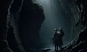
The visualisations are generated by artificial intelligence and serve as inspiration.
Photos from the area
Real photos taken near the monument

Zdroj a licence jsou uvedeny u každého snímku.
Tips from visitors
No tips yet. Be the first!
Log in and add your tip.
Sources and literature
Photos: Hubert Kororo / CC BY-SA 4.0 — Wikimedia Commons. The author and licence also appear when you hover over the image.
Faktickým podkladem tohoto textu byl článek na Wikipedii, jehož autory jsou přispěvatelé Wikipedie. Článek je dostupný pod licencí CC BY-SA 4.0.
Location on the map



Příběhy a pověsti
Legendy, pověsti a příběhy spjaté s touto památkou
Fotografie návštěvníků
Zatím žádné fotografie. Buďte první, kdo přidá fotografii z návštěvy!
Log in a přidejte svou fotografii nebo hodnoťte.
Za ověřenou návštěvu v aplikaci získáte víc bodů — poznáme podle GPS, že jste na místě.
Reviews and comments