



Hradiště Udánky Motte
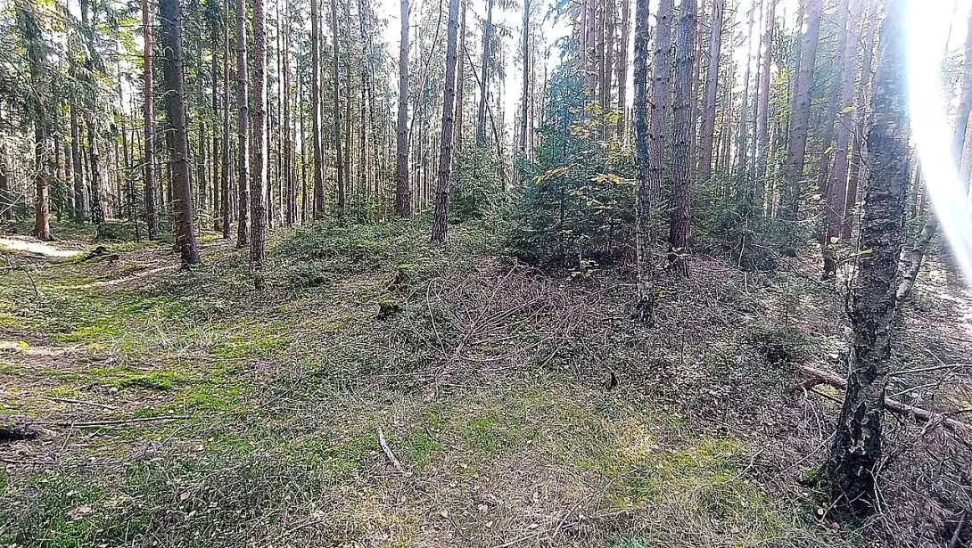
The German Castle, also known as the German Castle, is a medieval motte-type fortress located in the Pardubice region three kilometres west of the Moravian Třebová in the cadastral part of the village of Susice. The volume is protected as a cultural monument and represents an archaeologically well-explored example of the woodland and later the stone fortress of the lower nobility from the 13th to 15th century, which disappeared without direct reference in the written sources.
The creation of the building dates back to the second half of the 13th century, when a system of harbours serving as a seat of lower nobility developed massively in Czech countries. The first written mention of the village of the Event dates back to 1365, when the village was part of the estate Moravská Třebová, within which it remained until the end of the feudal period. The fortress itself is missing in the written sources; its existence and its original function is evidenced by the German local name * Wallgraben *, literally a moat wall. The archaeological research carried out by Herbert Weinelt in 1937, Jan Haml in 1970 and D. Jelínková in 1976 confirmed the two main construction phases and the way in which they disappeared.
The fortress architecture corresponds to a motte type with base dimensions 24,5 to 18 meters. It is surrounded by a moat of six to 8.5 metres wide, originally powered by water from a nearby stream; The material obtained during its digging was used to increase the artificial hill. In the southern part of the hill there was a stone two-wing building with three inner spaces, the walls of which were one metre wide and the stones were connected exclusively with clay. The fortification consisted of a massive fenced fence, probably covered with clay to protect against burning and reinforced by a dam of soil designed from the outer edge of the ditch.
The ownership relationships are only known from the context of the government: since the first written mention in 1365, the site belonged to the estate Moravská Třebová. The specific owners of the fort or its allocation of the flag in the 13th and 14th centuries from written sources are not known. The fate of the building was dramatic: the first wood-aluminium phase was destroyed by fire, a brick building was built in the 14th century, but it was abandoned and not restored in the 15th century.
Key events include building developments in two stages separated by fire and subsequent abandonment in the 15th century, which correspond to the frequent fate of smaller noble settlements in or after Hussite wars. An important milestone in the modern history of the monument is systematic archaeological research in 1937, 1970 and 1976, which enabled the reconstruction of the ground plan and construction technology.
Today, the location is freely accessible in the field, where the remains of valleys and ditches are well-readable. South of the fortress is led by the bike route No. 4029 and the teaching trail of the Ridge mine path, which facilitates orientation and access. The monument is worth visiting as an example of a motto with remarkably strong stone walls and a well-preserved water defense ditch system illustrating the engineering skills of medieval hardships.
Then and now
Drag the slider to compare how the landmark may have looked when it was built with the view today.
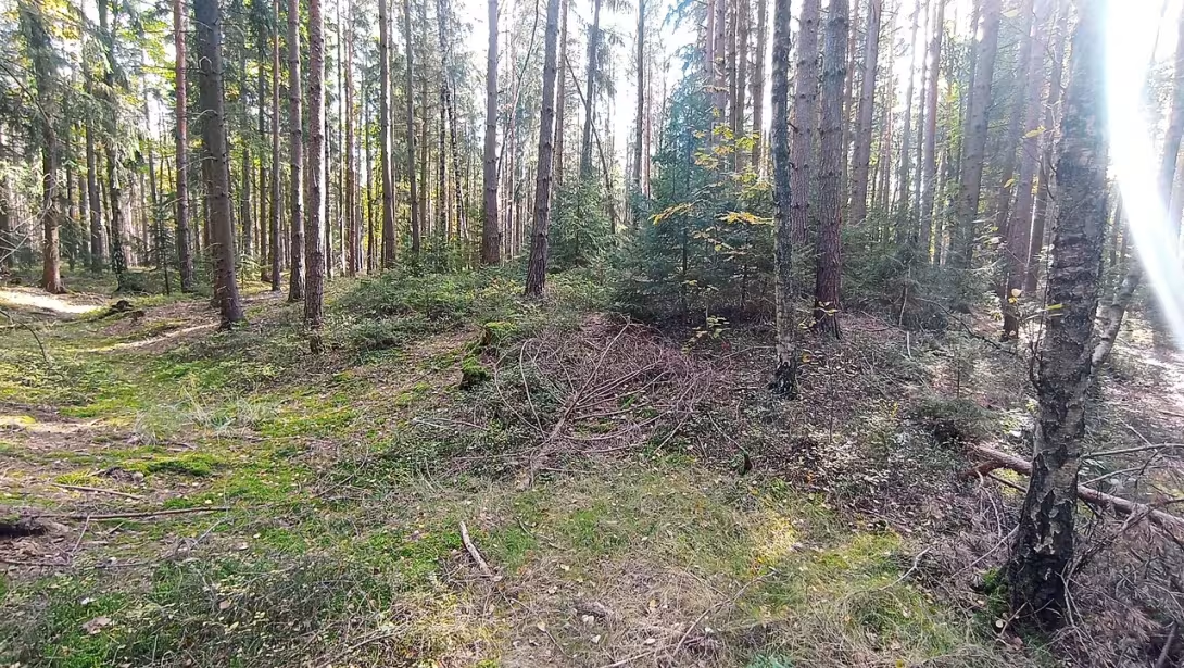
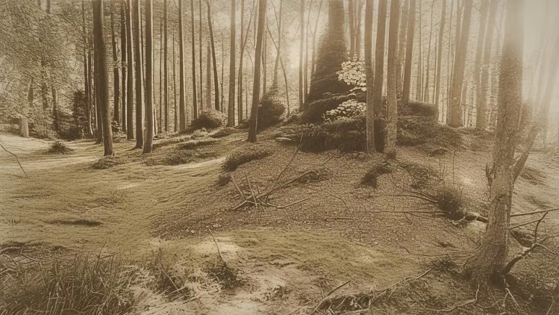
The historical appearance on the left is an AI-generated visualisation and serves as inspiration only.
Historical milestones
- around 1250
- Object creation
- 1365
- First written mention of the village of the Event
- 14th Century
- Walled construction replaces the wood clay phase
- 15th Century
- Object abandoned
- 1937
- First archaeological research
- 1970
- Second archaeological research
- 1976
- Third archaeological research
Architectural development
The first building phase, probably just wood clay, was built in the second half of the 13th century. It died of fire and in the 14th century a brick building was built in its place.
Historical events
- 1365
- First written mention of the village of the Event.
- 14th Century
- A brick building was built on the site of the fort.
Guide
Show guide text
This text was created by artificial intelligence and has not been editorially reviewed. It may contain inaccuracies.
Welcome to the Castle of the Event. Stop for a moment, take a breath and feel the atmosphere of this place where history rests in the silence of the landscape. You are standing right in front of a monument that, in its glory, represented security and power. In front of you, there is a fortress of motte, which is a specific kind of fortified mansion. If you look at the space in front of you, you'll see a hill of approximately 24 and a half feet. It was this high terrain that was the heart of the whole complex. Notice how this space is separated from the surrounding terrain. It is surrounded by a deep moat, which in the past formed the first and fundamental line of defense. Its width ranges from six to eight and a half meters, which, at the time, represented a very difficult obstacle to every enemy.
Let us now move together far further back in time, to the middle of the third millennium, namely around 1250. It was during this period that this object was created. Imagine a landscape that was much wilder and denser. The creation of the castle was at that time a strategic decision on how to control the surrounding area and ensure the protection of the inhabitants. Although the fort itself was established earlier, the first written mention of the village of the Event, with which this place is connected, appeared only in 1365. It's fascinating to think that people lived here and formed a community for ten years before the name of their village first appeared in official documents.
Now pay attention to the very structure you see before you. It has a very interesting engineering principle hidden in it. Look again at the deep moat and then the high hill of the fortress. Nothing was left to chance. The material that was recovered during the digging of the ditch was not taken away, but was used very practically to raise the hill itself. In this way, the builders effectively solved two things at once: they created a deep obstacle for the invaders, while lifting up the residential part of the castle high above the surrounding terrain, giving them a better overview of the landscape. Note also the position of the fort relative to the surrounding area. The moat was originally powered by water from a nearby small stream, so there was once a real water barrier that surrounded the castle and made it even more expensive.
If we move further in time in the picture, we'll get to the 14th century. There has been a fundamental change at this time. The original alumina phase of the construction, when the buildings were raised from wood and clay, was no longer sufficient. It was replaced by a walled-up structure that brought much more resilience and durability. Focus your attention on the south side of the fort. This is where a stone two-wing building used to stand. Try to imagine her in her full size. Inside there were three separate spaces that served different purposes. But what is truly remarkable is the way this building was built. The walls reached the width of one metre, indicating an effort to achieve maximum stability and safety. And yet there was no use here of any complex connecting material we know today. The stones were only connected with clay. It is fascinating to think about how much work and patience required the composition of such massive walls using only natural materials available in the surroundings.
When we look for the personalities that were connected to this place, we have to admit that history is silent. We don't know the names of the architects who designed this system of ditches and waves, nor do we know the names of the people who lived, slept, and planned their future in those stone spaces. But this ignorance gives the place some charm and mystery. Who was the person who first decided that this was where the moat would be dug? In the three inner areas of the stone house in the southern part of the castle, who decided the fate of the locals? Even if names are missing, traces of their work are still present here in the form of landscaping and remains of stone walls.
But in the fifteenth century, the break came. The object has been abandoned. Maybe the political situation has changed, maybe the strategic importance of the fort has changed, or maybe there's just stopped being someone to keep it. Hradiště Udánky slowly began to return to nature, grew into grass and fell into oblivion, while centuries were changing over it. The silence of this place was only disrupted in modern times when people returned here with a desire to reveal the truth about the past. The first archaeological research took place in 1937, which allowed us to reunderstand the structure of this fortress. Later, in 1970, there were second archaeological researches which supplemented the picture of how the castle looked and how it evolved in time.
The interesting detail you can write into your memory is the combination of simplicity and functionality. Imagine the contrast between the clay connecting mass and the metre width of the wall. Or imagine how the water from a small stream slowly filled a wide moat and formed an impenetrable wall of water around a small but solid hill. It is these details that tell us the story of people who have managed to create an effective defense system with minimal resources.
Now I'm leaving you to explore this place at your own pace. Walk around the trench, see the dimensions of this space and try to reconstruct that stone building in the south. Imagine how a fortress that stood here for centuries was born of clay and stone. Let yourself be consumed by the silence and history that is hidden in every grain of clay in this hill. Thank you for accompanying me on this short journey through time. I wish you a pleasant rest of the tour and many new discoveries around Moravian Třebová. Goodbye.
Tips for visitors
The best time to visit is during the spring months when the surroundings of the fort are covered with flowers and trees are in full pollination flower.
It is advisable to bring a waterproof food and drink wrapper with you because there is no possibility of buying food in the vicinity of the fort.
Photography is permitted, but it is desirable to respect the privacy of residents of nearby houses.
In the vicinity of the fortress there is a educational trail of the Høbečská mining trail, which offers interesting information about the history and geology of the region.
Frequently asked questions
Can the monument be visited?
This is an archaeological site. Often there is little to see on the ground and the land may be private. We have not verified access.
Where is the monument?
Location: Moravská Třebová, Pardubický kraj. The map on this page shows the exact spot.
Why is the monument protected?
It is listed in the Central List of Cultural Monuments of the Czech Republic as a cultural monument (register no. 1000148358).
Businesses nearby
Do you run a restaurant, accommodation, shop, museum, rental, wellness or other visitor service near this monument? Show yourself directly to the people heading to it — this is how they will see you in the app and on the web:
Nearby
There is a bicycle route no. 4029 and a teaching trail of the Ridge mine trail south of the fortress.
Accommodation nearby
Themed route
1. Cyclotrase No 4029, cyclotrase. It offers easy and pleasant reach to this part of the region. 2. Educational Path of the Stallion Mine Trail , Educational Trail. This path allows you to know local nature and history while walking. 3. Hradiště Udánky (fortress) , historical monument. The main destination of the trip, which is the most important place in the whole route.
Seasonal recommendations
Spring visit brings with it awakening nature and fresh green color of the surrounding vegetation. The lighting is delicate and diffuse in this period, creating a calm and optimistic atmosphere. To move around the terrain we recommend shoes with good grip, because after winter the tracks can still be wet or muddy. It is ideal to come early in the morning when the air is purest and the sun is not yet heated too intensely.
In the summer months the monument is covered in thick leaves and the surrounding area smells of herbs. The sun shines the strongest, offering beautiful contrasts, but at the same time it may be hot. In the main summer season there may be more visitors, which is why it is reasonable to arrive right after the opening so you can enjoy your peace. Do not forget enough drinking water, headgear and sun protection, especially if you plan to stay longer in the open area.
The autumn season is most magical for this place thanks to the golden and red shades of leaves and morning fog that cover old ruins. The atmosphere is quiet and slightly melancholic. Due to the variable weather and wind, we recommend choosing a waterproof jacket and layered clothes. The best time for a tour is in the afternoon, when light breaks through colored trees and creates a unique visual experience.
Winter turns the fort into a quiet and desolate landscape, where bare branches of trees and possible snow highlight the historical character of the place. The lighting is low and the shadows are long, which gives the monument a rough but impressive look. It is necessary to prepare for cold and possibly slippery surfaces, so choose very warm and durable shoes and clothing. Due to short days, plan to visit in clear hours of the day to use the maximum daylight.
Visualizations and artistic views


The visualisations are generated by artificial intelligence and serve as inspiration.
Tips from visitors
No tips yet. Be the first!
Log in and add your tip.
Sources and literature
Photos: Historylove Man / CC BY-SA 4.0 — Wikimedia Commons. The author and licence also appear when you hover over the image.
Faktickým podkladem tohoto textu byl článek na Wikipedii, jehož autory jsou přispěvatelé Wikipedie. Článek je dostupný pod licencí CC BY-SA 4.0.
Location on the map


Příběhy a pověsti
Legendy, pověsti a příběhy spjaté s touto památkou
Fotografie návštěvníků
Zatím žádné fotografie. Buďte první, kdo přidá fotografii z návštěvy!
Log in a přidejte svou fotografii nebo hodnoťte.
Za ověřenou návštěvu v aplikaci získáte víc bodů — poznáme podle GPS, že jste na místě.
Reviews and comments