



hráz rybníka Kunžvartu Water structure
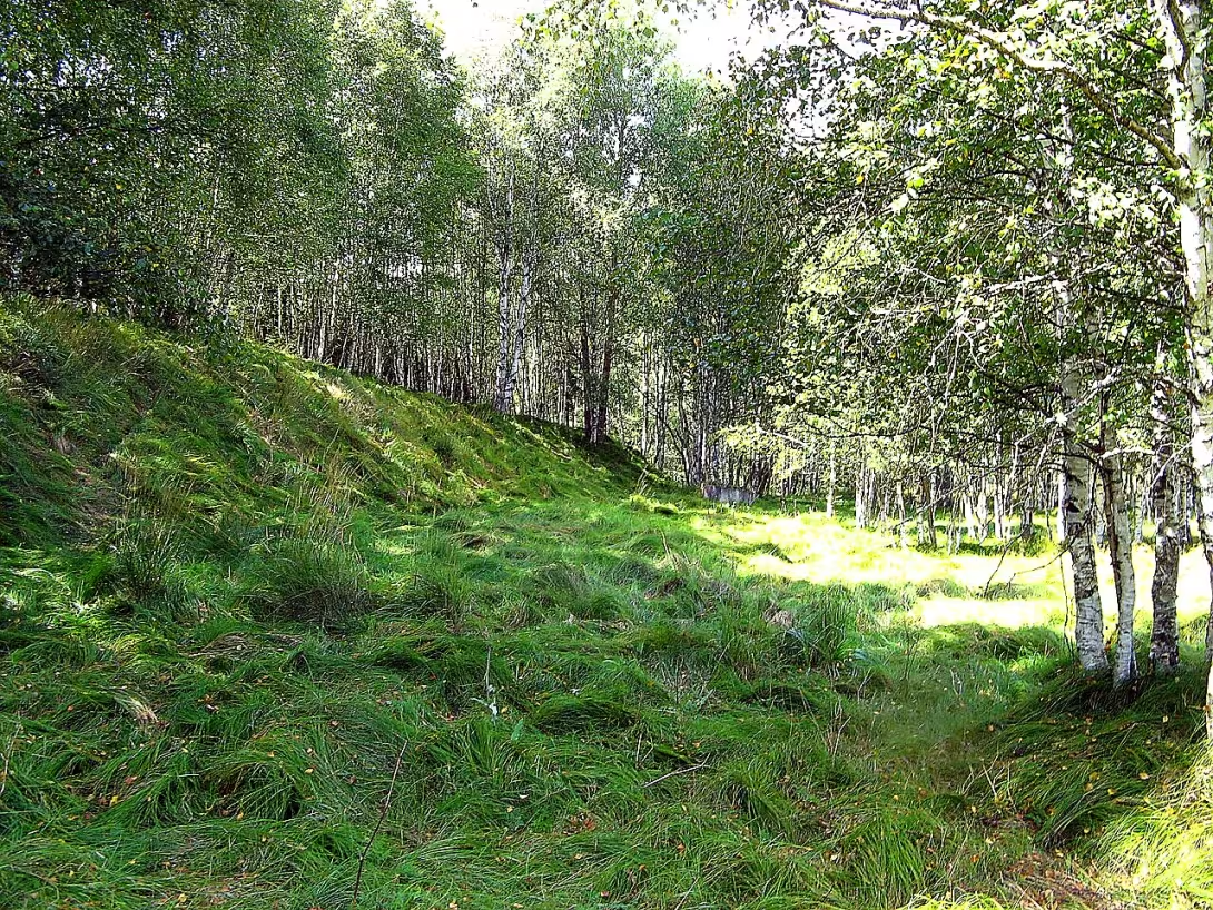
The dam of the Kunžvart pond is a remnant of an extensive Renaissance water work from the 16th century. It is located on the river Lásnice near the town Strážný in the district of Prachatice. This loose dam is today protected as a real-estate cultural monument. It represents an important piece of evidence of historical water construction and efforts to cultivate the Šumava landscape in the early modern era.
The Spanish dam was built by the flag Petr Malovec z Chýnova a na Vimperku, probably between 1543 and 1547. The pond was intended to be used for the farming of fish and for the swimming of wood and was approximately 150 hectares. The first written mention of the finished work dates back to 1553. In the past, the dam was mistakenly considered a medieval building from the 14th century, combined with the reign of Charles IV and plans to connect the Black and North Sea by water.
The technical design of the dam caused disputes during its construction. Petr z Rožmberka, owner of the moneymaking estate, complained about the improper foundation of the building on unstable ground. The modern geological survey confirmed these concerns. The dam was built on permeable nil sediments made of clay, sand and gravel, which overlapped the layer of saltwater soil. This design error, combined with an inappropriate background, led to a breach of the dam, which probably occurred in 1587, although some sources indicate that the pond was already deserted by 1581.
The object is approximately 529 meters long. The crown is up to 23 metres wide and the total width of the dam is up to 51 metres wide. The heel of the dam is at an altitude of 800 metres, and the crown reaches 807 to 808 metres. In the vicinity of the west end of the dam there was a Swladské mill which used the water from the jet powered by the river Častá. After World War II, the mill was confiscated and then demolished, so there is no construction in the site today.
Peter Malovec of Chýnov was the owner of the estate until 1547. Then the Vimper estate, including the pond, confiscated the Czech crown because of Malovka's participation in the failed state uprising against King Ferdinand I. Habsburg. In the 19th century he tried to restore the pond by the prince of forest Josef Fischer, but the intention was not implemented. Recently, the possibility of restoration of water works has been assessed, but the Ministry of the Environment has issued a dissent opinion. This was due to the negative effects on protected species, such as prawn, mihul river or perlorod river, and the integrity of the Europe-wide location of Šumava.
Today, the dam is freely accessible and has a green marked tourist route along its crown. The location offers the opportunity to look into the history of technical landscaping and commemorates the ambition of the nobility in the 16th century. Visiting this place is an opportunity to think about the relationship between man and nature and the limits of engineering at that time, which in the harsh conditions of Šumava encountered natural forces.
Then and now
Drag the slider to compare how the landmark may have looked when it was built with the view today.
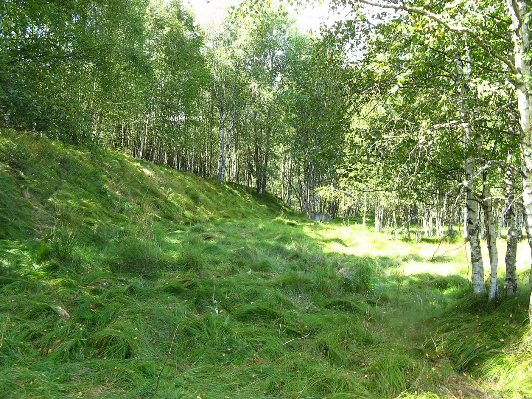
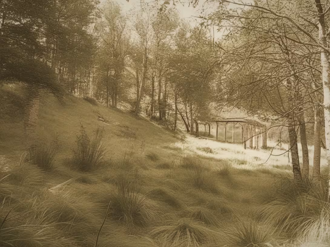
The historical appearance on the left is an AI-generated visualisation and serves as inspiration only.
Historical milestones
- 1543
- The construction of the pond by Petr Malovc.
- 1547
- Confiscation of the Vimper estate including the pond by King Ferdinand I.
- 1587
- A breach of the pond dam.
Architectural development
The spillage was based on native sediments, which proved technically inappropriate. The construction used local natural materials such as clay, sand and gravel. After rupture in the 16th century, the construction remained unchanged, damaged.
Historical events
1543-1547 construction of the pond, 1553 first written mention of existence, 1587 rupture of the dam.
Owners
Petr Malovec z Chýnova a na Vimperku (until 1547), subsequently confiscated by the Czech crown.
Points of interest
- The dam was built on unstable soil from clay, sand and gravel, which led to its rupture. - In the past, the construction was misjudged as a medieval work from the 14th century linked to the reign of Charles the Fourth. - The pond had an area of approximately 150 hectares and was used to raise fish and sail wood. - After World War II, the Splavský Mill was demolished near the dam, so there is no construction in the site today. - Recently, the Ministry rejected the restoration of the pond to protect rare species of animals and the integrity of the Šumava site.
Guide
Show guide text
This text was created by artificial intelligence and has not been editorially reviewed. It may contain inaccuracies.
Welcome to the beautiful landscape of Sumava. You're standing right here in a place that is quiet, quiet and at first glance can act as a simple part of nature, but in fact, it is a place where a huge human ambition has come together with the relentless laws of nature. Before your eyes, this sprinkled hráz rybníka Kunžvartu. Even if you see only her remains today, try to imagine the length and strength that this building once imagined. This structure stretches over 500 metres, and even in today's condition, it carries the trail of that magnificent water work that once dominated the whole area. Feel the atmosphere of this place, feel the calm of the surrounding waters and forests, but at the same time remember that beneath your feet lies evidence of a failed but fascinating attempt to control the water.
Let us now return together to the past, to the sixteenth century when this unusual chapter began to be written here. It was a period when the Shimava landscape began to change rapidly and people were looking for new ways to exploit the wealth of the country. Five hundred and forty-three years ago, a building began to be built here to change the face of the area. Petr Malovec from Chýnov was the main mover of the whole project. His intention was extremely ambitious. He didn't just want a small tank, but a huge pond that was supposed to have an area of approximately 150 hectares. Imagine the incredible width of the water surface that was wobbling in this landscape. The pond was intended to be used for fish farming, which at that time was a very lucrative business and a key source of livelihood and wealth for the monarchs and nobles at the time.
Now take a closer look at what's right in front of you. Even though this dam is only the rest of it today, its essence is still evident. Note that these are not solid walls made of stone, such as those you may see on the castles. This dam is sprinkled. This means that it was built by the gradual storage and consolidation of various types of materials that people found right in the vicinity. It consisted of layers of clay, sand and gravel. This method was common at the time, but it also carried a huge risk. Feel the length that's still in the field. Even though the construction is in ruins today, we still feel the effort to create a solid barrier to keep a huge amount of water in the pond. It's a work that was directly part of the earth, made from its own body.
But the history of this place was not only a story of building, but also a story of power changes and political upheavals. The fate of this water work was closely linked to the fate of powerful generations and kings. After construction began, there was a fundamental change in who had power over this landscape. In the year five hundred forty-seven, King Ferdinand's first Habsburg seized the Vimper manor, and thus this pond and its future fate came into his hands. There are other important figures in this history, such as Petr z Rožmberka, which was at that time one of the most influential figures in the country. All these figures were connected with power over water and over this Šumava landscape. King Ferdinand's reign brought new rules and new faces that had to deal with this vast water project.
And it is here that the greatest mystery and the greatest lesson from this place comes to mind. Why did this great work end up failing? Why did this huge water surface collapse? The answer lies in the very foundation that the builders may not have been fully aware of at the time. The dam was built on very inappropriate ground. Instead of being built on a solid and stable basis, it was laid on unstable soil which consisted of clay, sand and, above all, very soft saltwater soil. This error in the initial phase was fatal. Nature took its power back very quickly. It was ruptured shortly after the construction was completed. The final disintegration and demise of the pond took place in the year five hundred and eighty-seven. This event was a great shock to the company at the time and meant the end of a great dream of wealth from the pond in this particular location.
But there is one more interesting thing that can remind you how easy it is in history to mistake the truth for a myth. For many years this building has been mistaken for much older work. Some historians and people around them thought it was the remains of medieval construction from the 14th century, which would be directly linked to the glorious era of Charles the Fourth. Imagine the confusion about how wrong people were at the time this work was made. This error of perception took a long time to find out from new knowledge that it was a work much younger, from the time of the Renaissance, and that its fall was not the result of an ancient decay, but a specific technical error in construction.
Today, when you're standing here, all you see is silence and the remnants of a sprinkled dam. But in this silence, you can hear the story of human courage, ambition that exceeded the possibilities of the then techniques, and the relentless powers of a country that cannot be easily controlled. This dam is an important example of how in the 16th century people tried to change the landscape according to their needs. It is a reminder that even the biggest plans can fail if the strength of the subsoil on which they stand underestimates.
Thank you for joining us on this short journey through time. We hope that this story about the Kunžvart pond has intrigued you and helped you better understand the history of this place. Continue to explore this beautiful Šumava landscape, observe the surrounding nature and let yourself be carried away by the atmosphere that this place offers. We'll let you know you were with us.
Tips for visitors
The best time for visiting is late spring or autumn, when vegetation is thinner and historical spillage is better seen in the field. In the summer months the location can be covered with high grass and shrubbery. Take advantage of local communication in the village Strážný for a trip to the monument and then follow the forest roads towards the river Řasnice. Take your fixed shoes to the field and repellent, as you move near the wetlands and the canopy. For photography there is an ideal soft morning light that will highlight the contours of the long dam and the structure of the terrain around the River Lash. In the immediate surroundings, you can explore the natural beauty of the National Park of Šumava, the Boděžská slátina or climb the hill of Hamer Forest, from where is an interesting view of the landscape. For families with children, the location is suitable as a destination for easy walks through nature, where water flow and forest areas can be observed, but due to the nature of the ruins, caution is required when moving in a separate terrain of the dam.
Frequently asked questions
Can the monument be visited?
This is a structure in a public space that can usually be seen from outside free of charge. We have not verified that this particular one is freely accessible.
Where is the monument?
Location: Strážný. The map on this page shows the exact spot.
Why is the monument protected?
It is listed in the Central List of Cultural Monuments of the Czech Republic as a cultural monument (register no. 1000129830).
Businesses nearby
Do you run a restaurant, accommodation, shop, museum, rental, wellness or other visitor service near this monument? Show yourself directly to the people heading to it — this is how they will see you in the app and on the web:
Nearby
Národní park Šumava, říčka Řasnice, vrchoviště Stráženská slatina, obec Strážný, vrch Hamerský les.
Accommodation nearby
Themed route
Thematic cruise route around the dam of the Kunžvart pond
1. The dam of the Kunžvart pond (water work) Start your trip at the main destination, the dam of the Kunžvart pond. This historic construction is an example of 19th century technology and was used to regulate water levels for the needs of local fishermen. It's the perfect place to look at the skills of old builders.
2. River Lash (natural formation) From the dam, we will move briefly towards the River Lash, which is the presence of the Yellow Creek. This small river offers a quiet environment for relaxing and observing local fish. It is also an ideal place for a short path where you can enjoy the natural sound of flowing water.
3. Highlands Strážská slavina (natural department) We continue towards the northern part of the village to the Stražní slatina. This place is famous for its natural beauty and here you can explore rich plant life and perhaps even some wild animals that occur here. It's the perfect place for nature lovers.
4. Municipality of Strážný (city centre) Now we will return to the village Strážný itself, where you can spend your time in peace and explore local architecture. The village offers several picturesque streets and historic buildings that tell about the past of this area.
5. Upper Hamer Forest (natural formation) To the conclusion of our route we will look to the summit of the Hamer Forest, which will reward you with beautiful views of the surrounding countryside. This place is ideal for the last moment of relaxation and use of the natural environment.
This track offers a combination of historical, cultural and natural experiences in the area around the Pond of Kunžvart.
Seasonal recommendations
Spring: In the spring period, hráz rybníka Kunžvartu is transformed into a place full of hope and new life. When the sun begins to illuminate the landscape, green vegetation begins to bloom and surrounding forests offer a pleasant view of the young foliage green. The atmosphere is full of quiet calm when the water in the ponds spreads slightly and life wakes up after winter sleep. It is recommended to visit in the morning or at the end of the day when light is softer and nature offers the most beautiful views. Due to the possible occurrence of more birds and animals, you should be careful about your steps as the terrain may be unbalanced. A good idea is to wear comfortable shoes and clothes suitable for mild weather.
Summer: In summer, hráz rybníka Kunžvartu offers an ideal environment for relaxation under sunlight. The sun illuminates the landscape in the most beautiful shade and warm weather attracts visitors who seek relief from urban interference. The water in the ponds is calm and creates a comfortable environment for natural observations or just for relaxation on the banks. The best time to visit is in the morning or in the evening, when the temperature is tempered and light takes on a magical tone. It is recommended to wear light clothes that protect from the sun, and not miss the protective cream against UV radiation.
Autumn: In autumn, hráz rybníka Kunžvartu offers a wonderful view of the colors of nature, when tree leaves turn their shades into gold and red. The atmosphere is full of calm and quiet, when the weather is mild and the sun lights up the landscape in warm colors. It is advisable to visit in the morning or evening to enjoy a pleasant temperature and beautiful light effects. It is recommended to wear clothes that protect against cold wind such as hats or coats, and suitable shoes for potential wet conditions.
Winter: In winter months, hráz rybníka Kunžvartu offers a wonderful view of the snow covered landscape, where water in ponds turns into ice. The atmosphere is calm and quiet, when local nature rests under a light cover of snow. The best time to visit is in the morning or in the evening when the temperature is lighter and light creates magical colors on the horizon. It is recommended to wear warm clothes such as fur coats or blankets, and protective shoes for snow terrain. The view from the ice pond can be an interesting experience for lovers of winter landscape views.
Visualizations and artistic views


The visualisations are generated by artificial intelligence and serve as inspiration.
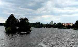
Photos from the area
Real photos taken near the monument

Zdroj a licence jsou uvedeny u každého snímku.
Tips from visitors
No tips yet. Be the first!
Log in and add your tip.
Sources and literature
Photos: Martin Vrut / CC BY 3.0 — Wikimedia Commons. The author and licence also appear when you hover over the image.
Faktickým podkladem tohoto textu byl článek na Wikipedii, jehož autory jsou přispěvatelé Wikipedie. Článek je dostupný pod licencí CC BY-SA 4.0.
Location on the map

Příběhy a pověsti
Legendy, pověsti a příběhy spjaté s touto památkou

Fotografie návštěvníků
Zatím žádné fotografie. Buďte první, kdo přidá fotografii z návštěvy!
Log in a přidejte svou fotografii nebo hodnoťte.
Za ověřenou návštěvu v aplikaci získáte víc bodů — poznáme podle GPS, že jste na místě.
Reviews and comments