

Pfaffenschlag Defunct village
Objekt se nedochoval — na místě dnes nestojí. Následující text popisuje jeho historii, ne současnou návštěvu.
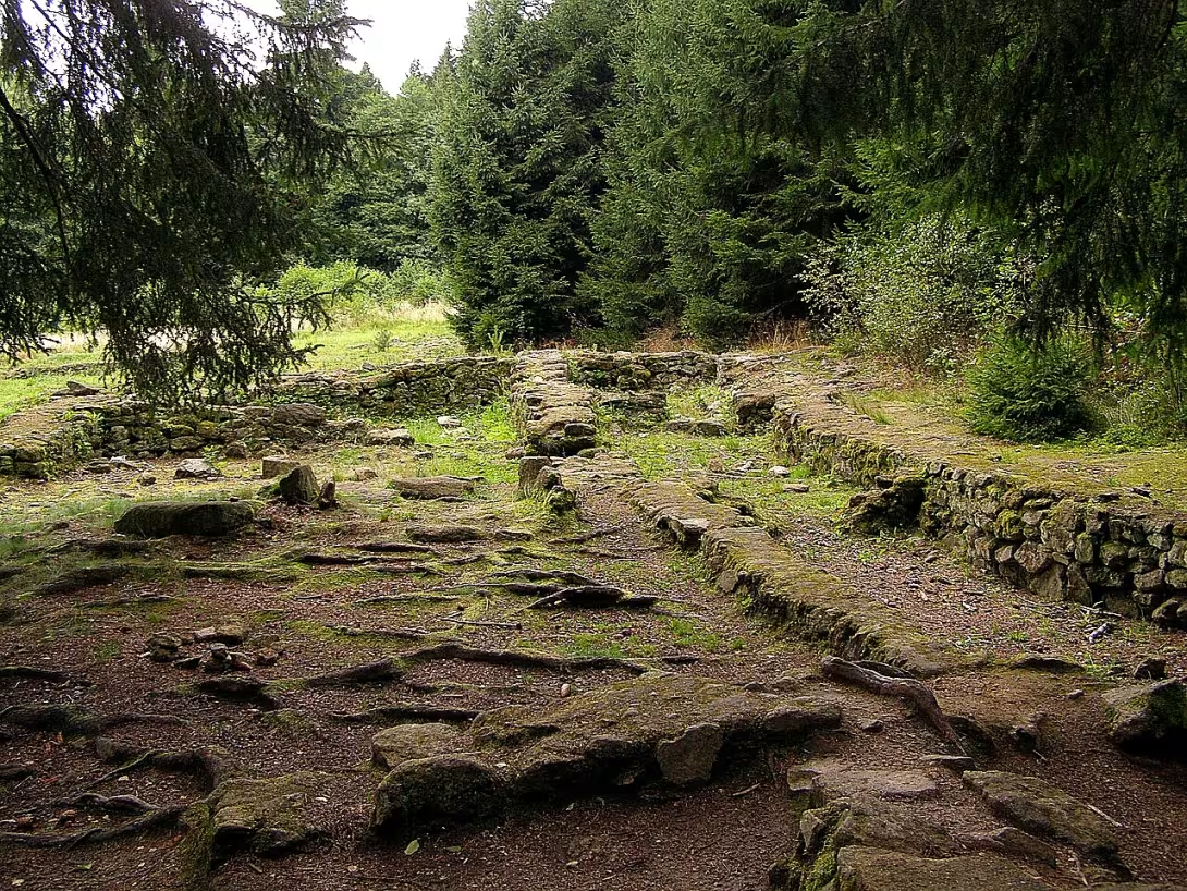
Pfaffenschlag is an archaeological site of a lost medieval Moravian village, situated in the forest west of the Slavonice cadastral area. Established in the 13th century and destroyed during the Hussite Wars, the site is notable for its well-preserved residential layout and its importance to studying historical settlement patterns.
Slavic populations likely inhabited the area before the original settlement vanished in the 12th century. During the 13th-century colonization of the borderlands under Přemysl Otakar II, a Slavonice priest established a new village on the site of the former Slavic community. This re-established settlement became known as Pfaffenschlag.
The settlement was organized into two rows of homesteads along a stream that served as the village axis. It comprised sixteen such dwellings, a mill, various farm buildings, and cellars. The primary houses were stone-built, containing a hall, a chamber, and a room with a stove or hearth. Larger residences also featured an earthen granary. Attached to these stone structures were wooden or wicker outbuildings, including cellars and underground passages, some extending up to 30 meters. The village also encompassed adjacent meadows and pastures.
Since its 13th-century founding, the village was owned by the Slavonice parish. Its history was interrupted by the Hussite Wars, when the settlement was burned and never rebuilt. It was likely targeted because it belonged to the local priests, as the town of Slavonice did not align with the Hussite movement. A nearby pond was constructed in 1483, fifty years after the village's destruction. Additionally, the surrounding area was used to build a border fortification line during the 1930s.
The remains were rediscovered in the summer of 1958 during research by the Moravské zemské muzeum, led by Vladimír Nekuda. While historical records attribute the destruction to the Hussite Wars, local legend claims the Swedes razed it during the Thirty Years' War. According to this folklore, villagers hid their valuables in a butter churn and placed it in a well before the attack. Legend says a wagon appears in Slavonice every midnight, traveling toward the ruins to search for treasure near the "butter churn well." It is said an honest citizen might retrieve the riches on Palm Sunday by reciting an old formula.
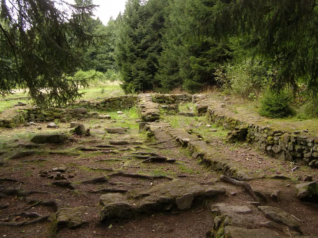
Today, the site is freely accessible to visitors, including cyclists. The ruins can be reached via a red-marked trail from Slavonice or a 200-meter path from the Slavonice–Stálkov road. Guests can examine the building foundations and study the layout of the medieval residential structures. Archaeological finds are exhibited in the Slavonice museum, which also features a model of the lost village.
This archaeological site provides a clear view of a medieval settlement's physical footprint. It remains a significant destination for those interested in the historical development and eventual disappearance of borderland communities.
Then and now
Drag the slider to compare how the landmark may have looked when it was built with the view today.
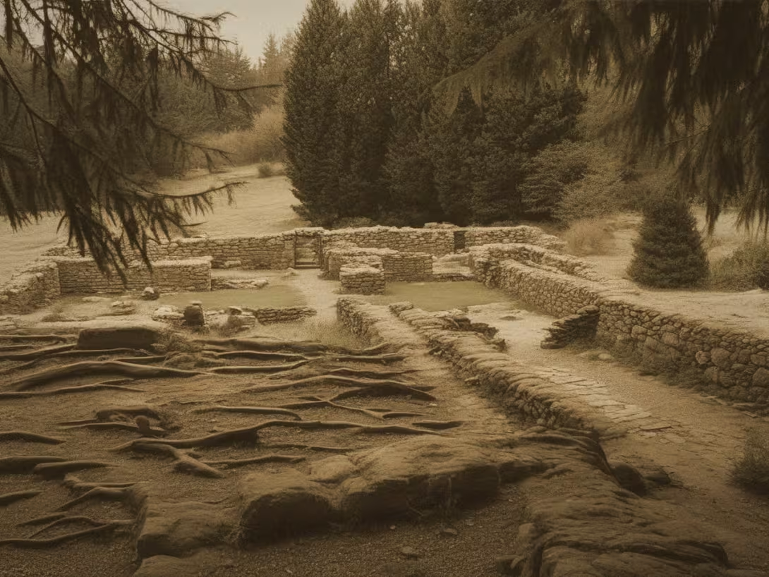
The historical appearance on the left is an AI-generated visualisation and serves as inspiration only.
Historical milestones
- 12th century
- Area likely inhabited by Slavic populations.
- 13th century
- Establishment of Pfaffenschlag as a new village.
- Hussite Wars (early 15th century)
- Destruction and burning of the settlement during conflicts.
- 1483
- Construction of a nearby pond, fifty years post-destruction.
- 1930
- Area used for building border fortifications.
- 1958
- Rediscovery and research by Moravské zemské muzeum.
Architectural development
The village consisted of sixteen homesteads, a mill, and various farm buildings arranged in two rows along a stream. Houses were constructed of stone and featured wooden or wicker outbuildings, some with underground passages up to 30 meters long. Larger dwellings included a granary built into the ground.
Historical events
The village was founded in the 13th century during the colonization period. It was destroyed during the Hussite Wars and never rebuilt. The site was rediscovered in 1958.
Owners
The Slavonice parish (since the 13th century).
Points of interest
- Pfaffenschlag is an archaeological site of a lost medieval Moravian village established in the 13th century and destroyed during the Hussite Wars. - The settlement was organized into two rows of homesteads along a stream and included sixteen dwellings, a mill, farm buildings, and cellars. - Larger residences featured stone-built structures with halls, chambers, rooms with stoves or hearths, and earthen granaries, alongside wooden or wicker outbuildings. - Local legend claims the Swedes razed Pfaffenschlag during the Thirty Years' War, involving a hidden treasure in a butter churn well. - The site is accessible to visitors via trails from Slavonice, offering views of building foundations and medieval residential structures.
Guide
This guide is narrated by a synthetic voice generated by artificial intelligence.
Show guide text
This text was created by artificial intelligence and has not been editorially reviewed. It may contain inaccuracies.
Welcome to this quiet, wooded corner of the landscape, just west of Slavonice. As you stand here, surrounded by the rustle of the leaves and the stillness of the forest, it might be difficult to imagine that you are not merely standing in a clearing, but are actually positioned amidst the ghostly remains of a once-thriving community. You are standing at Pfaffenschlag. While today the forest seems to have reclaimed this space, if you pause and listen to the silence, you can almost sense the echoes of the lives that were lived right where you are standing. This is an archaeological site, a place where the earth itself holds the memory of a lost medieval Moravian village.
Take a moment to look around and absorb the atmosphere. The ground beneath your feet, the subtle shifts in the terrain, and the way the light filters through the trees all contribute to the feeling that this place is special. You are walking through a landscape that has been layered with history, from the early Slavic settlers to the organized medieval colonists, and finally to the modern researchers who worked to bring this story back to light.
To understand why this place feels so heavy with history, we must travel back in time. Long before the village we recognize today was established, this area was likely inhabited by Slavic populations during the 12th century. These were people deeply connected to the land, living in harmony with the rhythms of the forest and the nearby streams. However, the Pfaffenschlag you are standing upon truly took shape in the 13th century. This was a period of great transformation in the region, an era of colonization where new settlements were being organized and established to expand the reach of local powers and religious institutions.
It was during this 13th-century expansion that a local priest took the initiative to re-establish this settlement as a formal colonization village. This was not a random gathering of people, but a planned community. Under the broader political shadow of great figures like Přemysl Otakar II, the structures of medieval society were being built, and Pfaffenschlag was a small but vital part of that growing tapestry. The village was designed with purpose, intended to be a place of productivity and stability.
As you explore the area, try to visualize the layout of the settlement as it would have appeared hundreds of years ago. The village was not a chaotic cluster of buildings; it was organized with remarkable precision. The settlement was laid out in two distinct rows of homesteads, stretching along the path of a nearby stream. This stream was the lifeblood of the village, providing water for both the people and their livestock. Within these two rows, there were sixteen individual dwellings, each serving as a home and a center of activity for a family.
If you look toward the areas where the water once flowed more prominently, imagine the sound of a mill working steadily, processing the grain that the villagers grew in the surrounding fields. Beyond the houses, there would have been various farm buildings and essential cellars used for storage. The architecture was functional and integrated into the natural environment, a testament to the ingenuity of the medieval settlers who turned this forest edge into a home. Even though the buildings themselves have long since vanished, the very shape of the land and the placement of the archaeological remains allow us to trace the footprints of those sixteen households.
But the story of Pfaffenschlag is also one of sudden and profound tragedy. The peace and productivity of the village were shattered in the early 15th century during the Hussite Wars. This was a time of intense religious and social conflict that swept across the lands, bringing fire and destruction to many settled areas. Pfaffenschlag was caught in the crossfire. The village was burned and destroyed, and in the chaos of the wars, the community was broken. Unlike many other settlements that managed to recover and rebuild, Pfaffenschlag was never restored. The people moved on, the fires died out, and the forest slowly began its long process of reclaiming the land.
For many years, the village remained a forgotten chapter of history. Even as the decades turned into centuries, the site changed. In 1483, fifty years after the village had fallen, a nearby pond was constructed, a sign that human activity continued in the vicinity, even if the village itself was gone. Much later, in 1930, the area took on a different, more somber significance when it was used for the construction of border fortifications, adding yet another layer of human history to this specific patch of earth.
It wasn't until 1958 that the true story of Pfaffenschlag was rediscovered and brought back into the light of modern understanding. Through the dedicated research and scientific efforts of the Moravské zemské muzeum, the scattered traces of the village were identified and studied. It was through this archaeological work that we learned about the specific number of dwellings, the presence of the mill, and the organized nature of the settlement. Scholars like Vladimír Nekuda played a crucial role in interpreting these findings, helping us to piece together the puzzle of a community that had been lost to time for nearly five hundred years.
There is a certain mystery that lingers here, isn't there? It is the mystery of disappearance. How does an entire community, with its sixteen homes, its mill, its cellars, and its daily routines, simply vanish from the map? One moment, there is the sound of the stream and the bustle of farm life; the next, there is only the silence of the woods. As you walk through the site, you might find yourself wondering about the individuals who lived here—the families who saw the village rise in the 13th century and the people who had to flee or face the flames during the Hussite Wars.
As you continue your journey through this site, I invite you to move slowly. Do not just look at the trees and the ground, but try to see through them. Look for the subtle clues in the landscape that hint at the old boundaries of the homesteads or the path of the ancient stream. Every step you take is a step through layers of time, from the medieval era to the modern scientific discoveries of the 20th century.
Thank you for joining me on this walk through the history of Pfaffenschlag. There is much more to discover in the surrounding area and the nearby town of Slavonice, so please, continue your exploration. Let the quiet of this forest remind you of the many lives that once thrived here, and may the memory of this lost village stay with you as you move forward. Enjoy the rest of your visit.
Businesses nearby
Do you run a restaurant, accommodation, shop, museum, rental, wellness or other visitor service near this monument? Show yourself directly to the people heading to it — this is how they will see you in the app and on the web:
Nearby
🏰 Historic sites (86)
- zaniklá obec Pfaffenschlag 0.2 km
- Bobovec 0.3 km
- železné opony 1.1 km
- Muzeum čs. opevnění 1935-1938 2.0 km +420606124829 web
- Pomník konce 2. světové války 2.0 km
- Muzeum samorostů 2.6 km
- zboř. zámek Maříž 3.4 km
- Léštnice 3.6 km
- Památní kámen 3.8 km
- Zámek Dobrohoř 3.9 km
- 9. květen 1945 4.1 km
- Rudoarmějec 4.1 km
- kámen znovuotevření hranic 4.6 km
- památník odsunu 4.8 km
- Museum Humanum Fratres 5.0 km
- Ehemaliger Gutshof aus Hoyos-Sprinzenstein‘schem Besitz 5.0 km
- Landštejn 5.3 km +420 384 498 580 web
- Expozice k historii hradu 5.3 km
- původní hrad Markl 5.6 km
- Kostel Sv. Jana Křtitele 5.6 km
🍽️ Restaurants and dining (80)
- Restaurace Maříž 3.2 km web
- Adria 3.5 km
- Adria II 3.6 km
- BikeBar 3.6 km +420739667575 web
- Hospoda u Vlastičky 3.6 km
- Na Kuželně 3.9 km
- Stop Cafe 4.0 km
- Ceramic Art&Salad (Bistro Maříž) 4.0 km Náměstí míru 451 +420 608 387 056 web
- Kebab Slavonice 4.0 km
- Spolkový dům 4.0 km web
- Alfa 4.0 km
- Kafe & Hrnky 4.0 km Náměstí míru 465 web
- Apetito 4.1 km
- U nás doma 4.1 km
- Besídka 4.2 km
- Kavárna Atomika 4.2 km Horní náměstí 532
- Hotel Hubert 4.3 km +420 601 528 31 web
- Casa angelina 5.1 km
- Kiosek u kurtu 5.3 km
- Hradní občerstvení 5.3 km
🏨 Accommodation (54)
- Penzion Bejčkův mlýn 2.2 km +420 384 493 181 web
- Oáza Maříž 3.2 km
- Cyklocamp 3.6 km +420 739 667 575 web
- Adria II 3.6 km
- Apartmány u Zdendy 3.6 km web
- Dům u Růže 4.0 km
- Alfa 4.0 km
- Arkáda 4.1 km náměstí Míru 466 web
- Rodinny Penzion 4.1 km Svatopluka Čecha 84 +420 736 454 289 web
- Apartmány Pod Věží 4.1 km Horní náměstí
- Besídka 4.2 km
- Hamr Podlesí 5.3 km
- Landštejnský dvůr 5.4 km
- LT Kromem 5.8 km
- Pension a restaurace RUDOLEC 6.3 km
- Penzion Čas 6.3 km
- Selský dvůr 6.8 km
- Bison Ranch 7.2 km Rožnov 1 +420 389 822 469 web
- ŘKC proboštství JH 8.9 km
- Zughotel Waldkirchen 9.7 km +43 670 500 66 77 web
🚲 Rentals and sport (7)
- lanový park 3.5 km
- U čápa 4.0 km
- Robert's Radservice 9.7 km
- Jägerrunde Dobersberg 10.1 km web
- Přírodní Koupaliště 11.7 km
- Cyklo-sport Petr Kunkal 12.2 km Křížovnická 70/I
- Kuželkárna 14.6 km
🥾 Hiking and nature (163)
- Uhliště 1.4 km
- skalní útvary 1.8 km
- Čihadlo 2.1 km
- Velký Troubný 2.3 km
- Graselova sluj 2.4 km
- Pod trojmezím 2.5 km
- Schillerův kámen 2.6 km
- Stříbrný vrch 2.7 km
- Hoher Stein 2.8 km
- Strážný kopec 2.8 km
- Pekelec 2.8 km
- vodní vpusť 3.0 km
- U Boba 3.0 km
- Graselova koupelna 3.1 km
- Dračí pramen 3.2 km
- U hranic 3.3 km
- Studánka u cesty 3.3 km
- Trezor v kameni 3.6 km
- Vlasta 3.6 km
- U smrku 3.8 km
Visualizations and artistic views


The visualisations are generated by artificial intelligence and serve as inspiration.
Photos from the area
Real photos taken near the monument

Zdroj a licence jsou uvedeny u každého snímku.
Tips from visitors
No tips yet. Be the first!
Log in and add your tip.
Sources and literature
Photos: Daniel Baránek / CC BY-SA 3.0 — Wikimedia Commons. The author and licence also appear when you hover over the image.
Faktickým podkladem tohoto textu byl článek na Wikipedii, jehož autory jsou přispěvatelé Wikipedie. Článek je dostupný pod licencí CC BY-SA 4.0.
Location on the map

Příběhy a pověsti
Legendy, pověsti a příběhy spjaté s touto památkou
Fotografie návštěvníků
Přidat fotografiiZatím žádné fotografie. Buďte první, kdo přidá fotografii z návštěvy!
Kudy se sem dá dojít a dá se dovnitř?
Log in a přidejte svou fotografii nebo hodnoťte.
Za ověřenou návštěvu v aplikaci získáte víc bodů — poznáme podle GPS, že jste na místě.
Reviews and comments