



přehrada Desná Water structure
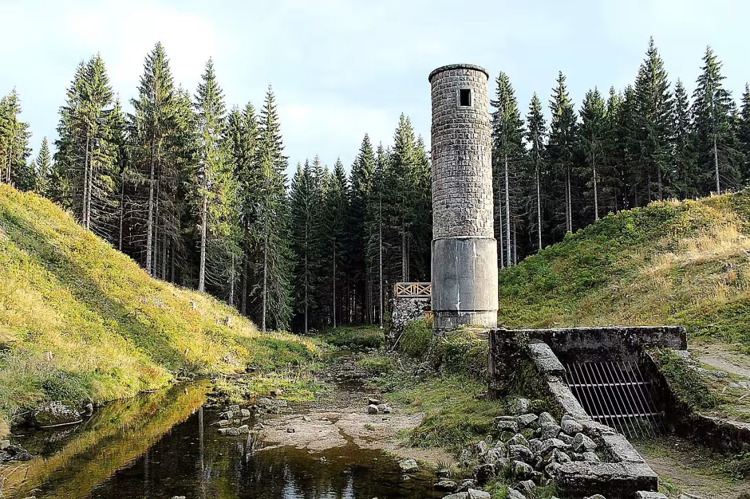
The Desná dam, also known as the Rifle, is a water work on the White Desná in the village Albrechtice v Jizerských horách. It was built between 1912 and 1915 and gained tragic glory after the breach of the dam in 1916, which claimed many victims.
The impulse for its construction was devastating floods in the foothills of the Jizera Mountains in the second half of the 19th century. The most significant of them was the flood in July 1897, when on July 29 the weather station in Nová Louka recorded precipitation of 345,1 litres per square metre in 24 hours. On the Czech side, this disaster claimed 120 victims and caused damage of millions of Austrian crowns. The need for flood protection measures led to the establishment of water cooperatives and cooperation with Professor Otto Intz, who lectured in Liberec on the valley dams. After his death in 1904 the project was completed by Prague engineer Wilhelm Plenkner.
Plenkner designed a dam system on the White and Black Desnas, which was intended to connect the bridge for the transfer of water. Both works were designed as ground-filled dams, as the rock massif for the foundation of the gravity dam lay too deep under a layer of sediment. The dam on White Desná had a crown of 172.8 metres in length and a width of 5.2 to 5.5 metres, while it measured 54 metres in heel. The height of the crown above the terrain and the maximum depth of the tank were 17.5 metres. A tank of 400,000 cubic meters flooded an area of 8,4 hectares.
Construction on White Desná was started by Franz Schön and sons on 17 October 1912. In the bottom of the valley was built a concrete bridge on two longitudinal concrete passports based on wooden piles. The work was done under unfavourable conditions; Intense rains damaged the work and the First World War forced austerity measures that reflected in the quality of the construction. The work was completed in September 1915 and collaborated in November of the same year.
The disaster occurred on September 18, 1916. In the afternoon, two forest workers recorded a spring coming out of the dam. Due to the increasing intensity of water leakage and fear for life, the seals have been partially opened. Seventy minutes after the first observation, the dam was ruptured. Water meat, which helped as a ram logs from a nearby saw, destroyed 33 houses, damaged another 69 and left 307 people without shelter. The disaster balance was 67 casualties.
The cause of the accident was considered inappropriate material and insufficient compaction of the dam body. The 1996 study refuted these reasons and identified the water leak as a cause which was caused by insufficient sealing in the project. The subsequent trial lasted 17 years and ended in the acquittal of the defendants. The Court found that the cause was a geological disorder at a depth where the standards at the time did not require test probes to be carried out.
The original water work was preserved from the slide tower and the stol to the Soush dam. The stol serves as a winter playground for eleven species of bats and since 2005 it has been declared a European important location, which means a ban on entry. There is a learning trail with six stops for visitors in the area.
Instead of the Rifle, it resembles a tragic combination of technical failures and natural influences. It is an important location for understanding the history of water management in a region worth visiting.
Then and now
Drag the slider to compare how the landmark may have looked when it was built with the view today.
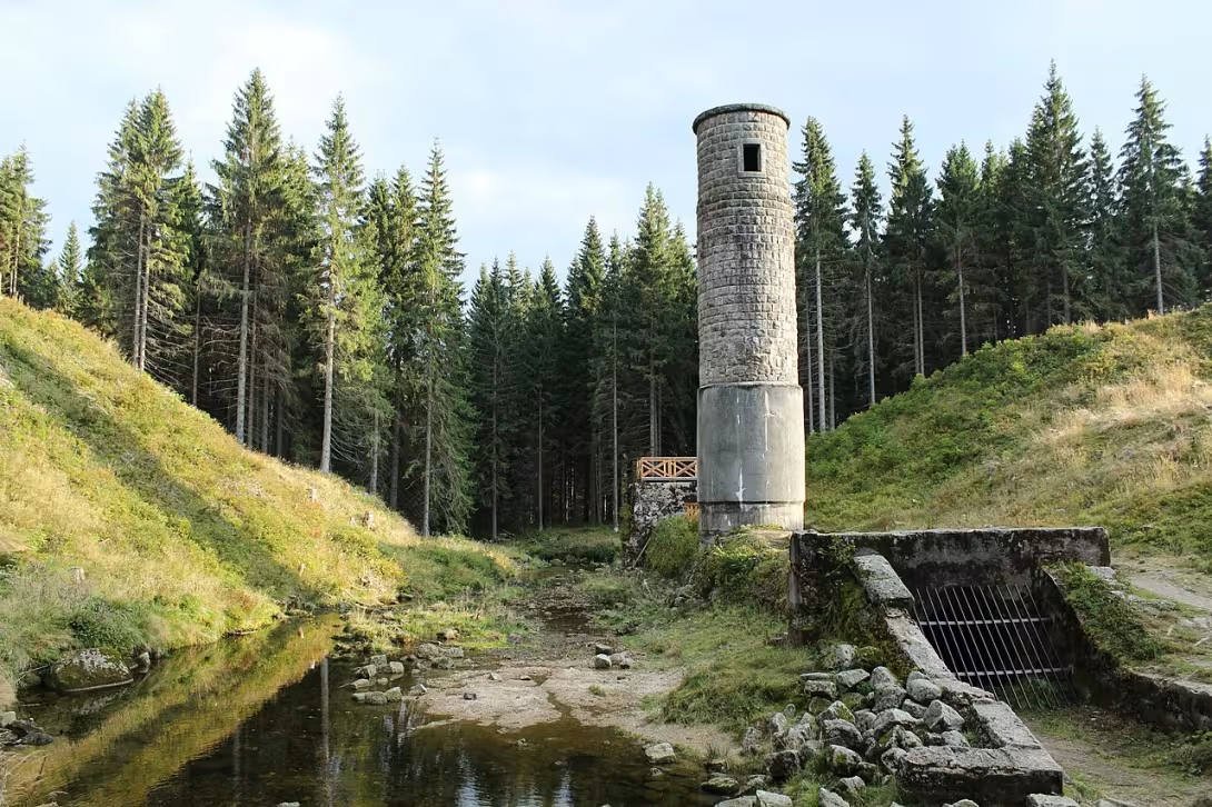

The historical appearance on the left is an AI-generated visualisation and serves as inspiration only.
Historical milestones
- 1916
- A breach of the dam and a disaster with human victims.
Architectural development
The dam was designed as a ground-based sprinkled structure. The construction took place in 1912-1915, but due to intense rains and World War I the work was damaged. The breach of the dam was caused by water leak and insufficient sealing.
Historical events
- 1912
- The dam was built.
- 1915
- Completion and approval of the dam.
- 1916
- A breach of the dam and a disaster with human victims.
Points of interest
- Desná dam was built between 1912 and 1915. - A tragic breach of the dam occurred in 1916, which took many victims. - The impetus for the construction of the dam was devastating floods in the Jizera Mountains, in particular the flood in July 1897 with collisions of 345,1 litres per square metre per 24 hours. - The dam project was completed by Prague engineer Wilhelm Plenkner after the death of Professor Otto Intz. - After the breach of the dam in 1916, the steeple tower and the steeple were preserved, which serves as a European important location for bats.
Guide
Show guide text
This text was created by artificial intelligence and has not been editorially reviewed. It may contain inaccuracies.
Welcome to a place that carries deep calm, but also a strong memory of the great unrest and tragedy of the past. You're standing right in front of a place people in these mountains often call the Rifle. You may now be surrounded by silence or just a splash of water, but try to imagine how much this place has changed in the past. Before your eyes, there is an open space where a human quest for protection and security has clashed with the untamed and destructive force of nature. This water structure, known as přehrada Desná, is not just an ordinary piece of technology, but a monumental witness to human efforts, which ended in an unexpected and painful end. Feel this atmosphere, feel the weight of history that took place here.
Let us now go back in time together and understand why such a fundamental work has been chosen here. To understand the meaning of this dam, we need to look at the events that took place in the second half of the nineteenth century. The region of the Jizera Mountains at that time suffered constant and very devastating floods. The water came unexpectedly, destroying houses, fields and, above all, endangering the lives of people living in the valley. One of the most terrifying and most important moments that changed the people at the time irrevocably was the July of the year a thousand eight hundred ninety-seven. At that time, an incredible storm spread over the mountains, and the rainfall was so extreme that over three hundred forty-five litres of water fell on each square metre of land in just 24 hours. Such a force of water was absolutely intolerable for the people of the time, and it caused enormous fear throughout the region. It was this tragic experience and the need to protect people's lives that led to the decision to build a Great Dust River dam. The goal was to create a solid barrier that could contain excess water and protect the following valleys from future floods.
Now pay attention to how this magnificent work was created. The entire construction process was extremely demanding and required great courage and expertise. The construction started in the year one thousand nine trăm twelve and lasted several years until it was completed in the year one thousand nine hundred fifteen. The architect Wilhelm Plenkner oversaw this whole complex project. Now, when you look at this place, try to imagine in your mind the enormous work, the technical precision and the faith in the success that people were putting into the building at that time. Every stone, every part of this structure was meant to serve as a symbol of safety and human triumph over the dangers of nature. The architecture of this water work was to prove that man could control even the wildest elements if he used his intelligence and strength to do so.
But notice how fragile this faith can be. History tells us a story that is full of sadness and unexpected twists. Although the dam was finished and people could finally feel relief, fate was very cruel. Already in the year one thousand nine trăm sixteen, that is, shortly after the construction was completed, the worst thing that people could have imagined at the time. The dam couldn't hold the water pressure and it ruptured. This event was not just a technical failure, it was a complete disaster that hit people's hearts. The passage of a huge mass of water caused devastating damage and, most painful, the lives of many innocent people. What was supposed to be a protection and rescue for the whole area, in a moment, turned into a cause of great suffering. This tragedy remains in mind as one of the darkest chapters in the history of this region.
While you're looking around now, you might wonder why that happened. There's something deeply mysterious and terrifying about it. How is it that a work built with the intent and supervision of competent experts such as Wilhelm Plenkner has failed so early and so devastating? This mystery, this contrast between great ambition and sudden destruction, is what makes this place so special. It is a reminder of how much our existence depends on powers that we often cannot fully control. This dam, now associated with the concept of Rifle, serves as an eternal memento not only of the power of water, but also of the fragility of human plans.
But now we will not just keep you with sad memories. We suggest you continue your walk and explore the surrounding countryside. Take a look at the terrain you see here, and try to reconstruct in your imagination the way the water rolled down that fateful year. Let the beauty of the Jizera Mountains consume you, which are now calm and harmonious again, and feel the contrast between today's calm and the stormy history that took place here. Every step of this place can bring you a new perception of history and a deeper understanding of how much our world around us changes. Thank you for choosing to visit this memory and devote your time to her story. We wish you a beautiful and inspiring journey along the paths of our mountains. Goodbye.
Tips for visitors
The best time to visit is when nature is the most colorful, for example autumn, which gives the place a melancholy atmosphere. For the best light in photography I recommend morning or late afternoon hours, when shadows highlight the structure of the destroyed water work.
You can reach the place by car or use public transport.
Due to the mountain position, emergency condition and weather, we recommend to bring with us fixed shoes, waterproof clothes and plenty of fluids. Monitoring the weather forecast will ensure better visibility.
It is important for families with children to be careful. Due to your emergency condition, only move on safe and determined routes. There are no other specific objectives to visit in the vicinity.
Frequently asked questions
Can the monument be visited?
This is a structure in a public space that can usually be seen from outside free of charge. We have not verified that this particular one is freely accessible. According to the heritage register the structure is in poor condition – do not enter it and take care nearby.
Where is the monument?
Location: Albrechtice v Jizerských horách, Liberecký kraj. The map on this page shows the exact spot.
Why is the monument protected?
It is listed in the Central List of Cultural Monuments of the Czech Republic as a cultural monument (register no. 1000120999).
Businesses nearby
Do you run a restaurant, accommodation, shop, museum, rental, wellness or other visitor service near this monument? Show yourself directly to the people heading to it — this is how they will see you in the app and on the web:
Nearby
🏰 Historic sites (174)
- Obětem protržení přehrady 18.9.1916 0.1 km
- Bučina 1.4 km
- Desenský vrch 1.7 km
- Marianska hora 874m 2.4 km
- Památce Jizerskohorských lesníků 3.5 km
- Muzeum místní historie 3.6 km
- Jahnův pomník 3.9 km
- Skály 4.0 km
- Pařízkův kříž 4.0 km
- Zimmermannova smrt 4.2 km
- Gackův pomník 4.5 km
- Sokol 4.7 km
- Karl Jäger 4.7 km
- Památník protržené přehrady 4.9 km
- Muzeum výroby hraček - Detoa 5.0 km web
- Hnojový Dům 5.0 km
- Stará Sklarna 5.1 km
- Muzeum Jizerských hor 5.2 km
- Pyramida 5.2 km
- MUDr. Wilhelm Lange 5.5 km
🍽️ Restaurants and dining (376)
- Lesní bar Krömerova bouda 0.1 km
- Hostinec a penzion U Elišky 3.1 km
- Montanie 3.4 km
- Občerstvení u Robina a Toma (maringotka) 3.5 km +420775172072;+420777615300 web
- Kiosek Dřevěnka 3.6 km
- Hájenka 3.6 km
- Chata Mariánka 3.7 km
- Bistro Fleur de Lis 3.8 km
- Restaurace u Splavu 4.0 km Josefuv Dul 150 web
- Horská stanice Knajpa 4.1 km
- Restaurace Sally 4.1 km +420603141668 web
- Kavarna 4.3 km
- Bar a Bowling Konírna 4.3 km
- Sněženka 4.4 km web
- Kiosek u vleku 4.5 km
- Bistro Skleník 4.5 km
- Sokolská chata 4.5 km
- Kiosek u Joukla Promenáda 4.6 km
- Zimni Kiosek 4.6 km
- Jako Doma 4.6 km +420 606 122 612 web
🏨 Accommodation (282)
- Pension Ráj 3.0 km
- Montanie Resort 3.4 km +420 483 383 265 web
- Pension u raka 3.4 km
- Pension Berounka 3.5 km +420731526652 web
- Penzion U Kapličky 3.6 km Mariánská hora 701
- Chata Peklo 3.8 km
- Horská chata Bludička 3.8 km Dolní Maxov 256 +420 737 284 165 web
- Vila Ašika 3.9 km +420 605218192 web
- Penzion Beránek 3.9 km
- Hotel Amantis 3.9 km Na Novině 401 web
- Hotel v Nebi 4.0 km
- Sally 4.1 km
- Penzion Špičák 4.2 km +420603431329;+420608036201 web
- Chalupa Bláža 4.2 km web
- Hotel Peklo 4.2 km
- Chata Čert 4.3 km
- Tara 4.3 km
- Penzion Krabička 4.6 km web
- Penzion Eden 4.6 km web
- Hotel Perla Jizery 4.7 km +420 483 704 339 web
🚲 Rentals and sport (65)
- SKI SNB 4.4 km
- Skokanské můstky Desná 4.7 km
- Bikepark Bobovka Tanvald 6.3 km
- B-sport centrum Hrabětice 6.7 km
- Sport 2000 7.0 km
- Cyklo - servis 7.0 km
- Proofy 7.2 km Údolní 405 web
- Hřiště 7.2 km
- Krytý bazén 7.2 km
- Sportovní hala 7.2 km
- Hřiště 7.3 km
- Sokolovna 8.6 km
- Bikeservis 9.4 km Přemyslova 5493/5 +420 739 089 618 web
- Lanový park 9.4 km web
- koupaliště 9.5 km
- Házená Jablonec 9.6 km web
- koupaliště Hejnice 10.2 km
- Městská sportovní hala 10.2 km U Přehrady 477/20 +420 773 336 774 web
- Crux 24 10.3 km web
- můstky Na Kamlu 10.4 km
🥾 Hiking and nature (385)
- protržená přehrada Bílá Desná 0.0 km
- Milíře 1.8 km
- Zelený vrch 2.2 km
- Mariánská hora 2.4 km
- Kání hnízdo 2.5 km
- Uhlířský vrch 2.9 km
- Výhled na přehradu Souš 3.3 km
- Novina 3.6 km
- Výhled Čertův Kámen 3.6 km
- Čertův Kámen 3.6 km
- Černý vrch 3.7 km
- Čihadlo 3.7 km
- Dlouhá seč 3.8 km
- Hruškové skály 3.8 km
- Jizera 3.9 km
- Výhled u posedu 3.9 km
- Desenský vrch 4.0 km
- Velká klečová louka 4.1 km
- Pěkný výhled 4.1 km
- Krásná vyhlídka 4.2 km
Accommodation nearby
Trips and activities nearby
Guided tours, tickets and activities nearby from GetYourGuide
Affiliate link: if you buy from the partner, we may receive a commission. The price for you does not change.
Search tours and activities →Themed route
Thematic cruise route around the Desná dam
1. Main objective: dam tank Desná - Type: Water work - Why it is worth a visit: This dam is not only a technical monument but also a beautiful place for relaxation and a view of the surrounding mountain landscape. It is an ideal place to understand water-based principles and to use recreational space.
2. Local forests - Type: Natural territory - Why is it worth visiting: The woods around the dam are ideal for short walks or picnics. They provide a peaceful space to disconnect and enjoy the view of mountain vegetation.
3. Local streams - Type: Natural water flow - Why is it worth a visit: These small streams are part of a natural hydrological system and can be an interesting place to observe wildlife or study aquatic ecosystems.
4. Local sidewalks - Type: Cycling / plowing route - Why is it worth a visit: The pavements offer comfortable roads around the dam and surrounding forests. They are ideal for cyclists and pedestrians who want to enjoy a beautiful green environment.
5. Local municipality of Albrechtice - Type: Municipal centre - Why it is worth a visit: Visiting the local centre allows you to know cultural and historical aspects of the region. It may be suitable for stopping drinking or buying local products.
This route offers a combination of technical, natural and cultural experiences in one area.
Seasonal recommendations
In the spring, the water level is rising rapidly. Nature begins to grow green, but the air remains cold and wet. I recommend you wear waterproof shoes because the roads can be very muddy. The best is to visit the place in the morning when the light is delicate and refreshing.
The summer months bring a dense shadow of forests and bright sun that highlights the grey concrete structure. The atmosphere is full of energy, but due to the large number of visitors it is advisable to come very early in the morning. Dress light and breathable substances, but take care of your safety because of the emergency condition of the work.
In autumn, the surroundings are coloured in gold and red tones, creating a melancholy contrast with the abandoned appearance of the water works. There is often a fog that gives the place mystery. Suitable are layered dresses and a visit in the afternoon when the low sun lights up beautifully to the details of the construction.
In winter, snow fills the landscape and frost freezes the surfaces, stressing the roughness of this place. Deny is short, so plan your trip to the morning to use enough light. Hot clothes and tight soles are essential to ensure that the drop on the frozen surface is minimal.
Visualizations and artistic views


The visualisations are generated by artificial intelligence and serve as inspiration.
Photos from the area
Real photos taken near the monument


Zdroj a licence jsou uvedeny u každého snímku.
Tips from visitors
No tips yet. Be the first!
Log in and add your tip.
Sources and literature
Photos: Jan Polák / CC BY-SA 3.0 — Wikimedia Commons. The author and licence also appear when you hover over the image.
Faktickým podkladem tohoto textu byl článek na Wikipedii, jehož autory jsou přispěvatelé Wikipedie. Článek je dostupný pod licencí CC BY-SA 4.0.
Location on the map
More monuments – Albrechtice v Jizerských horách
Show all in the municipality
Příběhy a pověsti
Legendy, pověsti a příběhy spjaté s touto památkou

Fotografie návštěvníků
Zatím žádné fotografie. Buďte první, kdo přidá fotografii z návštěvy!
Log in a přidejte svou fotografii nebo hodnoťte.
Za ověřenou návštěvu v aplikaci získáte víc bodů — poznáme podle GPS, že jste na místě.
Reviews and comments