



Tvrz - tvrziště Na valech Fortress
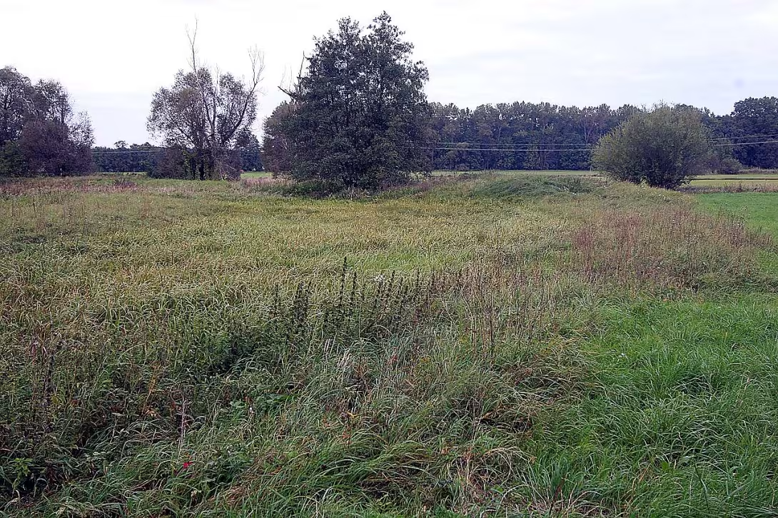
Objekt se nedochoval — na místě dnes nestojí. Následující text popisuje jeho historii, ne současnou návštěvu.
Fortress On the valleys in Chenice is the remnant of a medieval fortress from the 13th century, located on the meadows near the river Bystřice about 250 meters north of the Church of the Assumption of the Virgin Mary in the town Nechanice in the district of Hradec Králové. This historic complex is protected as a cultural monument of the Czech Republic and attracts its remnants of circular waves with three moats that witness the history of this site. The fortress is accessible on an unmarked field road, allowing visitors to get to know their history and architecture.
The history of the fortress dates back to the 13th century, when Nechanice first recorded mention in 1228. A significant moment was the year 1235, when the royal subchamber of Zavish, the ancestor of the lords of Krumlov, and the grandfather of the famous Zavish of Falkenstein, lived here. The fort became part of the ownership of the lord of Rožmberk, who exchanged it with King John of Luxembourg for other goods. By 1521, the fort was desolate and was no longer mentioned in the sale of the estate in that year, suggesting that it was abandoned.
Architecture reveals elements of 13th century building art. Until today, parts of the circular cauldron have been preserved, three moats and an acropolis of the inner fortress with a diameter of about 40 meters. The external diameter is approximately 140 metres. The first wall was reinforced by a wooden structure, possibly using a ground-struck pilot. On the south side there was a building, probably a branch tower or part of a perimeter building. From the findings of old bricks and their fragments it can be estimated that the wall was or was partly built from bricks or a combination of wood and bricks.
The property of the fortress has undergone some significant changes. After the royal submersible of Zavishi, she went into the hands of the lord of Rožmberk and later she was replaced with King John of Luxembourg. The fortress, which had probably already become desolate before 1521, underwent further changes when its remains were sold at auction and dismantled in 1833. Architectural articles, iron dagger with wooden clay, stone balls and fragments of a firearm were discovered during the dig.
A large number of shards were found on the site, mainly ceramics from the 14th and 15th centuries, suggesting long-term settlement of the area. An interesting find is the fragment of the stone container, probably imported from Saxony or Lusatia. These findings provide valuable information on living conditions and business relations at the time.
Today, the fortress is open to the public, even if its remains are only partially preserved. It is a place that offers visitors the opportunity to become acquainted with the history and architecture of medieval fortresses in the Czech Republic. The fortress is not only a monument but also a witness to the history of the region, which has undergone many changes and events.
Nechanice and its surroundings offer visitors the opportunity to get to know the history of Czech countries. The Church of the Assumption of the Virgin Mary in Chenice is another important monument that attracts attention to its architectural arts and historical findings. The river Bystřice gives the place a peaceful atmosphere and reminds the past population that lived here.
Fortress It is an important witness to the history of the Czech countries in the 13th century, when there was the development of chateaux as a centre of local administration and defence. This monument resembles the stabilisation of state power and the development of noble families, which were key aspects of the time.
Keep in mind the value of history and culture that hardships On the rocks he presents. It is a place worth visiting for every quitter who is interested in the history of Czech countries and their architectural monuments.
Historical milestones
- 1235
- The seat of the royal subchamber of Zavish
- 1521
- The fort is no longer mentioned in the sale of the estate, probably desolate
- 1833
- Sale of chateaux in auction and dismantling of walls
Architectural development
The original structure from the 13th century included three walls and three trenches, the first wall being reinforced by wooden pilots. The later stages of the construction were likely to use brick or brick-coated masonry. There was a building on the south side, probably a Bransky tower.
Historical events
1235: the seat of the royal subchamber of Zavish; 1521: the fortress is probably already desolate; 1833: sale in auction and dismantling of walls.
Owners
King's subchamber of Zavish (1235), gentlemen of Rožmberk, king of Jan Lucemburský
Points of interest
- The fort dates back to the 13th century and contains the remnants of a three-moat round. - In 1235, there was the royal undertaker of Zavish, the ancestor of the lords of Krumlov. - The outer diameter of the complex is approximately 140 metres, while the inner acropolis is about 40 metres. - For example, an iron dagger with wooden clay, stone balls and fragments of a firearm were found during digging. - Among the findings is a fragment of the stone container, which was probably imported from Saxony or Lusatia.
Guide
Show guide text
This text was created by artificial intelligence and has not been editorially reviewed. It may contain inaccuracies.
Welcome to one of the most interesting, even hidden treasures of this landscape. You are standing in a place that at first sight can act as a simple, peaceful meadow in the vicinity of Chehanic. You might think you're just looking at a green belt of ground that's rippling near the Bystrica River. However, please pay attention to how the terrain under your feet is changing slightly, how unusual inequalities are created, and how the ground, along the water stream, flows into shapes that clearly do not belong here. What you're watching right now is not just random hills or cliffs. You're standing right in front of the remains of a medieval fortress whose name is the fortress on the waves. Even if you no longer see tall stone walls or massive gates here today, the atmosphere of this place still bears a print of ancient power and strategic significance.
Let us return together to the deep Middle Ages, namely the 13th century. Imagine a time when security was a top priority and power was firmly linked to those who controlled strategically important places in the landscape. This fortress was not built randomly. Its location at the river Bystřice provided not only water, but also natural protection and control over the surrounding territory. In 1235, more than 700 years ago, there was one of the most important figures of the time. He was the royal undertaker of england. At that time, the name "Divinis" carried a weight that shook the whole kingdom. He was a man who held the keys to political and economic life and whose lineage later laid the foundations for the mighty reign of the lords of Krumlov. This fortress was a symbol of his position and seat back then, which had to be not only comfortable but above all well protected.
Now pay attention to what you see right in front of you, even if it may seem like a minor change in the landscape. If you look all over the premises, you'll believe you're moving within a huge circular system. The entire area of the fort has an external diameter of approximately 140 metres. This is a considerable area which, at the time of its flowering, had to act in an astonishing way. Notice the wavy lines in the ground. These are the remnants of circular cauldrons, which in the past have been supplemented by three deep ditches. These trenches were designed to stop any enemy trying to approach the center of the fort. If you look at the center of this circular system, you'll find a smaller, elevated place. This is an acropolis, the inner core of a fortress that measures approximately 40 meters in diameter. It was here, at this innermost point, that probably found the most important center of the dwelling, the safest place that was protected by all layers of waves and moats. Even though all the buildings are long gone today, this geometry of the earth is still clearly drawing up a plan for the way people fought back and organized their lives.
But the history of this place is a story not only of ascension, but also of gradual decline. After the golden age of the thirteenth century, when the mighty nobles lived here, the situation began to change. Over time, up to the sixteenth century, the fort ceased to be mentioned regularly in historical records. It probably became less significant, began to wither away and gradually desolate. What was once the proud seat of a royal official became an abandoned place that was gradually absorbed by nature. The last wounds came in a thousand eight hundred thirty-three. In that year this space was sold at auction and the remaining stone remains of the walls were dismantled, probably for the purposes of the construction in the surrounding area. That's why you don't see any stone monuments here today, but only these earthworks, the earth shapes that have survived for centuries.
Even though you do not see buildings here today, the country under your footsteps still hides secrets. In archaeological research and dig-ups at this place, objects were found to help us understand the everyday life of the people at the time. Among the findings, for example, there were iron objects that suggest what tools or weapons people were used to. Every piece of metal found in the country is like a messenger from the past telling us about work, fighting, and being in this place. Maybe right now, under the layer of earth you're walking on, there's another undiscovered detail waiting to be discovered.
Look around you and feel the calm of this meadow. It is hard to imagine that this quiet place was once full of life, the sounds of metals, the voices of people and the tension that accompanied the defense of such a strategic point. This fort is not just a pile of dirt and ditches. It is the memory of a country that has kept its former owner's face and structure for over a thousand years of transformation.
I hope you get this look at the fort He helped better imagine the world that once existed here. Please continue to walk along the river Bystřice and perceive the beauty of this landscape, which is so closely linked to the history of our nation. Thank you for your visit and read again what you see around you, knowing that you are standing in a place where history touches. Goodbye.
Businesses nearby
Do you run a restaurant, accommodation, shop, museum, rental, wellness or other visitor service near this monument? Show yourself directly to the people heading to it — this is how they will see you in the app and on the web:
Events nearby


Zdroj akcí: otevřená data měst a obcí ČR (Národní katalog otevřených dat) a kalendář akcí Národního památkového ústavu.
Nearby
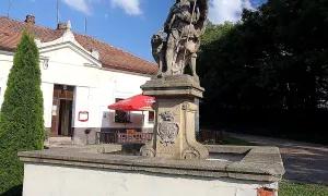
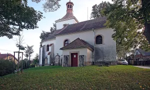
Kostel Nanebevzetí Panny Marie v Nechanicích, říčka Bystřice.
Visualizations and artistic views


The visualisations are generated by artificial intelligence and serve as inspiration.
Photos from the area
Real photos taken near the monument


Zdroj a licence jsou uvedeny u každého snímku.
Tips from visitors
No tips yet. Be the first!
Log in and add your tip.
Sources and literature
Photos: Petr1888 / CC BY-SA 3.0 — Wikimedia Commons. The author and licence also appear when you hover over the image.
Faktickým podkladem tohoto textu byl článek na Wikipedii, jehož autory jsou přispěvatelé Wikipedie. Článek je dostupný pod licencí CC BY-SA 4.0.
Location on the map
Příběhy a pověsti
Legendy, pověsti a příběhy spjaté s touto památkou
Fotografie návštěvníků
Zatím žádné fotografie. Buďte první, kdo přidá fotografii z návštěvy!
Log in a přidejte svou fotografii nebo hodnoťte.
Za ověřenou návštěvu v aplikaci získáte víc bodů — poznáme podle GPS, že jste na místě.
Reviews and comments