



Dlouhá stoka Water channel
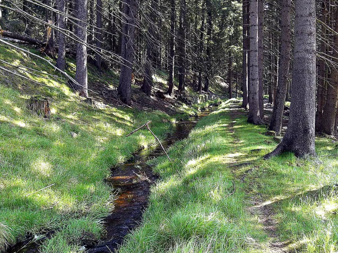
Dlouhá stoka is a renaissance artificial water channel with a length of 24,2 km. It is located in the Karlovy Vary Region in the Cheb district around the village Kladská. It is an important technical monument, which since 2014 has been registered as a national cultural monument along with the Kladský and Nový ponds.
The building was created to provide sufficient water supply for tin mining in Slavkov Forest. The water was necessary for the propulsion of red mills, crushing steps and pumping equipment. The channel also served to sail mining wood from Kynžvart forests to the operations in Krásně and Horní Slavkov. This was necessary due to the exhaustion of wood stocks in the immediate vicinity of the mines.
The need for artificial water supply was due to the lack of natural flows, namely Slavkovsky and Seifertsgrün creek. At the end of the 14th century there was the first canal from the Rota stream. It was later strengthened by the connections from the rivers of Ebmet, Mückenberg and Stöckelbach. At this time there were also retention tanks in the form of Mückenberg, New and Ebmetsky ponds. In 1499, the Slavkov miners and owners of the Bečovský estate of Pluhy of Rabštejn entered into a contract to use these water works.
The Dlouhá stoka itself, originally called Floßgraben (Sailing moat), was measured in 1530 by the mine meter Hans Rossmeisle. Construction work took place between 1531 and 1536. During the second half of the 16th century, the system was further expanded and improved, reaching a total network length of over 30 km. The whole system included ten large mining ponds, 14 stables and 35 bridges.
From a technical point of view, it was an extraordinary performance. In its scope and implementation, it was unprecedented in Central Europe until similar channels were created in Harz, Germany or Banská Štiavnica, Slovakia. The channel had a width of over 2 meters and a very precise gradient of approximately 0.35 meters per 100 meters length. At the time of his flowering, he powered 52 mills on ore.
The flow starts at an altitude of 810 m near the Kladsky pond. Some sources indicate the beginning above, at the discharge from the Kynžvar pond at 820 m high The channel goes from west to east through the cadastral territory of the Spring, Mariánska Spa, Nová Ves near Sokolov and Beauty. The longest section lies in the cadastral territory of the Spring and the shortest in Mariánské Lazne. On the way they pass the national natural monument of Opole's meadow under Cross and Cross. The water from the canal for a small water treatment plant is served in Nové Vsi and it flows under the hill in front of Beauty. Dlouhá stoka ends in the village Krasno, where it flows into the stream Stoka.
Today, Dlouhá stoka presents a unique testimony about Renaissance engineering and mining development in Czech countries. Its visit offers the possibility to see a trail of complex water systems in the field, which was crucial for the industrial development of the region.
Then and now
Drag the slider to compare how the landmark may have looked when it was built with the view today.
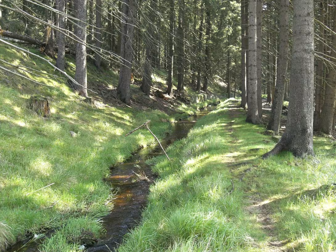

The historical appearance on the left is an AI-generated visualisation and serves as inspiration only.
Historical milestones
- 1530
- Measurement of the route by the Rossmeisle mine meter.
- 1531
- Opening of construction work on the canal.
- 1536
- Finishing the construction of the water works.
- 2014
- Listing for the list of national cultural monuments.
Architectural development
The route was measured in 1530 and the construction itself took place between 1531 and 1536. During the second half of the 16th century, the system was further improved and extended to a network of channels over 30 km long. The whole system included ten large mining ponds, 14 stables and 35 bridges.
Historical events
1530 - Likely year of formation of Long Sewers; 2003 - Dlouhá stoka is declared a cultural monument; 2014 - acquires the status of national cultural monument under the name Dlouhá stoka with ponds Kladský and Nový.
Owners
The ownership of the Long Sewers is linked to the history of the region. Originally, it was probably built to supply water to local mines or mills. Accurate information on ownership changes is not available, but it can be assumed that ownership has changed over the centuries and has been linked to the development of the region.
Points of interest
- It's a Renaissance artificial canal of 24,2 km long. - It was created to provide water for tin mining and the swimming of wood from the woods. The whole system included ten large ponds, 14 stables and 35 bridges. - At the time of flowering, he powered 52 mills on ore. - To the extent and implementation, it was unprecedented in Central Europe until similar channels were created in Harz or Banská Štiavnica.
Guide
This guide is narrated by a synthetic voice generated by artificial intelligence.
Show guide text
This text was created by artificial intelligence and has not been editorially reviewed. It may contain inaccuracies.
Welcome to one of the most important water works of our ancestors. You are standing in front of the Long Sewer, which is a fascinating monument to human ingenuity and endurance, which is situated in the region of Kladska in the Karlovy Vary region. Now, when you look around you, you see an artificial water channel in front of you, which is neatly yet impressive by the presence of the Slavkov Forest. At first glance, you may find it a simple stream of water, but you're actually looking at the technical miracle of your time, which in the year two thousand fourteen was rightly included in the list of national cultural monuments.
Let us now return together in time many centuries back to the time of the Renaissance, when this space looked quite different and the air smelled dust from the crushing of ore and the smell of dense forests. In the 16th century, tin mining was in full swing in this area. However, the extraction of precious metals required a huge amount of energy and water that nature did not offer in this particular place in the amount that was needed. It is for this practical reason that the idea was to build a large system of channels that would bring water from selected sources directly to mining operations.
The whole process began in the year one thousand and five hundred thirty, when it was entrusted with the special task of a mine meter called Hans Rossmeisl. He was the main brain and architect of the project. Rossmeisl had to measure the route with incredible precision, overcoming the terrain of the Slavkovsky Forest, while maintaining the correct flow so that the water would flow smoothly and efficiently. It was a colossal task because the instruments at the time were very simple, and yet he managed to design a journey over twenty-four kilometres long.
As soon as the route was measured, in the year one thousand and five hundred thirty one the construction works themselves began. Imagine thousands of hours of manual labor, digging in hard ground and folding stones. All these efforts resulted in a year of a thousand five hundred thirty-six, when the water work was officially completed. The whole process therefore lasted about six years, which is a very short period of time given the scale of the construction.
Now that you're standing here, pay attention to the actual structure of the channel. Notice how the water flows through the terrain. Dlouhá stoka was not just an ordinary line in the country, but a complex engineering system. If you go for a walk along her trough, you can see how accurately it was designed. The whole system included ten large ponds, which served as water storage facilities to keep the inflow stable even during the drought. The water from these ponds flowed further over fourteen stavels, allowing the water to be regulated according to current needs.
In addition, the system consisted of a total of thirty-five bridges that allowed both humans and animals to safely cross the water path. Notice how these elements naturally became involved in the landscape. Dlouhá stoka had two main functions. The first one was energy. The water was powered by pumping equipment that drained water from deep shafts, crushing hills and red mills. At the time of its greatest flourishment, this system powered up to fifty-two mills on ore. Imagine the noise, the excitement and the activity that ruled here in the sixteenth century, when dozens of mills were simultaneously processing ore from the depths of the earth.
The second function was logistical. At that time, there was no modern traffic or cars that could handle heavy costs in a dense forest. That is why it served the sewers to sail mining wood from Kynžvarsk forests directly into mining plants. The wood was necessary for the construction of shafts and as fuel for melting ore. Thus, the water was essentially the transport belt at the time, which connected the forests with the industrial centres.
It is fascinating to think that, at the time of its creation, this work was unprecedented in Central Europe. In scope and execution, it was an absolute rush. Rossmeisl and his workers have created an infrastructure that has passed its time by many years. If you look at a quiet stream of water today, you may not see in it the technical triumph at the time, but you just have to realize that this channel was the heart of the entire region. Without it, tin mining in this area would never have achieved such an expansion.
The interesting thing that might interest you is the incredible length. More than twenty-four kilometers of artificial trough in hilly terrain required incredible patience. Imagine how much work it has done to keep this long channel clean and in good condition so that no sediment can be stored in it and that the water continues to flow to the mills. Each kilometre has been carefully guarded and maintained because any crack or blockage could mean stopping work in dozens of mills and putting the mining profits at risk.
Now, when you look around, feel the atmosphere of this place. You're standing in a place where nature has merged with human ambition. Dlouhá stoka is proof of how people in the Renaissance managed to control the elements to make the most of them for their development. Even though the mills are no longer bland and the wood is sailed in a different way, there remains the spirit of the time and respect for craftsmanship.
Let us now slowly finish this part of our journey. I hope this brief interpretation has helped you better understand what Dlouhá stoka is. It is not only water in the canal, but a monument to courage, precision and technical genius of the Renaissance era. I ask you to continue to explore the area in peace. Follow the line of the canal, look for traces of old bridges, and try to imagine how much activity there was five years ago.
Notice how the water slowly waves and brings with it the history of the entire Slavkov Forest. Let yourself be guided by the silence of this landscape and take a moment to think about how powerful our manera has changed to work with nature. Thank you for your attention and I wish you a pleasant continuation of the journey towards the other secrets of this beautiful region. Say goodbye to this place in peace and with a sense of wonder of what human hands could build. Have a good trip.
Tips for visitors
The best time to visit is spring and autumn months, when the colours of Slavkovsky Forest are the most distinctive and the water in the canal is clean. Use your own car or public transport to transport to the area, check the specific connections in the current timetables.
For a walk along the water works take suitable shoes to the field, plenty of water and repellent against insects, as you move in the forest landscape. For photo lovers we recommend morning or late afternoon light, which will highlight the flow of water and surrounding greenery.
In the nearby area you can visit the Kladský and Nové ponds, a natural monument to Upolnova meadow under the Cross, instead of the Cross or climb the stone lookout on top of the view.
We recommend families with children to focus on water and nature observation in the longitudinal canal, which is a great way to introduce children to the history of water construction in nature.
Frequently asked questions
Can the monument be visited?
We have not verified whether this monument is accessible. Please ask the owner or operator, or the local municipal office.
Where is the monument?
Location: Kladská, Karlovarský kraj. The map on this page shows the exact spot.
Why is the monument protected?
It is listed in the Central List of Cultural Monuments of the Czech Republic as a national cultural monument (register no. 383).
For kids
Imagine coming back 496 years until there was a castle with a fortress. It was like a big fortress protecting people from thieves and enemies. Who lived here? They were earls of the House of Lords of Vartenberk. They took care of the castle and its inhabitants.
How did it look here? The castle was big and had tall walls so no one would have a chance to get in. There were many buildings - including church and boys' school. People lived in small houses near the castle where food and other things were sold. The castle was also a huge economy.
Businesses nearby
Do you run a restaurant, accommodation, shop, museum, rental, wellness or other visitor service near this monument? Show yourself directly to the people heading to it — this is how they will see you in the app and on the web:
Events nearby

Zdroj akcí: otevřená data měst a obcí ČR (Národní katalog otevřených dat) a kalendář akcí Národního památkového ústavu.
Nearby
V okolí se nachází rybníky Kladský a Nový, Národní přírodní památka Upolínová louka pod Křížky a Křížky, dále kamenná rozhledna na vrchu Na vyhlídce.
Accommodation nearby
Trips and activities nearby
Guided tours, tickets and activities nearby from GetYourGuide
Affiliate link: if you buy from the partner, we may receive a commission. The price for you does not change.
Search tours and activities →Themed route
Here is the design of the thematic route:
1. On the lookout (stone view) - Start the trip by climbing to the top, from where you can admire the wide view of the whole landscape. 2. Cross (important place) - Continue to this point, which forms a united whole with the surrounding area. 3. Upolínové meadow under the Cross (national natural monument) - Walk through unique nature and admire the rare vegetation of this area. 4. Dlouhá stoka (Water Works) - Visit the main destination of the trip and get acquainted with the construction of this interesting water work. 5. Kladský and Nové Pond (water areas) - End the trip in the quiet waters of the local ponds, which complement the landscape around the village Kladská.
Seasonal recommendations
In spring, the surrounding water works awaken. The trees start to green and the melting snow can make the water level higher. The atmosphere is fresh, but often wet. I recommend wearing waterproof shoes because the road can be muddy. The best is to visit the place early in the morning when light is soft and nature is the most lively.
In the summer months, the surrounding area is full of dense greenery and the sun lights up the sewers very intensively. It's the time of the greatest heat, which can increase the humidity in water. Dress lightly and remember to protect yourself against insects. The ideal time for a walk is late afternoon when the sun is no longer so hot and the shadows are longer.
Autumn brings golden colors and morning fog to the landscape, which give the water part a mysterious atmosphere. Leaves fall into the water and create an interesting picture. It is necessary to take warmer layers of clothing and shoes with good grip because wet leaves can be slippery. The light is low in this period and very beautiful for observing details.
Winter season is characterized by silence and freezing air. Around the sewer there may be snow or ice, which creates a rough but fascinating look. It is necessary to wear a very warm jacket and thermal underlayers. Because of the short days and the low sun, it is best to come around noon to make as much light as possible.
Visualizations and artistic views


The visualisations are generated by artificial intelligence and serve as inspiration.
Photos from the area
Real photos taken near the monument


Zdroj a licence jsou uvedeny u každého snímku.
Atmosphere of the place
This atmospheric visualisation of the place and period was generated by artificial intelligence. It is not real footage of the location.
Tips from visitors
No tips yet. Be the first!
Log in and add your tip.
Sources and literature
Photos: Chmee2 / CC BY-SA 3.0 — Wikimedia Commons. The author and licence also appear when you hover over the image.
Faktickým podkladem tohoto textu byl článek na Wikipedii, jehož autory jsou přispěvatelé Wikipedie. Článek je dostupný pod licencí CC BY-SA 4.0.
Location on the map
Příběhy a pověsti
Legendy, pověsti a příběhy spjaté s touto památkou

Fotografie návštěvníků
Zatím žádné fotografie. Buďte první, kdo přidá fotografii z návštěvy!
Log in a přidejte svou fotografii nebo hodnoťte.
Za ověřenou návštěvu v aplikaci získáte víc bodů — poznáme podle GPS, že jste na místě.
Reviews and comments