




Hradec u Kaplice Hillfort
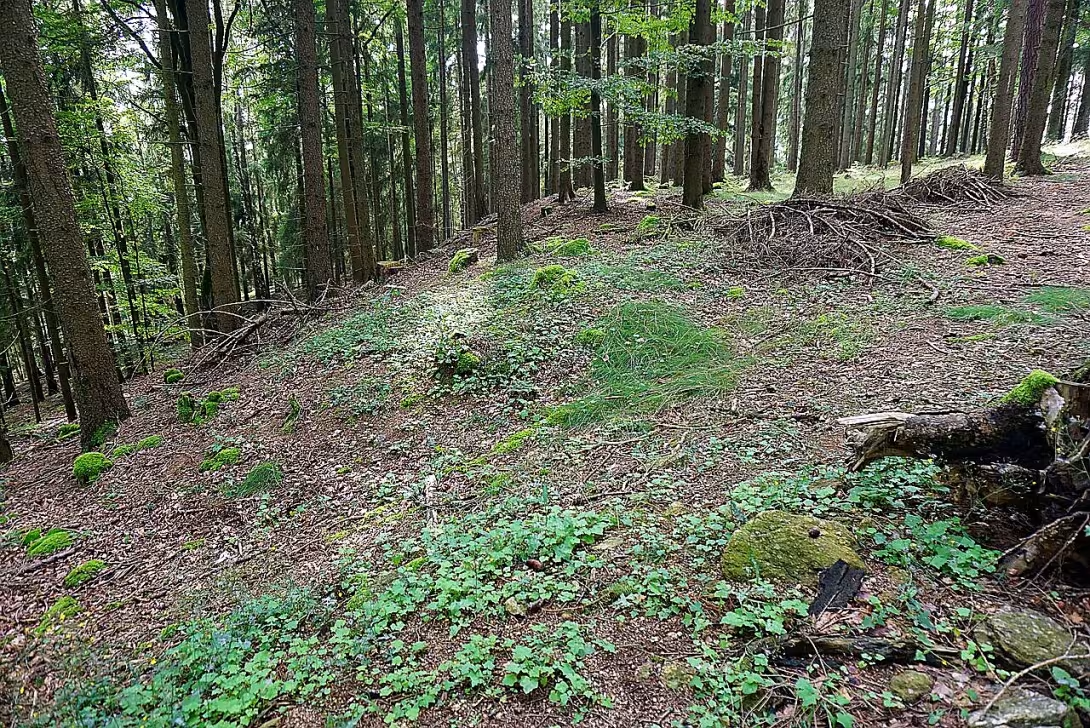
Hradec u Kaplice is a prehistoric castle located on the Hradištské vrůch in the Spolenovské výština, about three kilometres east of the city of Kaplice. Its origin is expected in younger or late bronze time and today the site is protected as a cultural monument.
Although archaeological research did not decide on precise dating, the castle was probably created in the late Bronze period. During this period, fortified settlements were developed in Europe and Czech countries. They served as centers of local communities and strengthened territorial structures.
The site is located at the top of the Hradiště hill at an altitude of 780 metres. The fort has a two-piece layout. The first part consists of a triangular foothold of a length of 90 metres, from whose fortification a stone wall of up to 0,5 metres tall. On the south side of the vanguard, the acropolis lies 15 metres higher. Both parts are separated by a wall with a height of up to 1.5 metres and a width of 10 to 15 metres.
The perimeter fortification of the acropolis is best preserved on the east, south and southwest side. In other sections the protection was secured by steep slopes and rock formations, although there was probably also a fortification. Valleys are eight to ten metres wide; The outside is 1.5 metres tall and 0.5 metres inside. According to XZ0 research ZXe was a wall of wooden formwork filled with stones, but the construction of wood and clay, reinforced on the front side of the wall from dry laid stones is more likely.
In the 1930s he led the archaeological research L. Franz, which focused mainly on exploring preserved remains of fortifications.
There is a lookout tower near the site and about 900 metres north of the Black River. Thanks to its location and preserved wares, this monument is an important element of prehistoric settlement in this area.
Hradec u Kaplice offers access to the system of prehistoric defence and settlement. Visiting this place allows you to observe the remains of ancient architecture right in the field and in the natural environment.
Then and now
Drag the slider to compare how the landmark may have looked when it was built with the view today.
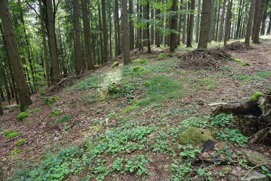
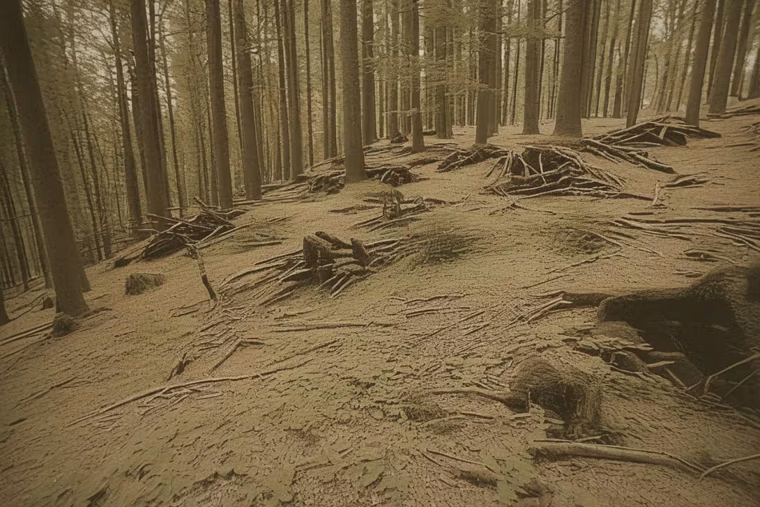
The historical appearance on the left is an AI-generated visualisation and serves as inspiration only.
Historical milestones
- Around 1000 BC l.
- The probable formation of the castle in the late Bronze Age.
- 1930-1939
- Archaeological research of fortifications led by L. Franz.
- Present
- Protecting the site as a cultural monument.
Architectural development
The fort is two-piece and consists of a 90-metre long front and a 15-metre higher acropolis. The fortifications consisted of walls which were probably made of wood and clay and reinforced with walls of dry laid stones. Valas acropolis were eight to ten meters wide.
Points of interest
- The site is located at the top of Hradiště hill at an altitude of 780 metres. - The fort has a two-piece layout formed by a triangular dam and acropolis. - Valy acropolis is eight to ten meters wide and probably constructed from wood and clay with stone walls. - The origin of the castle is expected in younger or late bronze times. - In the 1930s, L. Franz led archaeological research here.
Guide
Show guide text
This text was created by artificial intelligence and has not been editorially reviewed. It may contain inaccuracies.
Welcome here, at the very top of Hradištské vrůch in the heart of the Sobelnov Highlands. Stop for a moment, take a breath and feel the space around you. You are standing in a place that once served as a fortress, sanctuary, and probably a centre of power for the people who lived here thousands of years before us. Hradec u Kaplice is not a monument with high walls or decorative facades like we know from cities, but its strength lies in the landscape itself and in the silent witnesses of the past that we still find in the country and the terrain. Look around you at the outlines of the hill and imagine what this place looked like at a time when nature was much wilder and safety depended on the height on which you built your home.
Now let's move back very far in time. It is assumed that this fort originated around the year 1,000 BC, i.e. in the late or younger Bronze Age. Imagine a world where mankind had just learned to control metals and where communities were smaller but very organized. Why did they choose this place? The answer is seven hundred and eighty meters above sea level. From this point on, the residents had a perfect overview of the surrounding terrain. They saw everyone approaching them, and they were also protected from the enemy by natural terrain. The fort was not only a dwelling, but a strategic point that defined the life of the entire area. Although archaeological research has failed with absolute precision to determine the date of each stone, the atmosphere of this place still tells the story of people who sought stability and protection in troubled times of prehistoric times.
Now pay attention to the construction and layout of this space. Even though today you see mainly forested peak and grass, under your feet lies a fascinating architectural plan. The fort is divided into two main parts. Notice that space is not uniform. The first part consists of a so-called vanguard, which has a specific triangle shape. The prepayment probably served as the first line of defence, or as an area for economic activities and temporary residence of people who did not need to be at the very heart of the fort. Above it is the acropolis, the highest and most important part of the castle. The acropolis was the heart of the complex, a place where probably the highest layer of society or where the most important objects of the community were stored.
Now, if you look around and try to see the structure of the terrain, think about how much effort it must have been to build a fortification. The waves of acropolis that once stood here were truly impressive. Imagine rough walls between eight and ten meters wide. It wasn't just a pile of stones, it was a sophisticated structure. Probably these walls were made up of a combination of wood and clay that were reinforced by walls of stones. Imagine the hundreds of hours of work, carrying heavy tribes from surrounding forests and thousands of stones from surrounding terrain to create a barrier to avert any attacker. Even though these structures are mostly embedded or broken by time, their tracks still follow the boundaries of this cultural monument.
But this space would only remain a silent pile of land if there were no interest in people who tried to uncover its secrets. In this context, we must mention the name L. Franze. It was in the thousands of nine hundred thirty to one thousand nine hundred thirty-nine that he led the systematic archaeological research of the fortification here. Imagine these men in the fields, with shovels and brushes in their hands, patiently removing the layers of soil so that for the first time in thousands of years they can look at the structure of the waves. Franz's work was crucial for us to know today about the triangular front and the exact width of the fortifications of the acropolis. Thanks to his efforts, Hradec u Kaplice became a recognised archaeological site and was subsequently declared a cultural monument, which ensures that these traces of the past will not be lost in oblivion.
But there is also a certain amount of secrets associated with each such place. One of the greatest mysteries of Hradec at Kaplice is its precise dating. Although the fort is attributed to the late Bronze, archaeological findings and research did not give the possibility to set a date with absolute certainty. It is a fascinating paradox of modern science that, although we know the exact layout of the waves and know what they were built from, the exact time frame for their creation remains the subject of professional debate. Maybe people lived here longer than we think, or maybe the fort has passed through several waves of rebuilding. This uncertainty gives the place a special charm. You stand in a place that refuses to be fully defined and allows you to confuse your idea of prehistoric inhabitants yourself.
Now try to imagine what life was like at this peak in the winter, when the wind floated the walls of the acropolis, or at a hot summer noon, when from this point they watched the movement of the game in the valley. It was an existence full of toil, but also full of a sense of security, which was provided by this very height and robust walls. Hradec u Kaplice is not just a collection of archaeological data, it is a monument to the human will to survive and organize in an environment that was much more inhospitable then today.
Now we invite you to take a slow look around and explore the surrounding area. Feel the silence that prevails here today, and contradict it with the noise that must have been there during the construction of the valleys or at a time when the castle was bursting with life. Follow the line of terrain, search the landscape for triangular shapes and imagine where the foothold ended and where the holy land of the acropolis began. Let your imagination guide you, but at the same time respect the integrity of this protected place.
Thank you for spending some time with us in the depths of the primeval. We hope this short trip in time helped you to see in Hradec near Kaplice more than just a wooded top hill. It's a place where nature meets history and where every stone can tell a story about the Bronze Age people. We wish you a pleasant further journey and many other discoveries in the beautiful hills of Szecnov. Goodbye.
Tips for visitors
The best time to visit is the spring and autumn months, when the landscape of the hills is the most beautiful and the temperatures are ideal for field walks.
The place can be reached by car and public transport; We recommend to verify specific connections and parking possibilities in the area.
Don't forget to bring with you fixed shoes suitable for nature and plenty of drinking water, because it is an archaeological site in the hilly terrain.
For the best photos we recommend using the light shortly before sunset. The best sightseeing points in the area offer a nearby lookout tower.
With children we recommend to explore the castle as an educational trip to the primordial. As part of the visit, you can take the children to the nearby lookout tower or for a short walk to the Black River, which flows north of the monument.
Businesses nearby
Do you run a restaurant, accommodation, shop, museum, rental, wellness or other visitor service near this monument? Show yourself directly to the people heading to it — this is how they will see you in the app and on the web:
Nearby
There is a lookout tower near the castle and about 900 metres north of the Black River.
Accommodation nearby
Trips and activities nearby
Guided tours, tickets and activities nearby from GetYourGuide
Affiliate link: if you buy from the partner, we may receive a commission. The price for you does not change.
Search tours and activities →Themed route
1. River Black - Water flow. A quiet place near the water, located approximately 900 meters north of the castle. 2. Hradec u Kaplice - Archaeological site. The main destination of the trip where you can explore the remains of ancient history. 3. View tower - View tower. It stands near the castle and offers a beautiful view of the surrounding countryside.
Seasonal recommendations
In spring, the archaeological remains of Hradec at Kaplice are awakened along with nature. Light is fine and scattered in this period, which ideally highlights the structure of old stone remains. Wild flowers begin to bloom around the ruins and everything turns green. For visitors it is best to choose the morning hours when the air is the cleanest. We recommend wearing layered clothes because the morning cold can be followed by the heat of the sun.
Summer months bring intense sunlight and long taxes to the place, allowing slow discovery of every detail of the site. The atmosphere is alive, but due to high temperatures, the movement between the stones can be more challenging. In the main summer season it is advisable to arrive as early as possible in the morning to avoid the greatest heat and possible groups of visitors. Don't forget the headgear, enough drinking water and sun protection.
The autumn season gives the ruins a magical and slightly melancholy touch. The morning mist often rolls over the archaeological layers, creating a mysterious atmosphere for photography. Golden and brown leaf colours create a beautiful contrast with grey stones. It is advisable to prepare waterproof shoes as moisture in the ground may be increased. The best time to walk is in the afternoon when the sun shines at a lower angle and the colors are the most distinctive.
Zimą makes Hradec u Kaplice seem raw and very calm. Without leaves on trees, silhouettes of ruins are visible even from a distance and frost can create interesting patterns on the stones. The atmosphere is quiet and lonely, which is ideal for those looking for deep perception of history without interference. Due to shorter daily times and lower temperatures it is necessary to choose very warm clothes and plan a visit on bright, sunny days when visibility is best.
Visualizations and artistic views


The visualisations are generated by artificial intelligence and serve as inspiration.
Photos from the area
Real photos taken near the monument


Zdroj a licence jsou uvedeny u každého snímku.
Tips from visitors
No tips yet. Be the first!
Log in and add your tip.
Sources and literature
Fotografie: MartinVeselka / CC BY-SA 4.0 — Wikimedia Commons. The author and licence also appear when you hover over the image.
Faktickým podkladem tohoto textu byl článek na Wikipedii, jehož autory jsou přispěvatelé Wikipedie. Článek je dostupný pod licencí CC BY-SA 4.0.
Location on the map
More monuments – Kaplice
Show all in the municipality
Příběhy a pověsti
Legendy, pověsti a příběhy spjaté s touto památkou

Fotografie návštěvníků
Zatím žádné fotografie. Buďte první, kdo přidá fotografii z návštěvy!
Přihlaste se a přidejte svou fotografii nebo hodnoťte.
Za ověřenou návštěvu v aplikaci získáte víc bodů — poznáme podle GPS, že jste na místě.
Reviews and comments