



Slavětín Ruin
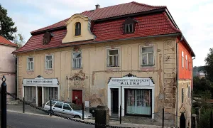
Objekt se nedochoval — na místě dnes nestojí. Následující text popisuje jeho historii, ne současnou návštěvu.
Slavětín is a small town in the district of Louny, whose name is also a lost chateau that once stood here. It was the work of the Rvenice flags, which apparently built it in the early Middle Ages. The more real form of the chateau is linked to the 14th century, when páni z Hazmburka gradually acquired it. In 1340, from which we have the first written mention, the Hazmburks purchased the other half of the chateau and thus completely dominated it.
The chateau remained in the possession of the Hazmburg family for centuries. The short exception is the period from 1450 to 1474, when it was taken near the city of Louny. Then he returned to the hands of the lord of Hazmburk, where he remained until the beginning of the 16th century. That's when they sold it to Václav Sokol of the Plague. The chateau was then divided among his four sons. Their estate became dependent in 1586 - they were stopped by Jindřich, the younger Doup. Five years later, in 1591, the falcons of Mor decided to pay off the Doup.
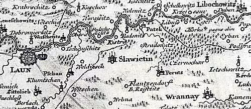
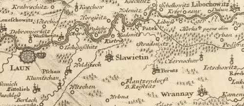
At this time, around the end of the 16th century, the town was supposedly hit by bigger fires. The chateau was probably destroyed along with it. After 1619, the owners of the town took turns in a fast sequence, but the chateau is no longer shown in written sources. His trail disappeared from public awareness. Even so, on Müller's map of Bohemia from 1720 you could see the mansion in Slavětín marked.
Since then, however, it has only gone downhill. In 1796, part of his remaining wall was used to build the fenced wall of the garden. In the first decades of the 19th century, the rest of the ruins were pFrequency. In 1833 and 1834, workers gradually dismantled the last remnants of the walls to create building material on the manor barn.
We know almost nothing about the chateau itself. The only knowledge comes from the description of the worker who was directly involved in the destruction of the ruins and from the brief entries of the municipal chronicler. According to these testimonies, the chateau had a chamber that was buried in debris. The walls were remarkably thick, measured up to five cubits. The chateau protected the waterfront on its south and east side, while the remaining sides were defended by ponds.
Today in Slavětín nothing material from the chateau was preserved. The extinct building, which was gradually swallowed up by the ground and time, resembles the rich history of this town and the change in the power ratio in the region of Lounia.
Then and now
Drag the slider to compare how the landmark may have looked when it was built with the view today.
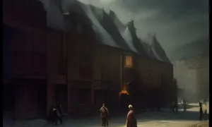
The historical appearance on the left is an AI-generated visualisation and serves as inspiration only.
Historical milestones
- 1340
- The Hazmburk lords bought the other half of the chateau.
- 1450-1474
- The chateau was taken over by the city of Louny.
Architectural development
Details of the building development of the chateau are not known. We know from the rest of his intel that his chambers and walls were five cubits thick. The chateau was protected by a moat on the south and east side and ponds on the other sides.
Historical events
- 1340
- The Hazmburk lords bought the other half of the chateau.
- 1450-1474
- The chateau was taken over by the city of Louny.
- 1591
- The falcons of Mor paid off Henry Doupovka and the chateau was probably destroyed by a fire.
Points of interest
- Slavětín is a small town in the district of Louny and bears the name of the lost chateau.
- The chateau was built by flags from Rvenice, but the real form dates back to the 14th century when the family from Hazmburk owned it.
- In 1340, the Hazmburks bought the other half of the chateau, and they completely dominated it.
- The chateau was held by the Hazmburg family for several centuries, with a short exception between 1450 and 1474 when it was seized by the city of Louny.
- After the fire around the end of the 16th century, the chateau was destroyed and its remaining masonry was used in 1796 to build the fenced wall of the garden, then the ruins were dismantled in 1833 and 1834.
Guide
This guide is narrated by a synthetic voice generated by artificial intelligence.
Show guide text
This text was created by artificial intelligence and has not been editorially reviewed. It may contain inaccuracies.
In Slavětín in the Louny region, there once stood a castle, sometimes also referred to as a manor. Today nothing remains of it. The remains of its ruins were dismantled and served as building material.
The castle in what was then an older small town was probably built by the lords from Rvenice. In the fourteenth century, its half belonged to the lords of Hazmburk. In 1340 they purchased the other half, and the first written mention of the castle dates from this year. The lords of Hazmburk then held Slavětín until the beginning of the sixteenth century. An exception was the years 1450 to 1474, when the nearby town of Louny took control of the castle.
Before 1525, the Hazmburks sold the castle to Václav Sokol of Mor. After his death, his four sons divided the property among themselves. In 1586 they pawned the entire estate to Henry the Younger Doupovec of Doupov, but in 1591 the Sokols of Mor redeemed it. Around that time the small town burned down and the castle apparently perished with it. After 1619 the ownership of the small town passed through several hands, but the castle is no longer mentioned in the records.
Müller's map of Bohemia from 1720 still shows the manor seat in Slavětín. In 1796, however, part of the walls fell victim to the construction of a garden enclosure wall. The rest of the walls were dismantled by workers in 1833 and 1834 to obtain stone for the construction of the manor barns.
We do not know what the castle looked like. Only a description survived from a worker who demolished the ruins, and a brief note from the village chronicler. According to them, chambers filled with rubble were found during the demolition. The walls were up to five cubits thick. On the south and east sides, the castle was surrounded by a water-filled moat, and on the other sides it was protected by ponds.
For kids
Imagine going back to the past, where medieval culture exists on Czech territory and chateaux are a symbol of power and wealth. This is how we present the chateau Slavětín, which once stood in the same town in the district of Louny.
What did it look like? Who lived here? What happened here? The chateau Slavětín was the seat of the masters of Rožmitál and it was one of the most beautiful chateaux in the whole country. That's where people lived who lived for a living by agriculture, trade and war. They were heroes who opposed enemy attacks and protected their homes.
Businesses nearby
Do you run a restaurant, accommodation, shop, museum, rental, wellness or other visitor service near this monument? Show yourself directly to the people heading to it — this is how they will see you in the app and on the web:
Nearby
🏰 Historic sites (49)
- Bývalý Débeřský dvůr 2.5 km
- Historický Perucký vodovod 2.6 km
- Pomník Františka de Paula A. Thuna 4.0 km
- zámek Peruc 4.0 km nám. E. Filly 1
- Památník vojákům Rudé armády 4.1 km
- Muzeum české vesnice 4.2 km
- Památník obětem II. odboje 4.4 km
- Galerie Emila Juliše 4.6 km
- Památník vojákům Rudé armády 4.6 km
- Památník obětem světových válek 5.0 km
- zámek Panenský Týnec 6.1 km
- Obětem 1. a 2. světové války 6.2 km
- Pomník tří císařů 6.2 km
- Kapitán Otakar Jaroš 6.7 km
- menhir Pastýř 7.7 km
- Panna Maria 7.8 km
- Mistr Jan Hus 7.9 km
- Galerie Benedikta Rejta 7.9 km
- Pomník obětem 2. světové války 8.6 km
- Pomník obětem 1. světové války 8.7 km
🍽️ Restaurants and dining (73)
- Hospoda Hasičárna 3.9 km
- Na Václaváku 4.6 km Třebízského 63
- U Sumbala 4.6 km Komenského náměstí 25
- Hostinec Pod rozhlednou 5.0 km
- Hostinec 5.0 km
- Stop Cafe 5.9 km web
- Food Book 6.3 km
- Zichovec pivovar 6.3 km 5. května 2789 725 879 944 web
- Stop Cafe 6.5 km web
- U Jíchů 6.7 km web
- Pohoda 6.9 km Rybalkova 2978 +420 739 285 179 web
- U kulatého stolu 7.0 km
- Pivovarská restaurace Na Letňáku 7.1 km +420736400655 web
- Dělnický dům Cítoliby 7.1 km Zeměšská 219 web
- Žerocká hospoda 7.3 km
- Gala 7.3 km
- U Brachy 7.3 km
- Kebab4ypu 7.6 km
- U Žida 7.6 km
- Bellagio 7.7 km
🏨 Accommodation (22)
- Kemp Peruc 3.7 km
- Laura 6.3 km web
- Kasárna 6.4 km web
- Alena 7.1 km
- Heller 7.2 km
- Apartmány Rossa 7.6 km Pražská 78 +420 777 195 904 web
- Na Hradbách 7.8 km web
- Zlatý Lev 7.8 km web
- U Daliborky 7.8 km web
- Caramell 7.8 km web
- U Radnice 8.0 km
- Union 8.0 km web
- Hotel Černý kůň 8.0 km +420 739 609 800 web
- Hudebka 8.0 km web
- Merlot 8.1 km Žatecká 186 +420 415 653 025 web
- Barokní Špitál 8.1 km
- Hotel Pod Sluncem 10.8 km Třebíz 25 +420312521898 web
- Sklenik 11.1 km
- Sklenik 11.1 km
- Farma pod Házmburkem 11.4 km +420 770 199 772 web
🚲 Rentals and sport (10)
- Pláž koupaliště Hřivčice 1.8 km
- Koupaliště 3.7 km
- Kola Fiala 6.8 km Říční 1120
- Kola Chrobák 7.2 km Hrnčířská 583
- Cyklistický stadion 8.6 km
- Auto - moto areál Ředhošť 10.7 km
- K+S 11.4 km
- Venkovní posilovna 13.5 km
- Sokolovna 14.6 km
- Plavecký areál Postoloprty 14.9 km
🥾 Hiking and nature (67)
- Boženina studánka 4.0 km
- Studánka v Debeřském údolí 4.1 km
- Krásná vyhlídka 4.6 km
- Blšanský chlum 4.7 km
- Štola Stradonice 4.9 km
- Stradonka 5.2 km
- Velký vrch 5.7 km
- Park generála Fajtla 6.1 km
- Riegrovy sady 6.1 km
- Hladový vrch 6.2 km
- Studánka Telce 6.2 km
- Malý vrch 6.4 km
- Koštice 6.8 km
- Luna 7.0 km
- nám. Rudé armády 7.9 km
- Holánkovy sady 7.9 km
- Visálek 8.1 km
- Srna 8.2 km
- Rohatec 8.3 km
- Viselec 8.4 km
Visualizations and artistic views


The visualisations are generated by artificial intelligence and serve as inspiration.
Photos from the area
Real photos taken near the monument


Zdroj a licence jsou uvedeny u každého snímku.
Atmosphere of the place
This atmospheric visualisation of the place and period was generated by artificial intelligence. It is not real footage of the location.
Tips from visitors
No tips yet. Be the first!
Log in and add your tip.
Sources and literature
Photos: Gortyna / CC BY-SA 4.0 — Wikimedia Commons. The author and licence also appear when you hover over the image.
Faktickým podkladem tohoto textu byl článek na Wikipedii, jehož autory jsou přispěvatelé Wikipedie. Článek je dostupný pod licencí CC BY-SA 4.0.
Location on the map

Příběhy a pověsti
Legendy, pověsti a příběhy spjaté s touto památkou
Fotografie návštěvníků
Zatím žádné fotografie. Buďte první, kdo přidá fotografii z návštěvy!
Log in a přidejte svou fotografii nebo hodnoťte.
Za ověřenou návštěvu v aplikaci získáte víc bodů — poznáme podle GPS, že jste na místě.
Reviews and comments