



Číňovský mlýn Water mill
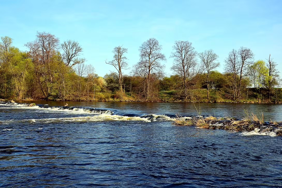
Objekt se nedochoval — na místě dnes nestojí. Následující text popisuje jeho historii, ne současnou návštěvu.
Číňovský mlýn was a water mill situated northeast of the village of China in the district of Louny. The object stood on the Ohři River and was probably from the 18th century. In 1967 it was demolished. There are only a few torsional walls left in place today. The monument is remarkable with its long-term protection, which lasted decades after the demise of the building.
The oldest history of the mill was left with little news, but it is assumed that it originated during the 18th century. In this period, when the Czech countries belonged to the Habsburg monarchy, rural infrastructure and water works needed for the then agricultural production were developed. The existence of the mill is documented on the Imperial Mandatory Prints from 1843.
The architectural mill consisted of several buildings. The technical solution used the water supplied by the drive from the lake in Ohří, which, after passing through the mill, returned through the drain channel to the river stream. In 1930 the mill was equipped with two wheels for the bottom water. He used a gradient of one meter and a flow rate of 2,284 cubic meters per second. The total power of the device was 9.6 horsepower.
The building was declared a cultural monument of the Czech Republic in 1958. A fundamental change occurred in 1967 when the mill was demolished. Although the physical structure had ceased to exist, the registration of the monument protection remained valid for another 43 years. It was only cancelled in 2010.
At present, only a few torsional walls remain at the site of the original mill. The location in the cadastral territory of the municipality Nové Sedlo resembles a lost technical monument, which has been kept as a cultural heritage for 52 years. Visiting this place offers the opportunity to explore the history of water miller in the region and to think about the changes of the landscape along the Ohře River.
Historical milestones
- 1843
- The mill is depicted on Emperor's required prints.
- 1930
- The mill had two wheels for underwater with 9.6 horsepower.
- 1958
- The building was declared a cultural monument.
- 1967
- The mill was demolished.
Architectural development
The mill consisted of several buildings probably built in the 18th century. The technical equipment included a drive from the lake on the Ohří River and a drain canal. In 1930 the mill had two wheels for lower water with a flow rate of 2,284 cubic meters per second.
Historical events
In 1958 the mill was declared a cultural monument. In 1967, the object was demolished. In 2010, the record of monument protection was cancelled.
Points of interest
- The mill stood on the Ohři River and probably originated in the eighteenth century. - In 1930, the facility was equipped with two wheels for the lower water and was capable of nine whole six-tenths of horsepower. - The building was declared a cultural monument in 1958, even though it was demolished in 1967. - The record of monument protection remained valid for forty-three years after the demise of the construction and was cancelled only in 2010. - There are currently only a few remnants of walls that resemble a lost technical monument.
Guide
Show guide text
This text was created by artificial intelligence and has not been editorially reviewed. It may contain inaccuracies.
Welcome, you're standing in front of a place where a water mill once roamed, today just a silent print of history on the banks of the Ohre River. In front of you is the area where the Číňovský mlýn once stood, and even if there is no stone structure, you can feel the forces of the river and human labor once met here. The air carries a light odour of moisture, and the ground beneath your feet reminds us that there once was water flowing here, which powered large mill wheels.
Let's look at the origin and historical context of this place. The mill was probably founded during the eighteenth century, i.e. when agricultural production developed in our region and hydropower was one of the main sources of propulsion. Its position northeast of the village of China in the district of Louny was chosen deliberately - the river Ohry offered plenty of flowing water, so it was possible to build a facility that served local farmers and craftsmen. The first written mention of the mill appeared on the Emperor's compulsory prints from 1843, where it was already drawn as part of the landscape. This proves that already in the first half of the nineteenth century the mill was firmly anchored in the local economy.
Over the years the mill developed and modernized. In 1930 it was equipped with two wheels on the bottom water, which meant that the water stream was directed below the shore level and thus increased the efficiency of the entire facility. This round had a total output of nine whole six-tenths of horsepower - a number which at that time represented a solid force for grinding grain, crushing hay and other agricultural activities. Although these are technical data, you can imagine large wooden wheels spinning along the river bank, their blades submerged in flowing water and transferred energy to stone or wood mill rocks.
The architecture of the mill, although it has completely disappeared today, nevertheless provides us with several clues that you can focus on while viewing the site. First of all, notice the shape of the terrain - on the right side of the river there is a slightly increased drive, from where the water was previously brought to the mill wheels. This drive was probably excavated by a channel that controlled the current to the lower wheels. Further look at the remains of stone foundations that can still be seen under the grass - these are traces of solid pillars on which the mill's construction itself stood. Even if no remains of roofing roofing or windows are preserved, you can imagine that the building had a simple but functional shape, typical of the water mills of the time - probably single-storey with an annex for storage of grain and maintenance wheels.
With regard to the key stories and personalities associated with this place, historical records unfortunately do not mention the specific names of owners or craftsmen who worked here. Yet it can be assumed that the mill was the center of the local community where farmers met to get their crops crushed, and where news and information were shared. In 1958 the mill was declared a cultural monument, which shows that even after its working time it was seen as an important historical element of the region. Unfortunately, this status was not reversed by the fate of the building - demolition took place in 1967, so only a print in the landscape and records in the archives were preserved from the original structure.
An interesting thing to consider is the paradox that even after the declaration of cultural monument the mill was demolished. Why did that happen? One option is technical problems - the old stone building could have been in a worse condition, dangerous to the surroundings, and repairs would have required substantial funds that were not available to the administration at the time. Another possibility is that at that time priorities in the protection of historical objects changed and some smaller buildings were not considered valuable enough to preserve them. This contradiction between the recognition of historical value and the practical decision on demolition remains an open question which encourages reflection on how we treat the legacy of the past.
Now that you're standing in this place, you can see not only the physical clues, but the story behind them. Notice how the Ohre River is still rolling around and how its water is still moving in the same direction as the mill wheels used to drive. Think about how many generations of people have found work here, what efforts they have made to maintain and what impact this small but important machine has had on the lives around it. Even if you can't see the wheel itself today, you can imagine how the blades were turning in the rhythm of the stream, how the hammer strikes were heard and how the gentle noise of water and wood was carried in the distance.
In conclusion, I invite you to look around the wider area of the New Sedla and discover other traces of the past that are hiding here. Explore the old paths, look at other historical objects in the county and let yourself lead this place where nature meets human activity. Whether you decide to continue along the Ohra bank or return to the village, take with you the knowledge that even the dead buildings have a voice that can be heard if you listen. Thank you for joining this audio guide, and I wish you a pleasant discovery of other chapters of our rich region.
Businesses nearby
Do you run a restaurant, accommodation, shop, museum, rental, wellness or other visitor service near this monument? Show yourself directly to the people heading to it — this is how they will see you in the app and on the web:
Events nearby
Zdroj akcí: otevřená data měst a obcí ČR (Národní katalog otevřených dat) a kalendář akcí Národního památkového ústavu.
Nearby
Mlýn se nacházel v blízkosti řeky Ohře v katastrálním území obce Nové Sedlo.
Visualizations and artistic views


The visualisations are generated by artificial intelligence and serve as inspiration.
Photos from the area
Real photos taken near the monument

Zdroj a licence jsou uvedeny u každého snímku.
Tips from visitors
No tips yet. Be the first!
Log in and add your tip.
Sources and literature
Faktickým podkladem tohoto textu byl článek na Wikipedii, jehož autory jsou přispěvatelé Wikipedie. Článek je dostupný pod licencí CC BY-SA 4.0.
Location on the map

Příběhy a pověsti
Legendy, pověsti a příběhy spjaté s touto památkou

Fotografie návštěvníků
Zatím žádné fotografie. Buďte první, kdo přidá fotografii z návštěvy!
Log in a přidejte svou fotografii nebo hodnoťte.
Za ověřenou návštěvu v aplikaci získáte víc bodů — poznáme podle GPS, že jste na místě.
Reviews and comments