



Sedláčkova stezka Road
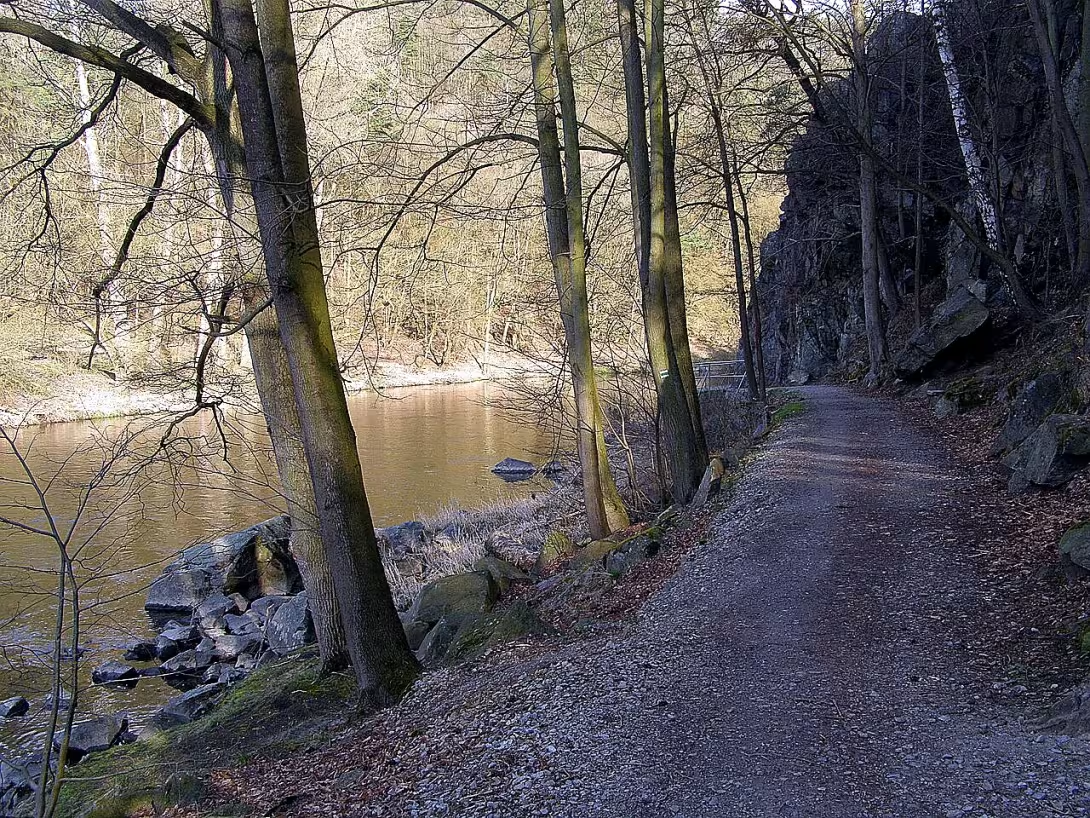
Sedláčkova stezka is a road leading along the Otava River from Sand to the castle of Obzkov, passing approximately 25 kilometres through the countryside. The route was created as an expression of respect for Czech historian and traveller Augustus Sedláček, who considered Zděkov to be king of Czech castles. Today it serves both pawns and cyclists, and its renovated form becomes part of wider cycling networks.
The idea of the trail appeared for the first time in 1917 in an article by Dr. Tlamich in the journal of Czech tourists. The Sandy Department of the Czechoslovak Tourist Club decided to build a trail for Professor Sedláček's 80th birthday in 1923. The construction was initiated and managed by Vice-President of the Spanish Tourist Club, the head construction board Ing. Antonín Hnídek. The construction was started on 2 October 1924 by the section from Zíce to the Lomnici River, which was built by Jindřecha Bubly from Horadějovice. In 1925 the building continued from Záška upstream to the Drowner. The bridge over Lomnica was first temporary and built by the sand carpenter František Káca; later, in 1935, it was replaced by a reinforced concrete structure. The Radadotek builder Josef Mráz then built up the rest of the trail up to Bodkov. The opening ceremony took place on 20 May 1928 with the participation of some 500 people, including tourists from Písek and Prague. The participants went through the last third of the route together, all the way to Zděkov, where the program was completed by a rich cultural escort. The guide was published by Professor Josef Veselý.
The original 25-kilometer route was designed for two people side by side and built at least 4 metres above the normal water level to protect it from flooding. Yet she later faced various obstacles. Poles, floods in 1940, ice in 1947 - all this gradually destroyed it. A fundamental change was brought about by the launch of the Orlická dam in 1962, which flooded the northern part of the trail. The remaining route must have been transferred over the valley.
Since 2006, the trail has been gradually renovated. It was adjusted to a length of 35 kilometres and converted into Cycle Trail 1225 for mixed operation of both foot and cyclists, with partial asphalt. The city of Písek, with the support of state institutions and regions, gradually restored individual sections. The ceremonial opening of the renovated part took place on 20 May 2007 with the participation of enthusiasts on historical bikes in period costumes. On this occasion, the city of Písek issued a guide with financial support from the region. Today, the route is mainly led by a red mark along the left bank, along which the European long-distance route E10 also passes; in the introductory part it is guided along the shore by the right green mark.
Then and now
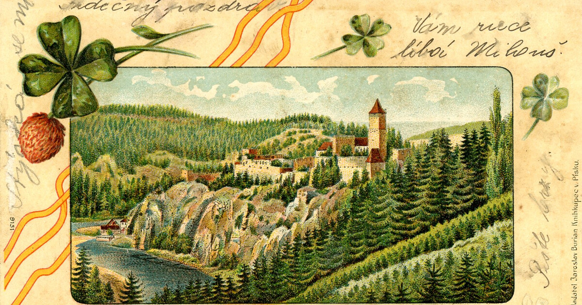
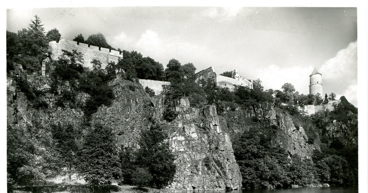
Drag the slider to compare how the landmark may have looked when it was built with the view today.
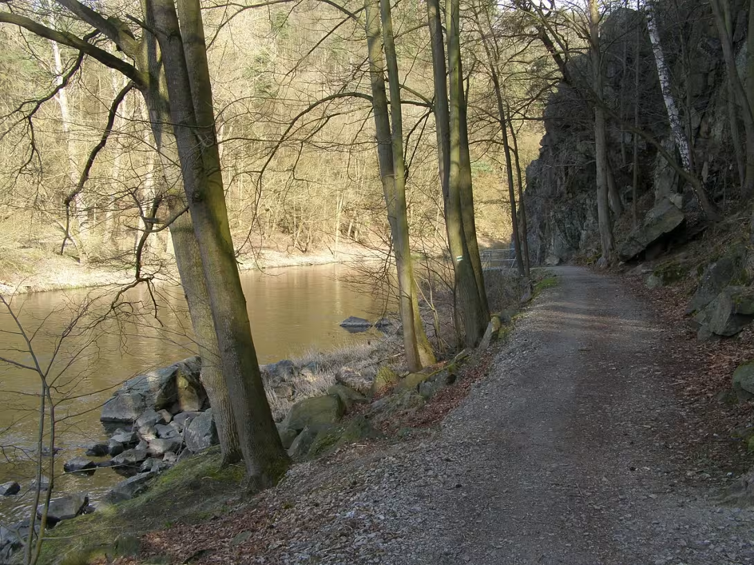

The historical appearance on the left is an AI-generated visualisation and serves as inspiration only.
Historical milestones
- 1917
- The first design of the trail was published in the magazine of the Czechoslovak Tourist Club Dr. Tlamich.
- 1924
- The construction of the section from Zíce to the river Lomnice by Jindřich Bubly from Horadějovice.
- 1928
- Festive opening of the trail with the participation of 500 people, including tourists from Prague.
- 2006
- Opening of the renovation of the route as cycle path 1225 for mixed operation.
Architectural development
The trail was originally built of stone and wood, the makeshift bridge over the water streams was replaced by reinforced concrete. In the 21st century some sections were asphalted and the route was modernised for cycling operations. Materials and structures have been adapted to current safety and transport standards.
Historical events
1917 - The first design of the trail published in the Czechoslovak Tourist Club magazine.
1924-1928 - Construction of the trail initiated and controlled by Ing. Antonín Nídek, festive opening on 20 May 1928.
1962 - Destroying part of the original route by launching the Orlická dam.
2006-2010 - Renovation and transfer of the route as a bike path with support of the city Písek and South Bohemian Region.
Points of interest
- The trail was named after the historian and traveler of Augustus Sedláček, who called Zděkov "king of Czech castles.".
- The idea of the trail was created in 1917 in an article by Dr. Tlamich and was realized to celebrate his 80th birthday in 1923.
- The construction was initiated and managed by Vice-President of the Spanish Tourist Club Ing. Antonín Hnídek, the first section was built in 1924 by Jindřich Bubla.
- The opening ceremony in 1928 was attended by about 500 people, including tourists from Prague, and ended with a cultural program at the castle of Zběkov.
- After the flood in 1940 and the flooding of the northern part of the trail in 1962, the route was translated over the valley.
Guide
This guide is narrated by a synthetic voice generated by artificial intelligence.
Show guide text
This text was created by artificial intelligence and has not been editorially reviewed. It may contain inaccuracies.
Sedláčkova stezka is a tourist path along the Otava River, which leads from Písek to Zvíkov Castle. It is named after Augustus Sedláček, a professor, historian, and passionate tourist from the turn of the nineteenth and twentieth centuries. It was he who considered Zvíkov to be the king of Czech castles.
The first proposal for the path appeared in 1917 in an article in the magazine of Czech tourists. The Písek branch of the Club of Czechoslovak Tourists then promised to build it for Augustus Sedláček's eightieth birthday in 1923. The construction was initiated and directed by the vice-chairman of the Písek tourist club, chief building advisor Antonín Hnídek.
Work began on October 2nd, 1924 with the section from Jistec to the Lomnice stream. A year later, construction continued upstream towards Topělec. Both first sections were built by the company of Jindřich Bubly from Horažďovic. A provisional footbridge across the Lomnice, built by Prague carpenter František Káci, was replaced in 1935 by a reinforced concrete one. The continuation to Zvíkov was completed by builder Josef Mráz from Radobyty.
The official opening took place on Sunday, May 20th, 1928 at the footbridge over the Lomnice with the participation of approximately 500 people from Písek and Prague. The participants then walked together over the last third of the path to Zvíkov, where the ceremony was concluded with a rich program. A detailed printed guide by Professor Josef Veselý was published for the opening.
The path measured 25 kilometers, which was roughly 6 hours of walking. It was wide enough for two people to walk comfortably side by side. It ran at least 4 meters above the normal water level so that it would not be flooded by floods. You could also start the route in Vráž or at the Vlastec and Vrcovice stations.
However, its passability was occasionally disrupted by fallen trees, a flood in 1940, and ice in 1947. A substantial part of the original path was destroyed by the filling of the Orlice Dam in 1962. The path was then rerouted above the valley.
Today, red tourist marking runs along most of the route, and the European long-distance trail E10 also passes along it. In the initial section, green marking runs along the right bank. After 2000, the city of Písek renovated the path in an adjusted route 35 kilometers long as cycle route number 1225 for pedestrians and cyclists, and had some sections paved. In the future, it is to become part of the Otava Cycle Path from Modrava, which is 151 kilometers long.
Frequently asked questions
Can the monument be visited?
We have not verified whether this monument is accessible. Please ask the owner or operator, or the local municipal office.
Where is the monument?
Location: okres Písek, Jihočeský kraj. The map on this page shows the exact spot.
For kids
Imagine coming back two hundred and twenty-four years. It was the time when the Czech Switzerland lived for 5,000 years. People built their houses here made of stone and clay, and when something happened to them, they went to their magician.
The stone bridge by the Elbe River was like a giant attack tower protecting the village from water. And on the shores of the river itself, trees grew like massive dragons with roots that stretched to the bottom. It was like "The Magician" - who was stronger here?
Businesses nearby
Do you run a restaurant, accommodation, shop, museum, rental, wellness or other visitor service near this monument? Show yourself directly to the people heading to it — this is how they will see you in the app and on the web:
Events nearby
Zdroj akcí: otevřená data měst a obcí ČR (Národní katalog otevřených dat) a kalendář akcí Národního památkového ústavu.
Nearby
- One of the most important castle sites in Bohemia, known as' King of Czech Castles'.
- Písek is a city with rich history, with monuments such as St. Nicholas Church or City Hall.
- A water work that flooded part of the original trail and led to its transfer.
Accommodation nearby
Themed route
Sedláčkova stezka Type: Thematic walking route Why is it worth a visit: This trip is dedicated to the life and work of Thomas Garrigua Masaryk, the first President of Czechoslovakia. It allows visitors to enjoy a peaceful walk in nature while enjoying the history of the region associated with this key personality of Czech history.
Castle Animal Type: Castle Why is it worth a visit: It lies approximately 5 km from the destination of the trail and is considered one of the most important castle houses in the country, often referred to as "king of Czech castles." Its majestic appearance and rich history make it a necessary stop for every lover of medieval architecture.
Písek - historical centre Type: City Monuments Why is it worth a visit: This city offers a rich cultural program and architectural gems such as St. Nicholas Church or City Hall. Walk on its streets complements the picture of the region about the urban history and atmosphere of the old Czech city.
Orlic dam Type: Water work Why is it worth a visit: Although it is located in another part of the Republic, it is included as part of a wider range of interests. Its existence reminds of the importance of water resources and recreational possibilities in the landscape, although for this particular trip from Písek it is virtually not achievable within one day without a long journey.
This route combines the educational value of the Sedláček trail with the majesties of the Castle of Zběkov and the urban experience in Písek. The beginning of the trail allows a gradual acquisition of context, followed by a visit to the castle, which is only a short way away, and a conclusion in the historical centre of the Písek. The Orlická dam serves here as a theoretical remark on the wider context of the water areas in the country, not as a physical stop to this particular southern cese route.
Seasonal recommendations
Spring Sedláčkova stezka offers a unique transformation of nature in the spring months. The sun lights green meadows and fields, while flowering shrubs and trees create a delicate, aromatic atmosphere. The air is still cold, but the sunlight warms it up, making it feel warm on the way. A specific feature is also the blooming area with elements of wild nature - for example, the first flowers of spring plants such as jitrocel or nettle. For the visit it is advisable to dress light but laminated clothing because temperatures can change quickly. It is recommended to also take sunglasses and sunscreen with you. The best time to walk is in the morning when the trail is still calm and light is mild, without strong sun.
Summer In the summer months Sedláčkova stezka will turn into a popular place for tourists and locals. The sun shines intensely here, so it is advisable to set off early in the morning to avoid heat and crowds. Nature is in full beauty - green meadows, blooming lawns and shady forest areas create a pleasant environment. The atmosphere is alive, but also calm if you avoid the high summer season. For a visit it is ideal for light, airy clothes and solid shoes, as part of the trail leads along uneven terrain. It is also recommended to take enough water and sun protection. The best time for walking is between 7 and 9 a.m. when the heat is still mild and the trail is almost empty.
Autumn Autumn Sedláčkova stezka offers a unique atmosphere where nature turns into colors from yellow to brown. The sun is less intense, but its rays illuminate forests and meadows with golden light, creating a magical mood. The air is colder, but pleasant, and nature prepares for winter. A specific feature is also the colouring of leaves and the first frost, which can create a fine ice on the meadows. It is advisable to wear warmer clothes for a visit, but still light, because temperatures range from 10 to 15 degrees. It is also recommended to bring an umbrella because autumn weather is often variable. The best time to walk is in the afternoon when light is mild and nature is in full autumn beauty.
Winter In the winter months, Sedláčkova stezka turns into a quiet place where there is a quiet atmosphere. The sun is weaker, but its rays illuminate the snow-covered landscape with fine light, creating a magical, almost fairytale mood. Nature is sleeping but beautiful - the trees are dressed in white cloaks and the meadows are covered with snow. The specific feature is also cold air and the possibility of seeing the first frost on plants. It is advisable to wear warm, layered clothes for a visit, including warm gloves and hats. It is also recommended to take a solid shoe with you, as part of the trail may be covered with snow or ice. The best time for a walk is in the afternoon when the light is mildest and the trail is quietest.
Visualizations and artistic views


The visualisations are generated by artificial intelligence and serve as inspiration.
Atmosphere of the place
This atmospheric visualisation of the place and period was generated by artificial intelligence. It is not real footage of the location.
Tips from visitors
No tips yet. Be the first!
Log in and add your tip.
Sources and literature
Photos: Mojmir Churavy / CC BY-SA 4.0 — Wikimedia Commons. The author and licence also appear when you hover over the image.
Faktickým podkladem tohoto textu byl článek na Wikipedii, jehož autory jsou přispěvatelé Wikipedie. Článek je dostupný pod licencí CC BY-SA 4.0.
Location on the map

Příběhy a pověsti
Legendy, pověsti a příběhy spjaté s touto památkou

Fotografie návštěvníků
Zatím žádné fotografie. Buďte první, kdo přidá fotografii z návštěvy!
Log in a přidejte svou fotografii nebo hodnoťte.
Za ověřenou návštěvu v aplikaci získáte víc bodů — poznáme podle GPS, že jste na místě.
Reviews and comments