


Vnitřní Brno Settlement
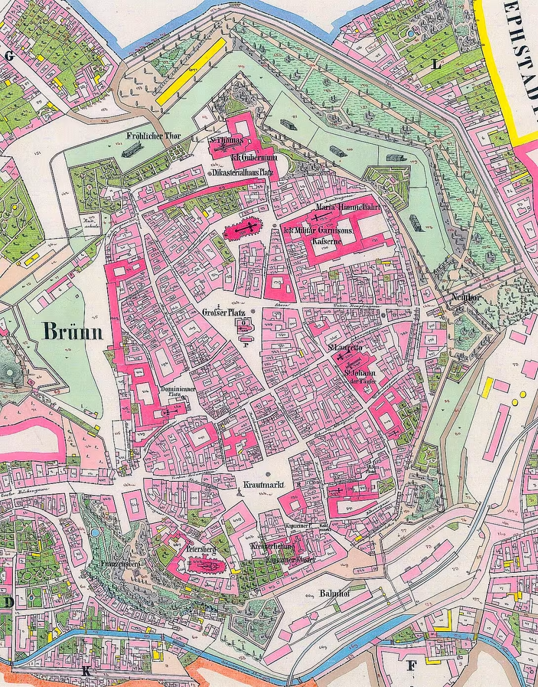
Vnitřní Brno is a historical designation of the city's territory as it existed in 1850-1919. This administrative unit is located in the municipality of Bohunice in the district of Brno-město in the South Moravian Region. It formed the basis for the later development of the city and largely coincides with today's urban part of Brno.
This space was defined as one settlement of the City of Brno, which existed until 1972. It included the city itself and a number of suburbs. Among the magistrates were Leather, Horses, Small New Streets, Nahony, Na Hraz and Tvěkom, Bakery, Road, Špilberk, Švábky, U Saint Anne and V Jirkáří. The illegitimate suburbs consisted of Lower and Upper Cejl, Josefov, Cross, New Sets, Old Brno, Trnita, Great New Street and Red and Zabrdovice. All of these parts worked simultaneously as separate cadastral municipalities.
From 1850 to 1919 the territory of Internal Brno was gradually enlarged. In 1869 it was connected to the premises of the Czech Psychiatric Hospital, which became the cadastral territory of Zábrdovice II. Before 1870, the Kříži cadastre was extended to include land from the village Žabovřesky. A significant moment is the year 1883, when the Brno Central Cemetery was founded on the Upper Herpal Land. He was at that time connected to Brno as a separate exclave under the name Stará Brno II.
Other changes took place at the turn of the century. In 1892, the land of the village of Jundrev was attached to the Old Brno I. In 1893- 1894 the first Brno engineering plant on the left bank of Svitavy was expanded. This increased the Výbrdovice cadastre at the expense of Černovice, specifically in the area of today's streets Hladíková, Olomouc and Market. In 1912, the King's Pole cadastral lost land at the north edge of Schreber gardens in today's Black Fields for the benefit of Lower and Upper Cejl. In 1915, the old-age cadastres were merged into the territory of Staré Brno and Vienna, where the northern part of the town of Horní Herspice was included.
Administrative adjustments continued later. In 1935 the border was adjusted with External Brno and in 1936 the Zábrdovice II was merged with Černovice. The first cadastral reform of 1941-1942 reduced the number of cadastral territories of Internal Brno to nine: Lower and Upper Cejl, Cross, City of Brno, New Sets, Old Brno and Vienna, Špilberk, Trnita, Great New Street and Red and Zabrdovice. Until 31 January 1949, the territory consisted of a separate judicial district of Brno-město.
Currently, most of the territory of former Internal Brno is part of the Brno city centre. The smaller peripheral parts today belong to the urban parts of Brno- Bohunice, Brno- Cernovice, Brno- south, Brno- Jundrov, Brno- Kohoutovice, Brno- Královo Pole, Brno- north, Brno- Žabovřesky and Brno- Židenice. In this area there are important objects such as Spilberk Castle and Central Cemetery.
Knowledge of the borders and development of Internal Brno allows a better understanding of urban growth and its historical breakdown. Visiting the centre and its historic suburbs offers direct contact with the administrative structure of the Brno city core.
Then and now
Drag the slider to compare how the landmark may have looked when it was built with the view today.
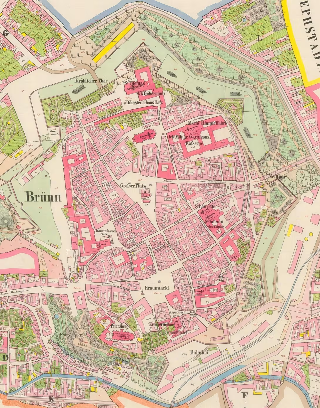

The historical appearance on the left is an AI-generated visualisation and serves as inspiration only.
Historical milestones
- 1869
- The area of the Prague Psychiatric Hospital was connected to Brno.
- 1883
- Establishment of the Brno Central Cemetery as the new cadastral territory of Staré Brno II.
- 1915
- Merge of the old-school cadastres into the new territory of Staré Brno and Vienna.
- 1972
- Cancellation of the town of Brno and its redistribution among local parts.
Historical events
In 1850-1919 Vnitřní Brno existed as a specific territorial unit with variable borders. Until 31 January 1949, the separate judicial district was Brno-město.
Points of interest
- Vnitřní Brno is a historical designation of the city territory from 1850-1919. - In 1883, a central cemetery in Brno was established on the Upper Herpal grounds. - The central cemetery was connected to Brno as a separate exclave at the time of its establishment. - Until 31 January 1949, this territory consisted of a separate judicial district Brno-město. - In this area there are important objects such as Spilberk Castle and Central Cemetery.
Guide
This guide is narrated by a synthetic voice generated by artificial intelligence.
Show guide text
This text was created by artificial intelligence and has not been editorially reviewed. It may contain inaccuracies.
Welcome to Bohunice, one of the fascinating parts of our city. You're standing in a place that makes us wonder how the city is changing, growing, and reforming its borders. In front of you, you see the space that may be common today, but in history it has played a vital role in the organization of the whole Brno. It's where the present meets the invisible boundaries of the past.
Today, when we talk about Internal Brno, we do not copy one specific building with a played front or one single tower, but we are talking about the entire historical territory. Imagine Brno in the middle of the nineteenth century. Between a thousand and eight hundred fifty and a thousand and eight hundred nineteen, there was the name Vnitřní Brno. It was a basic administrative entity that formed the core of the city. If you looked at the map at the time, you would see an area that is largely consistent with what we now know as the city of Brno. It was the heart of governance, power, and business activity that was all about.
Let us now stop at how this territory evolved over time. The history of this space is not only about stones, but about people and how they organized their life and death. Notice the area you're in. It's very interesting that the boundaries of the city were never static. In the year of a thousand eight hundred sixty-nine, there was a significant enlargement, when Brno was joined by the area of the hospital for mental illness. It was at a time when the city began to perceive the need to look after its citizens on a wider scale and integrate such institutions into its administrative system.
Now pay attention to one of the most important changes that has touched this particular space. Look around you and remember that in the year one thousand eight hundred eighty-three was founded in Brno Central Cemetery. This cemetery was built on the grounds that belonged to the Upper Heršpice village. But what is truly remarkable is the way he was involved in the city. The central cemetery was not a natural part of the city's body at the time, but it was connected as a separate exclave. This means that it was a territory that was administratively part of Brno, even though it was physically separated from the rest of the city's core. This created a new cadastral area called Staré Brno Two.
Try to imagine how difficult it must have been to manage a city that has its parts scattered and unconnected. This dynamic continued in the next decades. In the year one thousand and nine hundred and fifteen there was another merge, when the old-timer cadastras merged into a new territory that was called Stará Brno and Vienna. All these changes show how Vnitřní Brno gradually transformed and how its borders shifted to meet the needs of a growing population and a modernising society.
When we look at administrative history, it is important to mention that this territory has for a very long time remained united overall in terms of law. Until January of the year a thousand nine hundred forty-nine here operated a separate judicial district Brno-město. So imagine that for almost a hundred years this area has been seen as one legal and administrative space that separated the centre from the surrounding suburbs and villages. This brought a certain order to the city, but at the same time it created a clear distinction between what was perceived as an inner city and what was perceived as an outer area.
Now let's stop at one interesting thing that may not be visible at first sight, but that defines the character of this place. Vnitřní Brno, as we described it, was essentially a definition of urban identity for over half a century. It is fascinating that even though we no longer use this term in common terms, the traces of this distribution are still in maps and archives. In the year one thousand nine hundred seventy-two the town of Brno and its redistribution among the local parts were definitively abolished. This act definitely closed the chapter of the old administrative structure and created the structure that we know today.
Most of this historical space is now the city centre of Brno, but some of the peripheral parts now belong to other urban districts. It's a reminder that the city is a living organism. What was once one in all fell apart, joined together and redefined. Now, when you look around you, you don't just see buildings or streets, you see layers of time. You see the space where the needs of administration, health care and the honours of the dead met.
Think about how strange it is that the cemetery, which is now such a natural part of the Brno landscape, began as an isolated island, as an exclave. This shows us that planning the city in the nineteenth century was full of experiments and pragmatic solutions. Vnitřní Brno was not just a line on the map, but it was an expression of how the city perceived its own size and its influence on the surrounding landscape.
At this point we are not looking for specific names of architects or famous personalities who would leave their signature in the form of one statue or one building. The architects of this space were the time and need of administration. The main hero here is the city of Brno itself and its ability to adapt. It's a story about how a small centre has developed a modern city with a complex structure.
Let us now slowly end this short journey through the history of administrative borders. I hope that this view of Vnitřní Brno helped you better understand exactly where you are and how important this area was for the development of the whole region. Even though there is no Vnitřní Brno sign today, history is engraved into every piece of land you walk on.
I invite you to continue your journey in peace and explore other parts of this city. Note the details, feel the atmosphere of the surroundings and explore how modern transport and architecture intersect with these invisible historical borders. Brno has many secrets waiting for its revelation, and this journey through Vnitřní Brno was just one of many keys to its understanding.
Thank you for your attention and I wish you a pleasant exploration of the other beauties of our city. Goodbye.
Tips for visitors
The best time to walk around this historic territory is spring or autumn, when mild temperatures allow long walking and the colors of nature complement older architecture. You can easily reach the area by car or public transport; Check the specific connection in the current timetables.
Take comfortable shoes on the road, because it is a large area of the city, which you will best explore on foot. We also recommend that you carry a map of the old town to better understand the boundaries of this historical whole.
For the best photos, look for morning or late afternoon lights that highlight the details of facades and historic buildings. Ideal places for pictures are the edges of the former administration centre and views of the city building.
During the visit you can visit the centre of Brno, Špilberk Castle or the Central Cemetery in a short time. For families with children it is ideal to combine an outdoor tour with a game to find old characters in the streets, which makes the visit an adventure.
Frequently asked questions
Can the monument be visited?
This is a structure in a public space that can usually be seen from outside free of charge. We have not verified that this particular one is freely accessible.
Where is the monument?
Location: Bohunice, Jihomoravský kraj. The map on this page shows the exact spot.
For kids
Businesses nearby
Do you run a restaurant, accommodation, shop, museum, rental, wellness or other visitor service near this monument? Show yourself directly to the people heading to it — this is how they will see you in the app and on the web:
Events nearby


Zdroj akcí: otevřená data měst a obcí ČR (Národní katalog otevřených dat) a kalendář akcí Národního památkového ústavu.
Nearby
Území zahrnuje centrum města Brna, hrad Špilberk a Ústřední hřbitov.
Accommodation nearby
Trips and activities nearby
Guided tours, tickets and activities nearby from GetYourGuide
Affiliate link: if you buy from the partner, we may receive a commission. The price for you does not change.
Search tours and activities →Themed route
Here is the design of the cruise route:
1. Centre of Brno (city core) - The starting point of the journey where you can admire the historical architecture and atmosphere of the capital region. 2. Špilberk Castle (fortress) - A significant historical building with a rich past that offers a beautiful view of the surroundings. 3. Vnitřní Brno (other) (main objective) - Exploring selected parts of the city within the location. 4. Central cemetery (memorial cemetery) - A place of peace and reflection, known for its size and significant tombs.
Seasonal recommendations
In spring, the surroundings awaken to life, and the young greenery accompanied by the first warm rays of the sun that gently illuminate the facades. It is an ideal time for walks when the air is fresh and nature blooms around. We recommend shoes suitable for wet grass and visit in the morning before the roads become too busy.
Summer brings sharp light and rich colors, with an object perceived from the outside acting very strongly in full sun. In the high season it is advisable to set off early in the morning or at dusk to avoid the greatest heat. Remember light clothes, hat and plenty of water with you.
The autumn of the landscape covers golden and red tones that create a nostalgic atmosphere and perfectly contradict the material of the building. The light is softer and golden in this period, which is pleasant for observing details. Due to the variable weather, it is best to choose layered clothes and waterproof shoes.
Zimą reigns in the space of calm and raw cold, which can be accompanied by a layer of snow changing the appearance of the whole area. The atmosphere is quiet and minimalist, especially in advent time. Hot clothes, gloves and solid winter shoes are essential for a comfortable outdoor survey, and it is best to use short daylight.
Visualizations and artistic views


The visualisations are generated by artificial intelligence and serve as inspiration.
Photos from the area
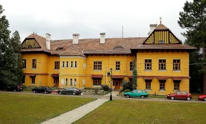
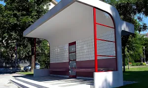
Real photos taken near the monument

Zdroj a licence jsou uvedeny u každého snímku.
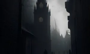
Atmosphere of the place
This atmospheric visualisation of the place and period was generated by artificial intelligence. It is not real footage of the location.
Tips from visitors
No tips yet. Be the first!
Log in and add your tip.
Sources and literature
Faktickým podkladem tohoto textu byl článek na Wikipedii, jehož autory jsou přispěvatelé Wikipedie. Článek je dostupný pod licencí CC BY-SA 4.0.
Location on the map


Příběhy a pověsti
Legendy, pověsti a příběhy spjaté s touto památkou
Fotografie návštěvníků
Zatím žádné fotografie. Buďte první, kdo přidá fotografii z návštěvy!
Log in a přidejte svou fotografii nebo hodnoťte.
Za ověřenou návštěvu v aplikaci získáte víc bodů — poznáme podle GPS, že jste na místě.
Reviews and comments