



Čertouská Street
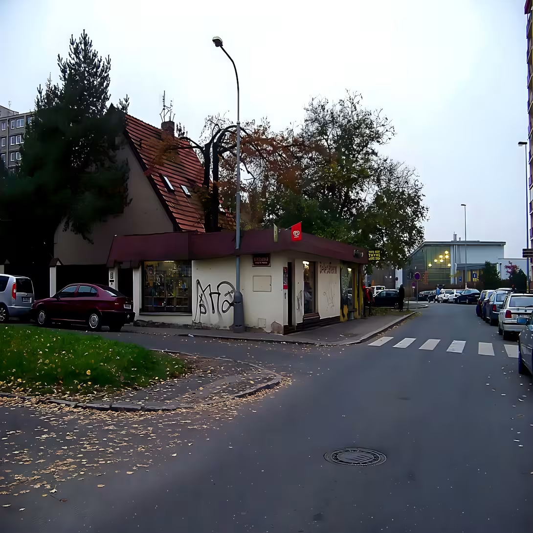
Čertouská is a street in the Prague district of Hlubetin (Praha 14). It was created and named in 1930. It connects Klánovický street with the street in Chaloupky and stands out for the character of family houses with gardens.
The street was established under the first republic, at the time of the development of Prague's marginal stoppage and suburbanisation. In the wider European context, interwar stabilisation has culminated in this period before totalitarian regimes. She got her name from the village of Chertousa.
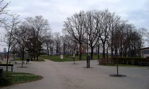
The northern section between Klánovický and Váňková is wide. The lanes are separated by grass-lined trees and dominated by family houses with gardens. Towards the north, between 591 and 596 houses, the pavement is connected with a green belt. This leads to a central deep public area, formerly known as Vetišek Square.
The site history is linked to administrative changes. In 1933 the village Čertousa became part of the Upper Počernice and the whole was connected to the capital city of Prague in 1974. During the Nazi occupation between 1940 and 1945, the street was called Tschertauser Straße.
The street currently intersects the street of Vaněkova and the bike route A26. According to the available maps to Čertouské also belongs a blind section to the southeast of V Chaloupky Street.
This location offers a view of the development of Prague's marginal stop in the early 20th century. It is an interesting destination for visitors, which attracts the urban development of Hlubětín and its connection to the surrounding public space.
Then and now
Drag the slider to compare how the landmark may have looked when it was built with the view today.
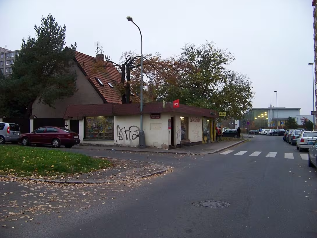

The historical appearance on the left is an AI-generated visualisation and serves as inspiration only.
Historical milestones
- 1930
- Creating and naming the street.
- 1933
- The village of Certousa, by which the street is named, has become part of the Upper Pottery.
- 1974
- Connection of the area to the capital city of Prague.
Historical events
1933: The village Certousa became part of the Upper Pottery. 1940-1945: At the time of Nazi occupation, the street carried the German name Tschertauser Straße. 1974: The whole area was connected to the capital city of Prague.
Points of interest
- The street was created and named in 1930 according to the village of Chertousa. - During the Nazi occupation between 1940 and 1945, the street had a German name. - The north section of the street is wide and the lanes separate the grass belt with trees. - The village Čertousa became part of the Upper Poternice in 1933 and was connected to Prague in 1974. - The locality offers a view of the development of Prague's marginal stops from the beginning of the 20th century.
Guide
This guide is narrated by a synthetic voice generated by artificial intelligence.
Show guide text
This text was created by artificial intelligence and has not been editorially reviewed. It may contain inaccuracies.
Welcome to Prague, in the part of the Deep Bits. You are standing in the street Čertouská, which surrounds you with its peaceful and domestic atmosphere. When you look around you now, you will see a space that acts as a womb for family life rather than as the noisy center of a big city. In front of you, there is a road that connects Klánovický Street to the street in Chaloupky, and if you look closely, you will see where Váňkov Street intersects it. It is a place where time has stopped and where you can perceive the rhythm of suburban life, which is so typical of this part of Prague.
Let us now look together at how this place was created and what its historical context is. This street you're in right now was founded and got its name in the year one thousand nine thirty. Its name is not random, but it refers to the village of Certousa that once existed here. It is fascinating to think that, at the time of its creation, this area was much more distant from what we see today as a capital city. The history of this place is closely linked to changes in administrative boundaries and administrative changes. Just three years after the street was named, in the year one thousand and thirty-three, the village of Certousa became part of the Upper Pomerania. This shows us how the map of the area has changed over the years and how small communities have merged into larger communities. The connection of this entire area to the capital city of Prague took place much later, only in the year one thousand and nine and seventy-four. This has made the local suburb a full part of Prague's infrastructure, yet it has retained its unique character.
Now pay attention to the surrounding development and what you see right in front of you. Note that the street is characterised primarily by its family houses. Look at how these houses are located and how their gardens are connected to them. It is these green areas that give the street its human dimension and a sense of privacy. It's the architecture of everyday life, where the harmony between inhabited spaces and nature is most intrigued. If you look to the north now, notice a significant change in space. The north section of the street is much wider. It is a very pleasant section where the lanes separate a wide grassy belt in which trees grow. This element is perceived as a natural separator that soothes space and brings an element of the park to the urban development. Watch how the trees create a natural shadow and how this wide strip follows on to the central, deep, public spaces that form the north end of this street.
When we think about the personalities and stories associated with this place, we have to acknowledge that the history of Čertouské Street is not written in the biographies of great builders or famous politicians. It is rather the history of ordinary people who built their homes here, grew their gardens and formed communities. The architects of the individual houses remained unknown, which in this case is almost symbolic. This street is not the product of one big plan or one famous name, but the result of the gradual growth and needs of people who wanted to live here. It's a monument to everyday life where every garden and fence tells their own little story about the generations that passed through here.
Let me now interest you in one interesting thing that brings our thoughts back to the darker times of the last century. Although today we see the name Čertouská as natural and permanent, it has not always been so. In the period of Nazi occupation, between a thousand and a thousand ninety-four and a thousand ninety-five, this street had a German name. It is a reminder of the time when our country was under foreign influence and even the smallest details, such as street names, were changed to match the will of the occupants. It is important to note that even this quiet and idyllic street has traces of European history. It's the contrast between today's room, which you feel in this grassy tree belt, and the tension that must have been here more than eight decades ago.
Stop for a moment and feel the silence of this place. Take another look at the broad green areas at the north end and imagine how this area evolved from a small village to a part of the Upper Púčernice to today's Prague district. Čertouská street is basically a bridge between the past and the present, between the countryside and the city.
Now that you have become acquainted with the history and character of this place, I invite you to further explore. Go through the rest of the street, feel the smell of gardens and enjoy a moment of peace along the shadows of the trees in the north section. Perhaps you'll find a way towards a central deep space where you can experience the center of this part of town. Thank you for walking through this quiet Prague street together. I wish you a pleasant rest of the day and many other discoveries in the beautiful city of Prague. Goodbye.
Tips for visitors
The best time to visit is late afternoon, when the sun hits the building at a pleasant angle and highlights the street character. For transport use a combination of passenger car or public connections whose current routes are checked in maps.
Take a walk with comfortable shoes suitable for the city area. If you plan to stay longer in the area, we recommend that you also pack a bottle of water.
For the best photos we recommend search for angles that capture the connection to the surrounding streets. The ideal light for exterior images is during the golden hour before sunset.
During the visit you can take advantage of the proximity of the A26 cycling route or visit the central public areas of deep space, located in close proximity.
Families and children will appreciate the possibility of combining an outdoor tour with a short trip after cycling, allowing children to move more in the natural environment.
Frequently asked questions
Can the monument be visited?
This is a structure in a public space that can usually be seen from outside free of charge. We have not verified that this particular one is freely accessible.
Where is the monument?
Location: Praha, Hlavní město Praha. The map on this page shows the exact spot.
For kids
Imagine coming back 96 years... There is a beautiful castle on the mountains, which is now a ruin. How did it look here? It was a small village with cottages and cottages. People who worked in the woods and in the fields lived here.
It was like playing Castle, where everyone played the role of hero and protected their country from enemies. But this place was real! The villagers built a castle to protect their homes and families.
Businesses nearby
Do you run a restaurant, accommodation, shop, museum, rental, wellness or other visitor service near this monument? Show yourself directly to the people heading to it — this is how they will see you in the app and on the web:
Events nearby

Zdroj akcí: otevřená data měst a obcí ČR (Národní katalog otevřených dat) a kalendář akcí Národního památkového ústavu.
Nearby
V blízkosti se nachází cyklotrasa A26 a ústřední hloubětínské veřejné prostranství.
Accommodation nearby
Trips and activities nearby
Guided tours, tickets and activities nearby from GetYourGuide
Affiliate link: if you buy from the partner, we may receive a commission. The price for you does not change.
Search tours and activities →Themed route
Here is the design of the thematic route:
1. Central Depth Public Area (resting place) - The ideal beginning of the journey, where you can orient yourself and make a short stay. 2. Čertouská (others) (monument) - The main destination of the trip, which offers a view of local history and architecture. 3. Cycling route A26 (path for cycling) - Path for active movement in nature that connects the surrounding points.
Seasonal recommendations
Spring brings to Prague streets the awakening nature and soft, gradually elongating light, which beautifully underlines the texture of stone and old plaster. In this period, the surrounding green trees and shrubs are still licking, creating a fresh contrast to historical architecture. The atmosphere is calm and full of hope, ideal for slow walks without rush. It is practically appropriate to wear layered clothes because spring weather is usually variable and it can be cold in the morning and evening. The best time to visit is in the morning when the air is fresh and the sun is not yet too hot for the eyes. Avoid rainy days if you want to capture facade details without blurred glass or wet pavement, which can be slippery.
Summer offers the longest days and brightest lighting, which reveals every detailed statue and relief on the object. Sun rays fall directly on the stone, creating sharp shadows and highlighting the depth of architectural elements. The atmosphere is alive and full of the energy of a city that is vibrating through life at this time. For a comfortable tour from the outside, it is crucial to wear light, breathable clothes and a hat because direct sun can be uncomfortable in the noon hours. We recommend visiting the memory early in the morning or late in the afternoon when the temperature is more tolerable and light softer. Take with you enough drinking water and sunglasses to enjoy the view without unpleasant blinding.
Autumn brings warm, golden tones of decaying leaves to the city, which perfectly match the colours of historical buildings. The light is lower and warmer, creating an intimate and nostalgic atmosphere ideal for reflection. Nature around the monument is in full bloom of colors, which gives the whole experience a painting character. It is necessary to wear shoes with a good heel and anti-slip sole for walking along the pavement, as fallen leaves can hide wet or slippery places. Put on a warmer sweater and a light jacket because the evenings are cooling fast. It is best to go out in the late afternoon, when the sun shines low from the west and illuminates the facade from the side, highlighting its relief elements.
Winter brings sharp, clean light, which often reveals architectural lines with greater precision than in other seasons. If it rains or snows, wet surfaces can act as mirrors and reflect the sky, which adds a dramatic dimension to the whole view. The atmosphere is quiet and calm, often accompanied by the scent of roasted nuts or spices from nearby cafés. For a comfortable outdoor stay, a layered clothing strategy is required: the inner thermal layer, the central insulating layer and the outer waterproof jacket. Don't forget the warm gloves and scarf, because the cold wind can be unpleasant. The best time is usually in the morning when the air is the cleanest and the temperature is not yet low enough to limit the duration of the stay outside.
Visualizations and artistic views


The visualisations are generated by artificial intelligence and serve as inspiration.
Photos from the area
Real photos taken near the monument


Zdroj a licence jsou uvedeny u každého snímku.
Atmosphere of the place
This atmospheric visualisation of the place and period was generated by artificial intelligence. It is not real footage of the location.
Tips from visitors
No tips yet. Be the first!
Log in and add your tip.
Sources and literature
Photos: ŠJů (cs:ŠJů) / CC BY-SA 3.0, rozlišení zvýšeno umělou inteligencí — Wikimedia Commons. The author and licence also appear when you hover over the image.
Faktickým podkladem tohoto textu byl článek na Wikipedii, jehož autory jsou přispěvatelé Wikipedie. Článek je dostupný pod licencí CC BY-SA 4.0.
Location on the map


Příběhy a pověsti
Legendy, pověsti a příběhy spjaté s touto památkou
Fotografie návštěvníků
Zatím žádné fotografie. Buďte první, kdo přidá fotografii z návštěvy!
Log in a přidejte svou fotografii nebo hodnoťte.
Za ověřenou návštěvu v aplikaci získáte víc bodů — poznáme podle GPS, že jste na místě.
Reviews and comments