




Hradiště Na Brdláku Hillfort
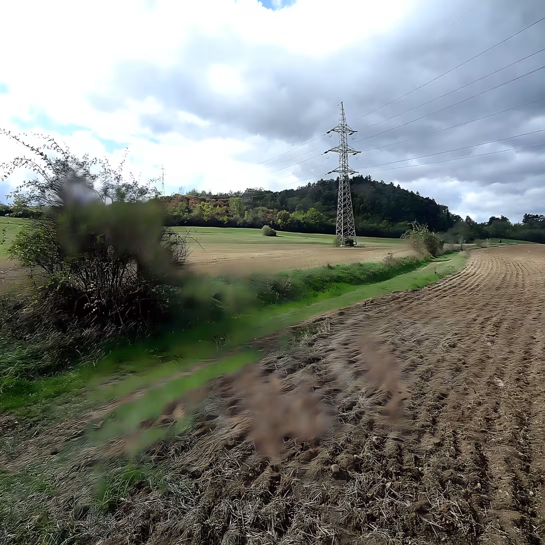
Hradiště Na Brdláku, also known as Shovel or Korno, is an undated archaeological site near Korn in Beroun County in the Central Bohemian Region. This location is located on the right bank of the Berounka River and reaches an altitude of 385 metres. It is protected as a cultural monument, although nothing is guaranteed about its exact age or age.
The history of Castle Na Brdlák remains a secret. While no archaeological research has taken place on the site, which means that no precise historical details are known about it, there is a hypothesis linking the castle to the period of the Hallatians. This period (about the 8th - 5th century B.C.) was a period of intense cultural and technological change in Europe, giving the impetus to contemplation of the Halsace old age. The reason for this hypothesis is to find two graves from the period of the Hallatians in the cadastral territory of the village.
Castle architecture On Brdlák reveals interesting elements, although their exact origin and function remain unclear. The remains of the fortifications are located on the top of the Roof, which is part of the Horovic hill. On the south side of the castle they have the character of loose stones, while on the north and east side probably the original wall formed a wooden structure covered with clay. The course of fortification on the west side is not certain, which is partly attributed to the amount of landscaping of unclear origin which are associated with mining in nearby quarries.
Although about the owners and administrators of the castle There is nothing concrete about Brdlák, its historical context suggests that it may have been part of a wider network of settlements in the area. Without archaeological clauses, however, any assumptions about its administrators and the dramatic changes it may have witnessed remain mere speculation.
Hradiště Na Brdláku is now freely accessible even if there are no tourist routes. This site offers a unique view of the undated history and archaeological potential of the region. Exploring the castle can be a fascinating experience for visitors, offering opportunities to reflect on the past and possible historical history of the area.
Hradiště Na Brdláku is therefore an important cultural monument, which represents not only an archaeological interest, but also offers the opportunity to explore the unfinished history of the region. Visiting this castle is a valuable opportunity for those interested in primeval and archaeological sites in the Czech Republic.
Then and now
Drag the slider to compare how the landmark may have looked when it was built with the view today.
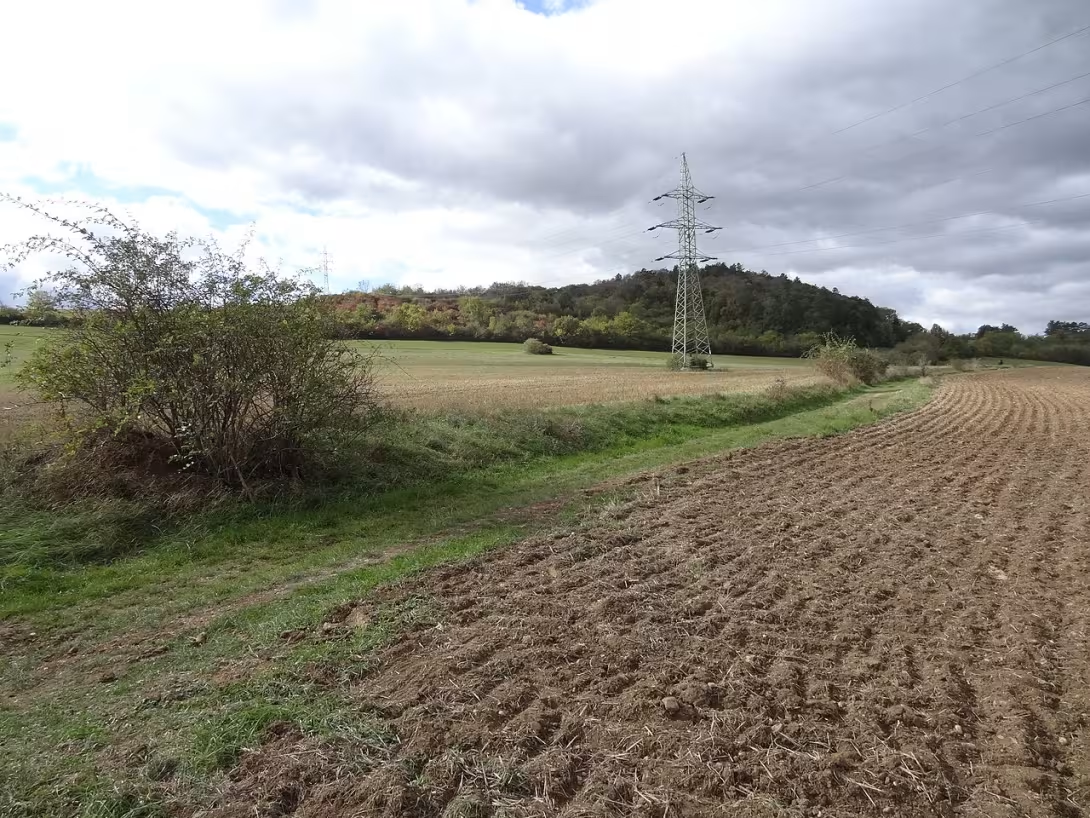
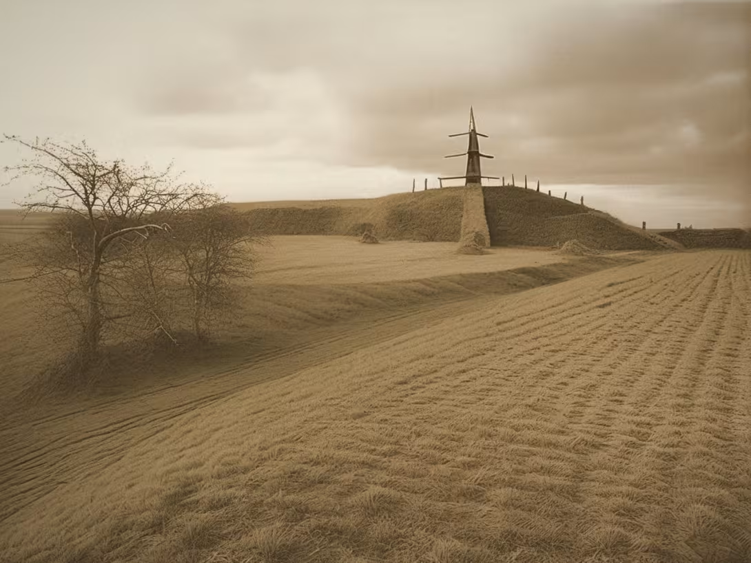
The historical appearance on the left is an AI-generated visualisation and serves as inspiration only.
Architectural development
The remains of the fortified fort are located on the top of the Roof, which is part of the Horovic hill. The fortification has the character of loose stones on the south side and probably a wooden structure covered with clay on the north and east sides. The course of fortifications on the west side is uncertain.
Points of interest
- Hradiště Na Brdláku is an undated archaeological site near Korn in the district of Beroun in the Central Bohemian Region.
- There is a hypothesis linking the castle to the age of the Halštats, which is supported by the discovery of two graves from the age of the Halštats in the cadastral territory of the village.
- The remains of the fortifications are located on the top of the Roof, which is part of the Horovic hill. On the south side of the castle they have the character of loose stones.
- Probably the original wall on the north and east side formed a wooden structure covered with dirt. The course of fortifications on the west side is uncertain.
- Hradiště Na Brdláku is protected as a cultural monument, although nothing is known about its exact age or age.
Guide
Show guide text
This text was created by artificial intelligence and has not been editorially reviewed. It may contain inaccuracies.
Welcome and welcome to this quiet but historically challenging place. You are standing on the slope of a hill that rises over the Berounka River, and before you is a landscape that hides stories from thousands of years ago. You may think you're looking at an ordinary forest slope, but your ancestors saw a strategic point here, instead of defense and life. This is the castle Na Brdlák, also known under local names Střešík or Korno. We are located in Beroun County, near the village of Korno, and right now you are on the right bank of Berounka, at an altitude of three hundred and eighty-five meters above sea level.
Let's move on to what surrounds us. The first thing you notice is the position itself. The fort is not some random crease in the plane, but it is located on a distinctive terrain unit that provides natural defence. In the past, when there were no modern weapons, such a height advantage was crucial for survival. Here you could easily see the surroundings, especially the flow of the river, which in ancient times was the main transport artery and source of water and food. The atmosphere here is calm, almost meditation, and that's exactly what we want you to enjoy. It's not about looking for large stone remnants to steal your breath, it's about seeing space and imagining what the environment might have been like centuries ago.
The historical context of this place is surrounded by mystery, which gives it magic. Hradiště Na Brdláku is classified as undated, which means that archaeologists have not yet been able to determine exactly when people started living here and when this place lost its meaning. We don't know the specific names of those who stood here or the exact time of their stay. This ignorance is a property that forces us to be humble to the past. We can't afford to make up details that we don't have documented, but we can lean on what we know from the surrounding findings. There is a strong hypothesis that connects this castle to the period of the Hallatians. This era, which is roughly equivalent to the older iron age, was the time when the first complex societies in Europe formed, when agriculture developed and when the first solid settlements with fortifications were created.
Look around you and try to imagine what the fortification that once stood here might look like. Even though we see today the natural terrain rather than the clear walls and moats, the remains of the fortifications are here. These are traces that time and nature have gradually erased, but which are still present in the relief hill. It's not about looking for wall walls, because at this time, it was more fortified by the ground walls and moats, often reinforced by wood. These structures were very effective for their time. Wooden palisades and ground barriers were able to repel enemy attacks and ensure the safety of the population. If you look at the slopes, try to imagine how a wall could be drawn here, which would separate the inner part of the fort from the outside world. It would be the line between safety and danger, between home and wilderness.
The interesting thing that makes this space even more fascinating is the discovery of two graves from the period of the Hallatians in the cadastral territory of the village. This find is an important indication which supports the hypothesis of the Hallatin dating of the castle. The graves tell us that not only did people live here, but they also died and were buried here. This means that this place had deep emotional and cultural significance for its people. It wasn't just a temporary camp, it was a place where the community was formed, where the festivities were celebrated and where life's questions were addressed. The presence of graves suggests that there was a stable population that required a permanent settlement with the necessary protection.
Let's think about who these people were. They lived when the company was changing. The transition from bronze age to iron age brought new technologies, new weapons and new methods of defense. Halštat culture was known for its emphasis on defence systems and social hierarchy. The people who lived here probably had clearly divided roles. Some took care of defense, others of agriculture, others of craft production. This cooperation was necessary for survival in a difficult environment. The Berounka River was their link to the outside world, but also their threat if it became dangerous. They had to learn to live with nature, respect its power and use its gifts.
Now pay attention to the atmosphere that exists here. The silence of the forest, the rustling of the branches, perhaps the singing of the birds. All of this is a frame for your image. There are no statues here, no writing plates that tell you a story. You must imagine him yourself. And that is the property that makes visiting such places unique. Each of us will create a different picture, a different history. You might imagine a warrior standing on a wall watching the horizon. Maybe you can imagine a mother who takes care of the children in the shelter behind the earth. Perhaps you can imagine an old man telling the young about ancient times. These images are as real as any historical document because they come from human experience and what we know about how people lived at this time.
One of the great mysteries of this place is that we know so little about it. Why hasn't the fort been preserved to a greater extent? Why hasn't more artifacts been found to help us better understand the lives of the people here? Perhaps it has been abandoned for reasons we cannot fully understand today. Maybe the population has been relocated, maybe some sort of disaster, or maybe the defense strategy has simply changed and people have moved on. This ignorance is part of history. We don't have to have answers to all the questions to appreciate the beauty and importance of this place. All we have to do is realize that there used to be people who were trying to survive and create their own world.
In conclusion, I'd like to invite you to enjoy this place for a while. Walk down the slope, look at the river, listen to the wind. Try to imagine how people from the period of the Hallatians would feel here. Would they feel safe here? Would they feel free here? And how would they look at the world around them? These places remind us that we are part of a long chain of generations that have lived here and that have left traces, whether visible or invisible. Hradiště Na Brdláku is one of the many places in our country waiting to be discovered and understood.
Thank you for your attention and for taking the time to stop and think about history
Tips for visitors
The best time to visit Hradiště Na Brdláku is autumn or spring when vegetation is less dense and offers a beautiful view of the surrounding landscape. These periods also bring mild weather, which improves comfort during walks.
Parking can be found near the river Berounky; we recommend to verify the availability of the parking lot before visiting. For those travelling by public transport, the place is well accessible by bus or tram; the current connection can be found in the online search engine.
When you visit, wear a suitable suit because the climate can be variable. We also recommend dry soil shoes and protective sunglasses. Don't forget to take water and refreshments, especially if you are planning an extended walk.
Photography at the Hradiště Na Brdlák offers several interesting perspectives. The best light is usually in the early morning or evening when the sun is not directly above your head. Try to see the panoramic view from the higher points on the right bank of the Berounka River.
In the vicinity of Hradiště Na Brdláku it is possible to visit the historical site of Korn, located nearby and offers an interesting opportunity to explore local culture. For families with children it is ideal leisure activity because the area offers space for moving games and beautiful walks.
Businesses nearby
Events nearby

Zdroj akcí: otevřená data měst a obcí ČR (Národní katalog otevřených dat) a kalendář akcí Národního památkového ústavu.
Nearby
XXXHistorical monuments (124)
- Svatopluk Čech 2.2 km web
- Museum Jarmili Novotné and Svatopluka Čecha 2.2 km Sada St. Bohemia 2 + 420 311 684 121 web
- Bohumil Žíhla (murdered † 27.5.1945 Soviet soldiers) 2.4 km
- Budňan rock 2.7 km
- Bunkermuseum # 2.8 km
- B-7 / 12 / A-160 Z 2.8 km web
- Tomb of the genus Daubkou 2.9 km
- Memorial to victims of World War I 3.0 km
- House hours6ZX 3.1 km + 420 608 910 010 web
- Museum Trade 3.2 km
- Museum of Bethlehem 3.2 km + 420 607 940 787 web
- Saint Sebastian 3.3 km
- Museum of wax figurines 3.5 km
- Castle Tetín 4.0 km
- Panna Marie 4.1 km
- Polemik Václav Hájek z Libočan and František Palacký 4.2 km
- Castle Tetín 4.2 km nu. May 9, 1
- Tetín Museum 4.2 km + 420 723 823 317 web
- Castle Sviná 4.4 km K Castle 1
- Jaroslav Petrbok 4.8 km
Restaurant and catering (305)
- Elma 1.5 km V Cottages 179 + 420 311 623 316 web
- U Lva 1.6 km V Cottages 29 + 420 603 204 843 web
- U Capsules 1.6 km Svatojanská 209 + 420 728 554 131; + 420 606 848 741 web
- U Railway station 1.6 km ZZA Vodou 120 + 420 605282813
- U Berounky 1.7 km K Delivery 32 + 420 607 102 413; + 420 311 622 395 web
- Zza Vodou 66 1.7 km
- The Garden 1.7 km Serbia 188
- U Flood 1.9 km
- Bistro 1.9 km Na Chlum 199
- Autocamp Karlstejn 2.0 km + 420 311 681 263; + 420 774 646 416 web
- In Shadow Lípy 2.2 km Monetary 200 + 420 311 572 949 web
- Guesthouse Karlstejn 2.3 km + 420 774 655 119 web
- Bufáček Liteň 2.5 km Railway station 415 + 420 736 671 426 web
- Taverna U Ezopa 2.6 km + 420 311 572 380 web
- Koliba u Eliška 2.9 km + 420 311 681 444 web
- V kozlovi 3.0 km
- Karl Parex 3.0 km + 420 728 928 551 web
- Guesthouse Bellevue - View Karlstejn 3.0 km Budnian stream 31 + 420 603 425 110 web
- Restaurant Cafe Bar Stodola 3.1 km
- Karlštejn 34 3.1 km Karlštejnská - castle 34 web
Accommodation (50)
- Camp Serbia 1.9 km + 420 775 985 576; + 420 777 733 363 web
- Autocamp Karlstejn 2.1 km + 420 311 681 263 web
- Romantic Hotel Mlýn Karlstejn 2.8 km
- Guesthouse Vinice 3.0 km web
- KorunA 3.2 km
- Karlštejn 3.4 km + 420 311 600 900 web
- Pod Dragon Rock 3.5 km
- Penzion Hájovna u Dubu 3.7 km
- Autocamp Island - Třebáňa Z6ZX 4.6 km + 420 777 150 241 web
- Kemp 6.1 km
- Na Island 6.5 km Na Island 816
- Restaurant & Guesthouse Rochotax 6.5 km Rochty 930 + 420721518394 web
- Pension Primus 6.5 km Na Onions 665 + 420 721 500 000 web
- Pension Rocha - depandance 6.6 km
- Venedik 6.7 km Na Pit 8
- Best Western Hotel Grand 6.8 km Us. M.Postal 49
- Czech Dvór 6.8 km Husovo us. 86 / 14
- Hotel Parkan 6.8 km Hornohradní 4
- Central Apartments 6.8 km Hus us. 26
- Guesthouse Tomáš Potouček 6.8 km Pražská 380
▶ Rental and Sport (36)
- VELO CAFÉ GARAŽ 4.0 km Castle + 420724877571
- broke shooting range 4.1 km
- Sokolovna Tetín 4.6 km web
- Cycloservice Kramata 4.7 km Třebany 262 + 420 604 438 030 web
- Beroun - hospital 5.7 km
- Kola Štorek 6.5 km
- Tyran 6.6 km
- Lokomotiva 6.6 km
- Cyclocenter. cz 6.9 km V Pilsen Gate 1
- dhCYCLING 6.9 km Czech 54 / 22
- Lithohlavy 6.9 km
- Studio Kytka s.r.o. 7.0 km
- NH Fitness 7.0 km Political prisoners 40
- Swimming pool 7.9 km web
- Sportcentrum Eden 7.9 km
- Sportisimo 8.0 km
- 45402 King's Court Sports hala 8.6 km
- Gym ZŠ 8.7 km
- Sport Hall of the King's Dvór 8.7 km web
- Martes Sport 8.9 km Business 542 + 420 703 377 841
Tourism and Nature (206)
- Wednesday 0.0 km
- Pricks 0.8 km
- Brdlák 0.9 km
- Na Chihadle 1.2 km
- Aragonite cave 1.3 km
- KOK Cave 1.9 km
- Castle Park 2.1 km
- Middle Hora 2.3 km
- Voškov 2.3 km
- The King's well 2.4 km
- The King's well 2.4 km
- Serbian cave 2.5 km
- Bat Cave 2.5 km
- Libuška Retro 2.9 km
- Javorka 2.9 km
- High Hora 3.0 km
- Mramor 3.1 km
- Geology History Vulkan 3.1 km
- Plešivec 3.3 km
- Martina 3.3 km
Accommodation nearby
Trips and activities nearby
Guided tours, tickets and activities nearby from GetYourGuide
Affiliate link: if you buy from the partner, we may receive a commission. The price for you does not change.
Search tours and activities →Themed route
1. Information boards - information point. Here you will get a basic overview of the history and importance of this archaeological site. 2. Hradiště Na Brdláku - archaeological site. The main space for discovering traces of ancient settlements and architecture. 3. Valleys and reinforcement - defensive construction. Walk around the perimeter system, which in the past served to protect the population. 4. Outlook in the area - a natural point. Place with the best overview of the layout of the castle and surrounding landscape.
Seasonal recommendations
Spring: At Brdlák spring wakes up with fine light and fresh greenery, which starts to cover archaeological terraces. The mood is full of expectations and calm, while nature gradually comes to life. For the visit I recommend choosing the morning hours when the air is the cleanest. Prepare your layered clothes, because the morning cold can quickly take turns with heat during the day, and don't forget waterproof shoes for wet soil.
Summer: The summer season brings an intense sun glow to the castle and a full bloom of surrounding vegetation, which creates a very vivid picture for the tour. In the main summer season there are more people in place, so it is best to arrive early in the morning or just before sunset to avoid the greatest heat and crowds. Don't forget enough drinking water, headgear and sun protection because the open terrain offers minimal shade.
Autumn: Autumn moons cover the castle with golden and brown shades, while morning fog gives the archeological area a mystical mood. Lighting is low in this period and very suitable for photography, which will be appreciated especially by lovers of landscape images. Due to the variable weather and wind, however, it is recommended to wear windscreens and firmer shoes to protect you from mud and colder air.
Winter: In winter, the castle is rough and the silence in the surroundings is almost palpable, especially if the landscape is covered with snow or frost. The day is short and the sun shines low above the horizon, creating sharp shadows on historical structures. It is necessary to wear a very warm and wind-resistant jacket, quality gloves and hat. Always check the current forecast before travelling, because frost and snow can make it harder to access some parts of the terrain.
Visualizations and artistic views


The visualisations are generated by artificial intelligence and serve as inspiration.
Photos from the area
Real photos taken near the monument


Zdroj a licence jsou uvedeny u každého snímku.
Tips from visitors
No tips yet. Be the first!
Log in and add your tip.
Sources and literature
Fotografie: MartinVeselka / CC BY-SA 4.0, rozlišení zvýšeno umělou inteligencí — Wikimedia Commons. The author and licence also appear when you hover over the image.
Faktickým podkladem tohoto textu byl článek na Wikipedii, jehož autory jsou přispěvatelé Wikipedie. Článek je dostupný pod licencí CC BY-SA 4.0.
Location on the map
Příběhy a pověsti
Legendy, pověsti a příběhy spjaté s touto památkou
Fotografie návštěvníků
Zatím žádné fotografie. Buďte první, kdo přidá fotografii z návštěvy!
Přihlaste se a přidejte svou fotografii nebo hodnoťte.
Za ověřenou návštěvu v aplikaci získáte víc bodů — poznáme podle GPS, že jste na místě.
Reviews and comments