



Městské opevnění v Rožmberku nad Vltavou Town walls
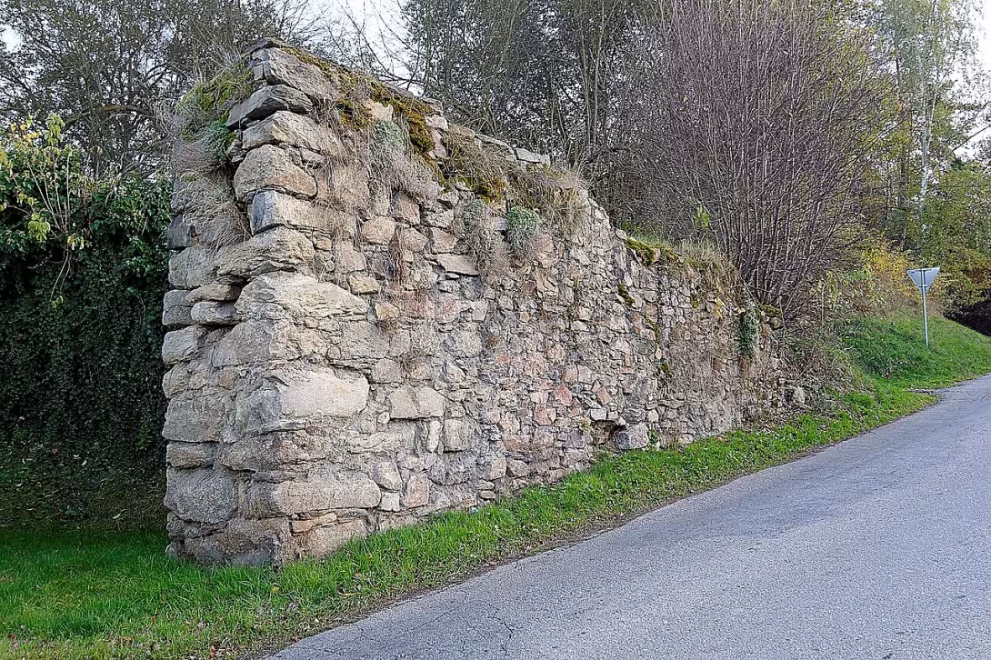
Městské opevnění v Rožmberku nad Vltavou in the district of Český Krumlov forms a system of broken preserved walls, which protected the medieval town in the 14th century. Today this torso, particularly visible on the south side, is protected as a cultural monument. It represents an important document of the defence system in the subbarrier of the castle.
The settlement in the substation is documented in 1262. At the turn of the 13th and 14th centuries the settlement was transformed into a small town. The important milestone was 1362, when the brothers Jošt, Henry, John and Petr z Rožmberka granted the seat of the city of Sand. The construction of the walls took place during the 14th century, when the Czech countries under the rule of Luxembourg experienced the boom of urban culture and the development of Gothic architecture.
The medieval city had approximately a triangular plan of about 4.6 hectares. The terrain descended from the south towards the Vltava River in the north. The fortification consisted of a wall about seven metres high and a width of 150 centimeters, supplemented by an external moat. According to a schematic plan from 1777, the wall was finished with battlements. The city was led by three gates located in the vertices of a triangular plan: north towards the bridge over the Vltava, southwest towards the Vyší Brod and southeast towards the Upper Dvořiště. All the gates were destroyed after 1827. The question of the existence of walls along the river remains unclear, as written sources are not always consistent in the distinction between the city and the neighbouring Latran. However, it is possible that the fortifications in these places had already disappeared before 1777.
The ownership ratios have changed over the centuries. After the men of Rožmberk, the town was acquired after 1456 by Jan Popel z Lobkovic, an ally of King George of Poděbrad. This political orientation led to military conflicts. In 1467, the city was unsuccessfully besieged by Zdeněk Konopistský from Šternberk. In 1469 the seat was conquered and another likely occupation of Austriana took place during the border war in 1478.
Today, the original system shows especially the torso walls on the south side of the city. The 1790 painting suggests that the fortification was still east of the Church of the Virgin Mary. For visitors, this element represents valuable evidence of the medieval form of the residence in close proximity to the castle Rožmberk. Visiting the site offers the opportunity to see the history of fortifications that shaped the form of Czech cities in the 14th century.
Historical milestones
- 1362
- The town received the right of the city of Sand.
- 1469
- The city was besieged and conquered.
- 1478
- The city was probably conquered by Austrians during the border war.
- 1827
- After this year, city gates were demolished.
Architectural development
The fortification was built in the 14th century and consisted of a wall about seven metres high and 150 centimetres wide. According to the 1777 plan, the wall was finished by the battlements. The entrance to the city was provided by three gates located at the vertices of a triangular plan.
Historical events
In 1362 the town acquired the rights of the city of Sand. In 1469, the city was besieged and conquered. During the 1478 border war, the city was probably conquered by the Austrians.
Owners
The men of Rožmberk, Jan Popel z Lobkovic.
Points of interest
- The city fortification formed a wall about seven metres high and a width of 150 centimeters, supplemented by an outer moat. - The medieval city had approximately a triangular plan of about 4.6 hectares. - Three gates led to the city located in the vertices of the triangular plan, which were all demolished after 1827. According to the 1777 schematic plan, the wall of the wall was finished by the battlements. - In 1469 the mansion was conquered and another likely occupation of the Austrians took place during the border war in 1478.
Guide
Show guide text
This text was created by artificial intelligence and has not been editorially reviewed. It may contain inaccuracies.
Welcome to Rožmberk over Vltava. You're standing right where time has stopped and where the stone remains of the walls are trying to tell the story of power, protection and relentless history. Look around you and feel the atmosphere of this place. What you see just before your eyes is not just fragments of an old masonry, but the final testimony of what this little town once looked like when its heart needed constant vigilance and protection. This part of the wall that you are now observing is particularly visible on the south side of the city and represents what has survived from the once formidable system until today.
Let's go back to the 14th century together. This is the era when the foundation of today's Rožmberk began to anchor firmly in history. In 1362 the town received the right of the city of Písek, which was a crucial moment which gave it new weight and importance throughout the region. With this new status, however, there was also the need to ensure the safety of citizens and property. The town was then designed with a very specific, triangular plan covering an area of approximately four and a half hectares. In order to defend this triangle effectively, it had to be surrounded by strong fortifications. It was during this period that this wall began to be built, which was to serve as an impenetrable barrier against all dangerous external influences.
Now pay attention to the details you have right in front of you. Although these remains are now broken, try to reconstruct their original form in your imagination. Imagine a wall that was up to seven meters tall. That's the height that would give every enemy immediate respect at that time. This wall was not only a thin barrier, but it was approximately one metre and a half wide, which gave it the necessary mass and stability. To make the defense even more effective, the wall was replenished by an external moat that was supposed to stop the enemy's troops before they even touched the wall itself. Feel the geometry - this whole system has been designed to protect every corner of the triangle city.
When you look at these remnants, you can imagine what kind of personalities have taken place in this history. Rožmberk was not just an ordinary town, it was a home for powerful monarchs and noblemen who had a major influence in the kingdom at the time. In this history, characters like Jošt z Rožmberka, Jindřich z Rožmberka, Jan z Rožmberka or Petr z Rožmberka are named. These people were the creators and guardians of this place. But history was not only about building and stability, it was also about conflict and the struggle for survival. The city had to face siege and attack. In 1469, the city was conquered and in 1478 it had to deal with the likely attack of the Rakusans during the then border war. At these times, these walls were truly decisive. The names of other powerful men such as Jan Popel z Lobkovic or Zdeněk Konopišťský ze Šternberka, whose fates were closely linked to this territory and its defenses, appear in history.
But notice what you see missing today. That may be the greatest mystery and the greatest loss of this place. This whole triangular system was once supplemented by three gates that were placed exactly in the corners of this plan. These gates were the key points through which goods, people and information flow. It was the gates that determined the rhythm of life in the town. However, there was a fundamental change after 1827. The city gates were demolished, which opened up the city to a wider area, but at the same time, it ended the era of its closure and strict defence. What we see today as a torso of walls is just a shadow of what once formed the impenetrable edge of the city.
The interesting thing to do is how different this space is from today's city perception. Imagine the closure, the security that was given to people by a seven-meter wall and a deep ditch. The entire area of the city was relatively small, but thanks to its shape and fortification it was extremely effective. Today we look at these remains as a cultural monument, as a beautiful element of history, but for the people at that time it was a matter of life and death.
Now, please, continue your walk and try to find traces of those ancient gates around you, or look at the very shape of the city, so you can better understand the triangular geometry that once ruled here. Every stone and every turning point tells its own story about the strength of the family of the Rožmberks and the relentlessness of time. Thank you for taking this short journey in the past. We wish you a pleasant continuation in discovering other secrets of Rožmberk nad Vltavou.
Tips for visitors
The best time to visit is during late spring or early autumn, when the weather is pleasant to walk around the walls and the surrounding landscape offers beautiful colour scenery without a summer rush of tourists.
When visiting, don't forget about fixed shoes, because the terrain around the remains of the fortifications can be uneven and in some parts less accessible. For families with children the location is suitable as part of a educational walk history, but we recommend increased caution in the remains of the walls due to their poor technical condition.
In the immediate surroundings you can visit the majestic castle Rožmberk, enjoy views of the river Vltav or explore the historic atmosphere of Latran, which forms an integral part of the local monument.
Frequently asked questions
Can the monument be visited?
This is a structure in a public space that can usually be seen from outside free of charge. We have not verified that this particular one is freely accessible. According to the heritage register the structure is in poor condition – do not enter it and take care nearby.
Where is the monument?
Location: Rožmberk nad Vltavou, Jihočeský kraj. The map on this page shows the exact spot.
Why is the monument protected?
It is listed in the Central List of Cultural Monuments of the Czech Republic as a cultural monument (register no. 1000152280).
Businesses nearby
Do you run a restaurant, accommodation, shop, museum, rental, wellness or other visitor service near this monument? Show yourself directly to the people heading to it — this is how they will see you in the app and on the web:
Events nearby
Zdroj akcí: otevřená data měst a obcí ČR (Národní katalog otevřených dat) a kalendář akcí Národního památkového ústavu.
Nearby
The castle Rožmberk, the river Vltava, the village Latran.
Accommodation nearby
Trips and activities nearby
Guided tours, tickets and activities nearby from GetYourGuide
Affiliate link: if you buy from the partner, we may receive a commission. The price for you does not change.
Search tours and activities →Themed route
1. Municipality of Latran (settlement) - Walk through historic streets gives the first impression of the atmosphere of this place. 2.Městské opevnění v Rožmberku nad Vltavou (walls) - The main destination of the trip, which represents the unique rest of the old defense system. 3. Castle Rožmberk (castle) - A dominant monument with a rich history that rises over the whole town. 4. River Vltava (water flow) - Ideal end of the road along the river bank with a beautiful view of the surrounding landscape.
Seasonal recommendations
In spring, the walls wake up with nature. The trees are beginning to bloom around the stone walls, and the surrounding area is bright green. The light is delicate and ideal for capturing the details of architecture. We recommend taking practical clothes suitable for variable weather and firmer shoes, because after winter there may be a significant amount of moisture or mud between the stones and around the walls.
In the summer months, the walls are filled with bright sun, which highlights the structure of the old stone, but at the same time the visit can be unpleasantly hot. The atmosphere is the most lively, the town is full of life and tourists are the most. To avoid the biggest crowds and heat, we recommend that you come immediately after opening or in the early morning. Don't forget the headgear and plenty of fluids. Due to the worst state of the monument, be very careful when moving around the walls.
The autumn season brings melancholy beauty to Rožmberk, especially when the fog and leaves are reduced to golden shades. The lighting is low and creates deep shadows on the walls. It's the perfect time for a quiet observation of history without crowds. Due to increased moisture and slippery surfaces, quality waterproof footwear is absolutely essential. Clothes should be laminated to protect you from sudden cooling and wind.
Winter turns the walls into a quiet and freezing ruin, which in the snowy environment is very impressive, albeit gloomy. The day is short and light is weak, which gives the place a magical but cold atmosphere. It's quiet here in Advent time, but you can count on the fact that freezing and snow can make moving around walls dangerous. The necessity is a very warm and windy jacket and shoes with good grip to protect you from slipping on the ice surface.
Visualizations and artistic views


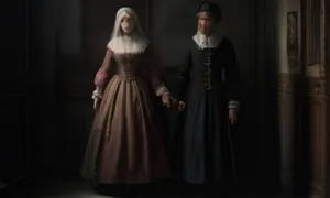
The visualisations are generated by artificial intelligence and serve as inspiration.
Photos from the area
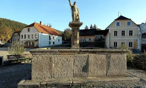
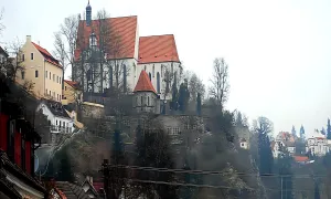
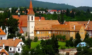
Real photos taken near the monument


Zdroj a licence jsou uvedeny u každého snímku.
Tips from visitors
No tips yet. Be the first!
Log in and add your tip.
Sources and literature
Photos: Gampe / CC BY-SA 4.0 — Wikimedia Commons. The author and licence also appear when you hover over the image.
Faktickým podkladem tohoto textu byl článek na Wikipedii, jehož autory jsou přispěvatelé Wikipedie. Článek je dostupný pod licencí CC BY-SA 4.0.
Location on the map
More monuments – Rožmberk nad Vltavou
Show all in the municipality
Příběhy a pověsti
Legendy, pověsti a příběhy spjaté s touto památkou
Fotografie návštěvníků
Zatím žádné fotografie. Buďte první, kdo přidá fotografii z návštěvy!
Log in a přidejte svou fotografii nebo hodnoťte.
Za ověřenou návštěvu v aplikaci získáte víc bodů — poznáme podle GPS, že jste na místě.
Reviews and comments