



Vodní nádrž Janov Water structure
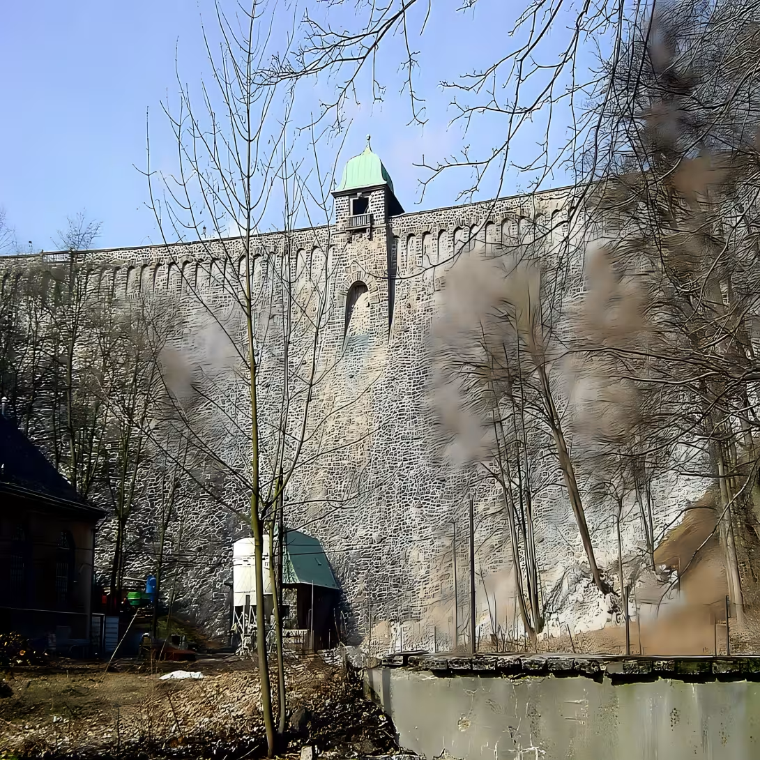
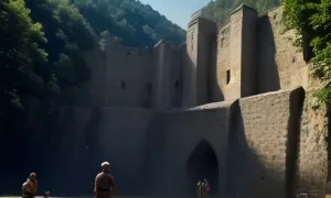
Vodní nádrž Janov, also known as Hamer or Mostecká dam, is a water work built in the years 1911-1913 in the Hamer Valley in the Erzgebirge Mountains. It is located in the district of Most on the confluence of the Loupnice River and the Klinské creek. It is used primarily to supply the population with drinking water.
The need for construction was created at the beginning of the 20th century because of the rapid industrial development of the Bridge, which had ceased to be sufficient for existing resources. The municipal committee chose the Hamer Valley because the city of Most owned forest land here and the precipitation area guaranteed sufficient quality water. The construction was intended to contain spring water in addition to supply to avoid flooding in the lowlands. The final project was developed by Professor Robert Weyrauch of the Technical University in Stuttgart.
The implementation took place between 1911 and 1913. The preparatory work began in September 1910 by felling the forest, cleaning the bottom and a transversal of the valley road. The dam itself was conked and carved from stone from a nearby quarry on the right slope of the valley. The construction was supported by technical means such as cable crane and cable car leading from the Janovsky administration building. In December 1913 the rough construction was completed. At that time it was the largest dam in Austria-Hungary. The work also included a water treatment plant and a three-mile steel pipeline leading to Most.
The construction was coordinated by an eight-member construction committee headed by Mayor Josef Herold. In particular, workers from Italy and Croatia were hired to concrete and break stone. The Italian workers had their own kitchen on the premises and for the needs of all the workers there was operated the hotel Dietl canteen. The total cost was CZK 4,694 237 and 15 pennies, slightly less than the original budget.
After being put into service in 1914 there were problems with water leakage walls on the left slope. They called in experts from the German Goth to fix it. The pressure injection to a depth of 33 meters significantly reduced water losses. In the first year of operation, in 1915, households consumed over 500,000 cubic meters of water. The dam covered the needs of the Bridge and the surrounding villages until the middle of the 20th century before the construction of the Fláska dam began in 1951.
At present, the water works manager is the state enterprise of the Water of the Ohry. The tank is located in the first sanitary protection zone. For this reason, the dam is not freely accessible and the communications in its vicinity are closed to the public.
The building represents an important technical monument from the beginning of the 20th century and proof of the industrial expansion of the region. It is recommended to visit the surrounding Hamer Valley and to observe from the outside this historic water work.
Then and now
Drag the slider to compare how the landmark may have looked when it was built with the view today.
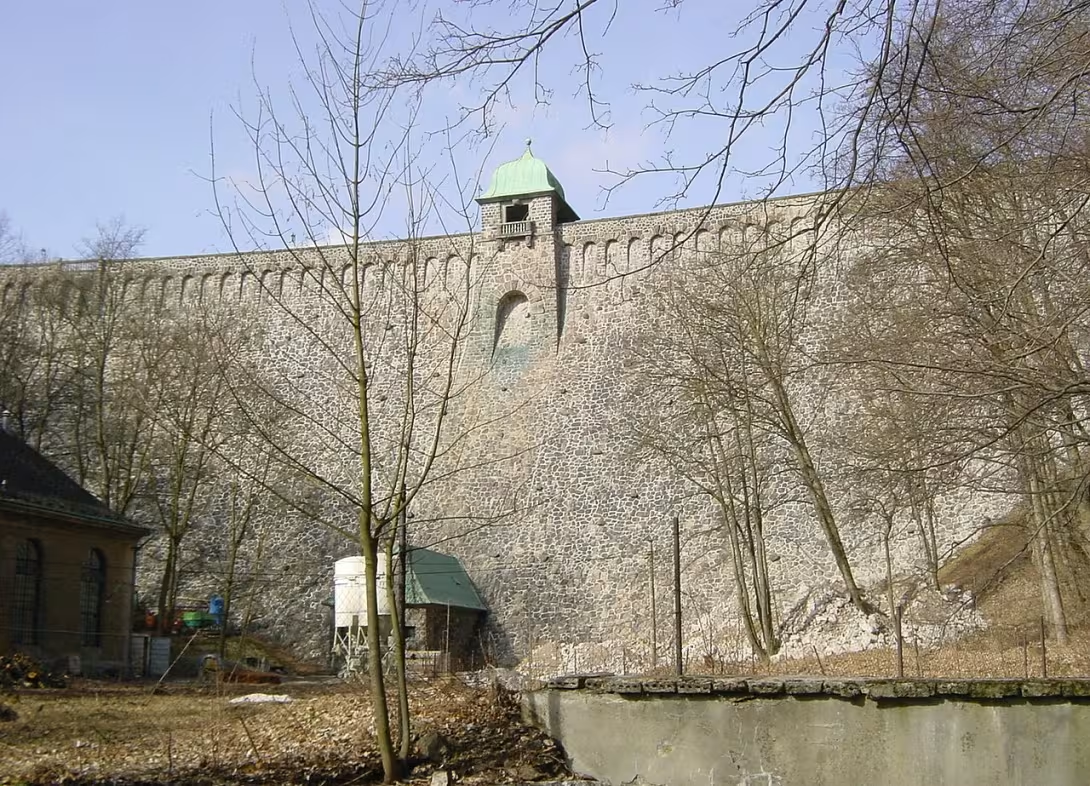
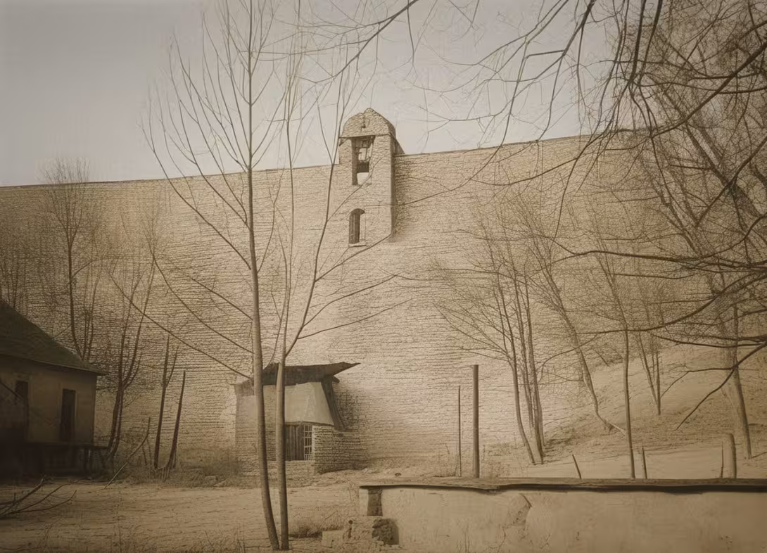
The historical appearance on the left is an AI-generated visualisation and serves as inspiration only.
Historical milestones
- 1906
- The City Council ordered the City of Most to draw up a proposal to deal with the supply of water to the population.
- 1908
- The entrustment of Professor Robert Weyraugh to work out the final project.
- 1910
- Opening of preparatory work by felling the forest and cleaning the bottom of September 21.
- 1911
- The launch of the construction of the dam itself in June.
Architectural development
The project was developed by Professor Robert Weyrauch from Stuttgart. The construction included felling the woods, cleaning the bottom and a cross of the lower road. The main dam was conked and embossed with stone.
Historical events
1906: decision of the Bridge Municipal Committee on drafting a proposal to deal with water scarcity; 1908: grant of building permission by the District Government of Most; 1911-1913: dam construction.
Owners
city bridge (built), water catchment area of the Ohře (current administrator)
Points of interest
- At the time of its construction it was the largest dam in Austria-Hungary. - The concrete and rock-breaking were mainly hired by workers from Italy and Croatia. - The total cost of construction was CZK 4,694 237 and 15 pennies. - Experts from the German Goth have been summoned to repair the water leaks. - The dam is not freely accessible because the tank is located in the first sanitary protection zone.
Guide
Show guide text
This text was created by artificial intelligence and has not been editorially reviewed. It may contain inaccuracies.
Welcome to one of the most important waterworks in our region. You are standing right in front of the Genoa water tank, which many of you may know under the names of Hamer or Mostecká dam. Look around you and see the calm of the Hamer Valley in the Erzgebirge Mountains. In front of you is the mirror of the water that originated at the confluence of the Loupnice River and the Klinsky River. It's a place where the force of nature connects to human engineering from the beginning of the last century. At this point you may only perceive the silence and view of the surface, but under the surface and in the construction itself there is a fascinating story about how the city of Most was trying to solve its basic needs.
Now let's move back more than a hundred years in time to understand why this building is here. It all began in the year one thousand nine hundred and six, when the city councilmen of Most realised that the current way of supplying the population with water was no longer enough. It was necessary to find a comprehensive solution to ensure drinking water for the growing population while protecting the surrounding lowlands from devastating spring floods. After several years of searching and planning, Professor Robert Weyrauch was commissioned in the year one thousand nine hundred and eight to work out a definitive project. He was a man with a great vision who could use the terrain of the Hamer Valley to create a tank that was meant to serve multiple purposes at once.
When you look at the dam itself, remember how much work people put into it at a time when there were no modern drivers or computer calculations. The preparatory work began in September of the year one thousand nine hundred and ten. Imagine this valley back then, which was densely wooded. The first step was to cut down the forest and clean the bottom thoroughly so that the building could stand on a solid foundation. The construction of the dam itself began in June of the year one thousand nine hundred and eleven. The whole process lasted several years and ended in the year one thousand nine hundred and thirteen. Notice the robustness of this work. Even though it now acts as a natural part of the landscape, it was a real technical miracle at the time of its creation.
Let the dedicated space around you now work and think about the people who created this building. Robert Weyrauch, as the main designer, put its expertise into the work, but it needed thousands of hands to implement it. Here we come to one of the most interesting parts of this story. At that time there were not enough local craftsmen with specific experience with such large concrete structures. Therefore, workers from Italy and Croatia were hired for concrete and stone-breaking. So imagine this Krušnomountain valley over a century ago, where Czech dialects with Southern languages were mixed, and where people from different corners of Europe cooperated in hard work. Among the personalities associated with this place was Josef Herold, who played a role in the creation process.
We will now stop at details that are not visible at first sight, but which give this place a unique character. At the time of its construction, this dam was the largest in the whole territory of Austria-Hungary. That gives you an idea of her prestige and importance back then. However, the construction was not cheap. The total cost was over four million six hundred ninety-four thousand crowns and fifteen pennies. At that time, it was an astronomical sum that underlines how the mighty city of Most invested in its future and the security of its inhabitants.
But nothing always runs smoothly. Even this monumental building had its problems. After the completion, there were water leaks, which is a critical problem for water works, which may jeopardise the stability of the entire dam. In order to solve this problem, real experts from German Goth had to be called. It is this combination of the domestic project, the Southern labour effort and the German professional redress that has made them a building that has survived for decades and is still in office.
Now, if you look again at the water level and the dam line, feel it not only as a technical object but as a monument to human endurance. This tank is not just about concrete and water, it's about trying to secure the lives of thousands of people in the Bridge. It is a symbol of stability in a landscape that has changed greatly over the years. The water flowing here connects the past to the present.
I wish you to take a quiet look at the surroundings and try to imagine the thousands of workers in the dust and the rumble of the quarry making this work. Walk the surrounding roads, perceive the smell of the forest and observe how the water in the tank mirrors in the sky. It's an ideal place to stop and think about how powerful you can reach the landscape to create something useful and beautiful.
Thank you for your attention and for exploring the history of Genoa water tank. I hope you're interested in this short trip to the past and that you're leaving with a new look at this place. I wish you a pleasant further journey and many wonderful experiences in discovering other secrets of our mountains and valleys. Goodbye.
Tips for visitors
The best time to visit is late spring or autumn, when the colors in the Erzgebirge Mountains are the most striking and the water level in the tank creates a quiet mirror. Transport to the area is possible by car and public connections, specific routes and connections can be checked in current maps.
In the valley, wear suitable shoes and clothes to protect you from moisture. For photo lovers, the best places are the shores of the tank in the morning or evening, when the low light beautifully highlights the surrounding hills and forests.
During the walk you can definitely visit the surrounding Hamer Valley, where you can watch the confluence of the Loupnice and the Klínské creek. This nature offers an ideal environment for a quiet rest outside the urban rush.
For families with children it is ideal to walk along the water and observe nature around the dam. Children will appreciate the discovery of the streams and the study of the landscape in the natural environment of the Erzgebirge Mountains.
Frequently asked questions
Can the monument be visited?
This is a structure in a public space that can usually be seen from outside free of charge. We have not verified that this particular one is freely accessible.
Where is the monument?
Location: Litvínov. The map on this page shows the exact spot.
Why is the monument protected?
It is listed in the Central List of Cultural Monuments of the Czech Republic as a cultural monument (register no. 1000154904).
Businesses nearby
Do you run a restaurant, accommodation, shop, museum, rental, wellness or other visitor service near this monument? Show yourself directly to the people heading to it — this is how they will see you in the app and on the web:
Events nearby



Zdroj akcí: otevřená data měst a obcí ČR (Národní katalog otevřených dat) a kalendář akcí Národního památkového ústavu.
Nearby
Hamerské údolí v Krušných horách, soutok Loupnice a Klínského potoka.
Accommodation nearby
Themed route
Here is the design of the cruise route:
1. Vodní nádrž Janov (water work) - Main destination. The site offers peace at the water and the possibility to observe the technical equipment of the dam.
2. Hamer Valley in the Erzgebirge Mountains (natural area) - Walk through a beautiful landscape near the dam. The path leads through typical mountain nature.
3. Confluence of the Loupnice and the Klinské creek (water body) - The point where two flows meet. It's an ideal place to relax in the splashing water of nature.
Seasonal recommendations
In the spring, the surrounding area becomes a varied area with a growing greenery. The air is fresh and light soft, which creates a calm atmosphere. We recommend shoes suitable for wet terrain and laminated clothing because the wounds can still be cold. It's best to visit the place in the morning.
Summer brings bright sun and rich colors of the landscape. The water area during this period is a refreshing impression and the surrounding trees provide shade. It is advisable to choose light summer clothes, hat and sun protection. The ideal time for a visit is early morning or late afternoon when it is not the hottest.
Autumn is a period of colorful leaves and fog that give the place a mysterious touch. The lighting is golden and nature is preparing to rest. It's practical to wear a waterproof jacket and tight shoes for walking in leaves. We recommend a visit in October when the Trees colors are the most intense.
Winter turns the landscape into a white space that is very quiet and dreamy. In case of snow, the atmosphere is cosy and calm. Attenna atenas atenas atenas atenas atenas atenas atenas atenas atenas atenas atenas atenas atenas atenas atenas atenas atenas atenas atenas atenas atenas atenas atenas atenas atenas atenas atenas atenas atenas atenas atenas atenas atenas atenas atenas atenas atenas atenas atenas atenas atenas atenas atenas atenas atenas atenas atenas atenas atenas atenas atenas atenas atenas atenaatenas atenas atenas atenas atenas atenas atenas atenaatenaatenas atenas atenas atenaatenaatenas atenas atenas atenas atenas atenas atenaatenaat atenaatenaatenaatenaatenaatenaatenaatena@@ athens athens athens athens athens athens athens athens athens athens athens athens athens athens athens athens athens athens athens athens athens athens athens athens athens athens athens athens athens athens athens athens athens athens athens athens athens athens athens athens athens athens athens athens athens athens athens athens athens athens athens athens athens athens athens athens athens athens athens athens athens athens athens athens athens athens athens athens athens athens athens athens athens athens athens athens athens athens athens athens athens athens athens athens athens athens athens athens athens athens athens athens athens athens athens athens athens athens athens athens athens athens athens athens athens athens athens athens athens athens athens athens athens athens athens athens athens athens athens athens athens athens athens athens athens athens athens athens athens athens athens athens athens athens athens athens athens athens athens athens athens athens athens athens athens athens athens athens athens athens athens athens athens athens athens athens athens athens athens athens athens athens athens athens athens athens athens athens athens athens athens athens athens athens athens athens athens athens athens athens athens athens athens athens athens athens athens athens athens athens athens athens athens athens athens athens athens athens athens athens athens athens athens athens athens athens athens athens athens athens athens athens athens athens athens athens athens athens athens athens athens athens athens athens athens athens athens athens athens athens athens athens athens athens athens athens athens athens athens athens athens athens athens athens athens athens athens; and
Visualizations and artistic views


The visualisations are generated by artificial intelligence and serve as inspiration.
Photos from the area
Real photos taken near the monument


Zdroj a licence jsou uvedeny u každého snímku.
Tips from visitors
No tips yet. Be the first!
Log in and add your tip.
Sources and literature
Photos: ProfessorX / CC BY-SA 4.0, rozlišení zvýšeno umělou inteligencí — Wikimedia Commons. The author and licence also appear when you hover over the image.
Faktickým podkladem tohoto textu byl článek na Wikipedii, jehož autory jsou přispěvatelé Wikipedie. Článek je dostupný pod licencí CC BY-SA 4.0.
Location on the map

Příběhy a pověsti
Legendy, pověsti a příběhy spjaté s touto památkou
Fotografie návštěvníků
Zatím žádné fotografie. Buďte první, kdo přidá fotografii z návštěvy!
Log in a přidejte svou fotografii nebo hodnoťte.
Za ověřenou návštěvu v aplikaci získáte víc bodů — poznáme podle GPS, že jste na místě.
Reviews and comments