

U svatého Vojtěcha Hillfort
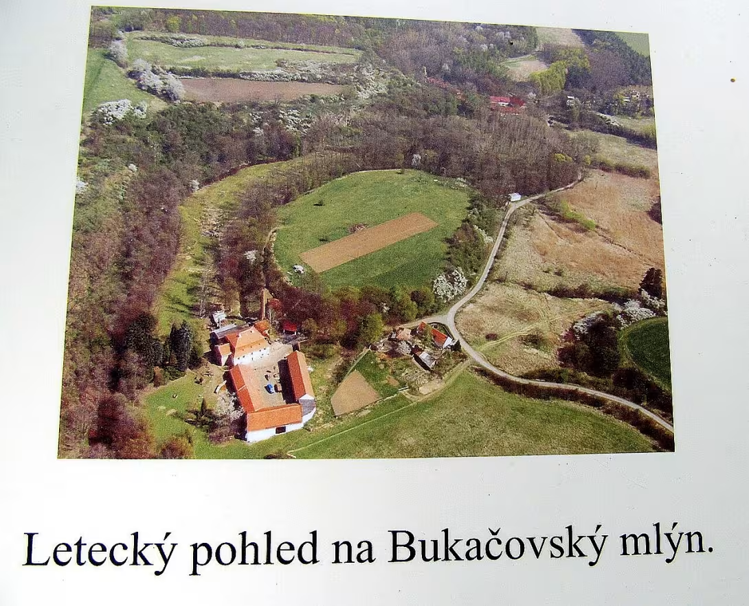
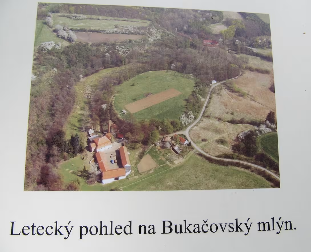
The fort near St. Vojtěv is a prehistoric settlement from the prehistoric to early Middle Ages. It is located southeast of the city Kouřim in the district of Kolín. The monument is remarkable by layering different cultures from the eneolite to the late bronze age to the Middle Ages. Since 1965, it has been protected as a cultural monument.
The location lies on the clay-sandy terrace above the river Exposition. It was created as an island in the former riverbed and stands out 15 metres above the surrounding valley. The total area of the building is 1.49 hectares. Natural protection is provided by steep slopes on the north and south side.
The oldest unfortified settlement from the period of eneolite belongs to the native culture. From this time, a simple pit house and secondary pits were uncovered. One of the storage pits of 90 × 108 centimetres and a depth of 115 centimetres contained ceramic fractions, bones and burnt objects. That suggests her use for a secondary heat funeral. Among the findings are two-sided spillet axes of the elephant type, serrated blades, arrow and semi-ground with stake structure. Exceptional discoveries are amfora with two drilled ears and a torso bowl on the foot with the influence of the učedolan culture. At a similar time there was a fortified village on Old Kouřimi on the opposite bank of the river. Later, members of the Utentico-Věterovský culture were active here.
In the late Bronze Age, the new-Shield culture built a fortified castle. It was protected by a stony wall with a chamber structure and a palisade on the front. The width of this hardness was between three and four meters. At present, only the terrain signs of the wall are preserved from the fortification.
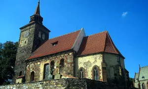
The last phase of the settlement falls into the 10th to 11th century, namely in the middle and younger times of the castle. It is assumed that there was a weak fortified mansion on the terrace. A tribune church dedicated to Saint Vojtěch was built at the site of the older burial site in the 11th to 12th century. The building is mentioned in written sources between 1659 and 1677. Later, under the reign of Emperor Joseph II, she served as a granary.
Today the location of the church is known only about thanks to the opus rubble, the vault and the irregular orientation of some graves. Some stonework elements were used in the construction of the wall of Bukavský mill in the immediate vicinity of the site.
At the turn of the 19th and 20th centuries, Josef Ladislav Píč launched an archaeological survey of the site, which found esque earrings in the graves. Further research was carried out by Miloš Šolle in 1962 and between 1978 and 1981.
This site represents a valuable archive of human settlements over thousands of years. Visiting the site offers the possibility to observe the terrain traces of ancient fortifications in a quiet environment near Kouřimi.
Then and now
Drag the slider to compare how the landmark may have looked when it was built with the view today.
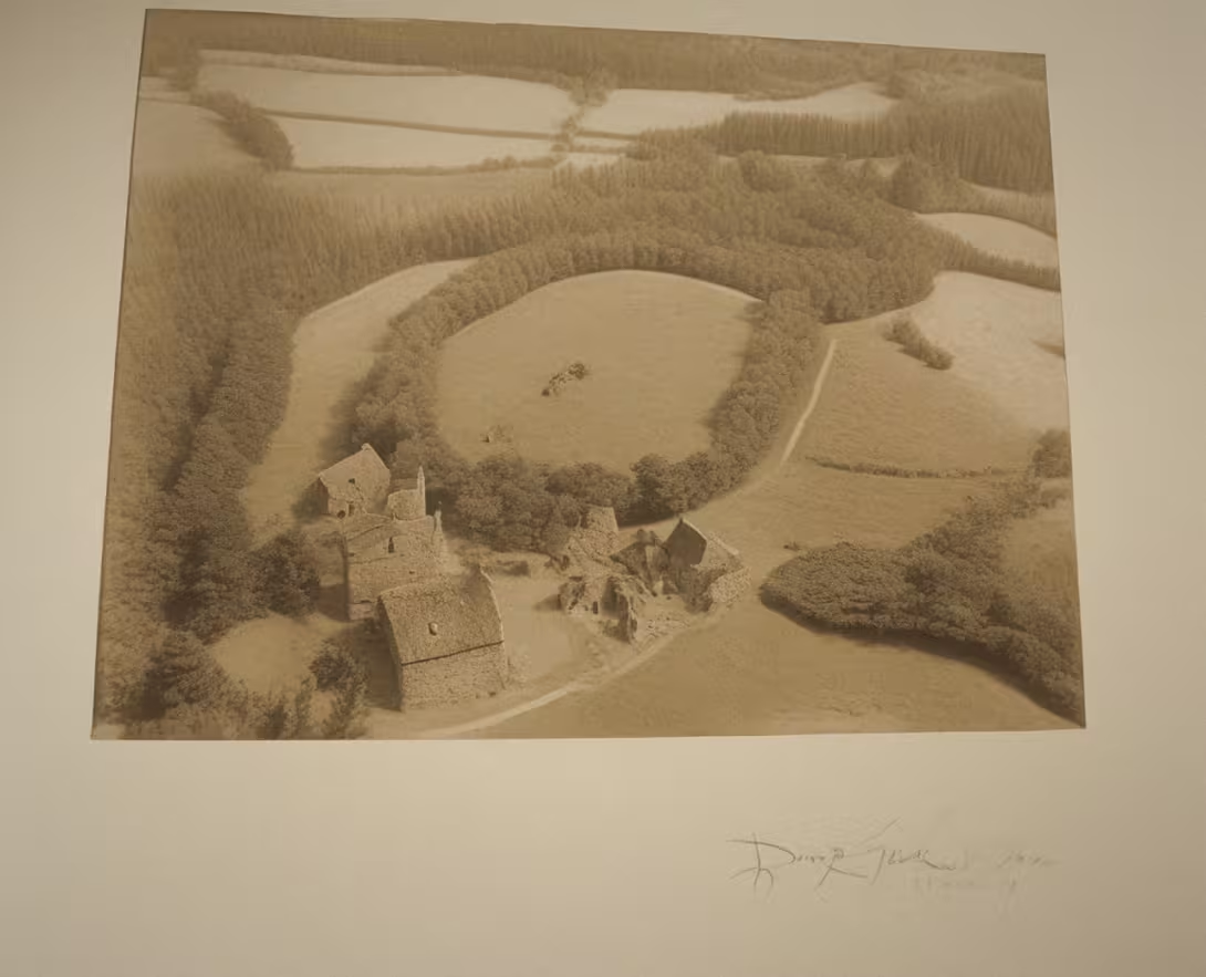
The historical appearance on the left is an AI-generated visualisation and serves as inspiration only.
Historical milestones
- 1962
- Archaeological research carried out by Milos Šoll.
- 1965
- The castle is declared a cultural monument.
- 1978- 1981
- Another phase of Milos Šolle's archaeological research.
Architectural development
In the late Bronze period there was a castle with stony wall of chamber structure and palisade. In the 11th to 12th century, a tribune church was built on site. The church building later served as a granary under the reign of Emperor Joseph II.
Points of interest
- The monument is a remarkable layer of different cultures from eneolite to late bronze to medieval. - The settlement was created as an island in the former river bed and stands out over the surrounding valley by 15 meters. - At the time of the eneolite, there was an amphora with two pierced ears and a torso bowl on the foot. - In the late Bronze period there was a fortified fort with stony wall and palisade. - In the 11th to 12th century, St. Vojtěv's church was built here, which later served as a granary.
Guide
This guide is narrated by a synthetic voice generated by artificial intelligence.
Show guide text
This text was created by artificial intelligence and has not been editorially reviewed. It may contain inaccuracies.
Welcome to Kouřimi, a place where history does not only take place in books, but it is tangible in the ground under your feet. You're standing in front of St. Vojtěch's site. Perhaps at first glance you may be surprised to see no high walls, no monumental columns, or flashy gates. In front of you is a landscape that looks calm and natural, but in rzeczywence below you sleeps thousands of years of human story. Feel the atmosphere of this place protruding over the surrounding valley by 15 meters. It was this position that gave him strategic importance in ancient times and made him a safe haven for people who lived here in different epoch.
Stop for a moment, and let us try to move far further back together in time before stone cities began to build in our parts. This place was chosen very cleverly. Centuries ago, in times we now call the final time of stones and the beginning of the metal era, a settlement was created here. Imagine this place wasn't always the hill you see today. At the oldest stage, people were living in an area that resembled an island in a river bed. The water around them served as a natural protection while the elevated terrain provided them with an overview of the surroundings. It was a time when people began experimenting with the first metal tools and their life was closely linked to nature and the river that once surrounded them.
Let's move forward a few centuries in time. With gradual development, the need for security has increased. In the late Bronze period it was not only an open settlement, but a real fortification was created here. People began to build forests to protect the people from attacks from the outside. Now, if you look closely around you and watch the shape of the terrain, notice the subtle inequalities in the ground. What may now look like the natural wavy surface of a meadow or a slight slope of a hill are actually the only preserved signs of the ancient wall. It is fascinating to think that these stealth terrain signs are silent witnesses to the dramatic events that took place here thousands of years ago.
Now pay attention to the next layer of history that has come to this place. After thousands of years of silence and gradual integration of old structures into the country here in the early Middle Ages, people began to live and build again. This location was so important that there was later a church dedicated to Saint Vojtech. However, it was not an ordinary temple, but a so-called tribune church, which was a specific type of early medieval architecture. Imagine this building in its glory, as it dominantly stood in this high place and rang the valley. However, as time progressed, the function of the building changed. History is often unexpected, and the buildings that served to pray can end quite differently. Later this church was used as a granary, a place for storing grain. It is a symbolic transition from spiritual space to practical use, which shows how the needs of local people have improved over the centuries.
When we think about how we learned about this place today, we must mention the people who have decided to dig the truth from the depths of the earth. Even if we don't know the names of the castle builders or the church architects, we know the name of the man who helped us rediscover this place. He was an archaeologist named Milos Sholl. The first major research was carried out in the year of nine hundred and sixty-two. His work was so crucial that by three years the Kemudian, in the year nine-thirty-five, the castle was declared a cultural monument. Miloš Šoll has returned to this place repeatedly, and other extensive stages of research have been carried out between the years by the nine thirty-eight and eighty-one. Because of its patience and precision, we now know that beneath our feet lies the real archive of human existence.
And now we come to what makes this place truly unique. The greatest mystery and treasure is the layering of cultures. Think of it as a giant pie where each layer represents a different era. From the oldest unfortified settlement from the time of transition from stone to metals, to the fortified fortified fortification from the Bronze Age to the medieval church and granary. It is rare to find one place where such a distinct period of human development is so clearly represented.
Try to imagine what's left in the country. Among the findings of the oldest age, i.e. the age of eneolite, was, for example, the Amphora, which is such a clay piece, which had two drilled ears, probably to make it easier to tie or hang. There was also found a torso bowl on the foot. These small objects, which may seem inconspicuous to us today, are extremely valuable to historians. They tell us about how people cooked, how they stored food and what craft skill they had back then. It's a fascinating notion that thousands of years ago, someone held this very bowl in their hands and maybe stood at the exact same point where you are now standing.
When you look around, you realize that this place is a bridge between the past and the present. Even though we can't see the walls today, we perceive space. Feel the difference between the quiet valley below you and this raised platform. It was this height 15 meters above the perimeter that was the key to the success of everyone who lived here. It was an advantage that allowed them to see the danger coming in time, but at the same time gave them a sense of superiority and security.
Today, this site is a silent witness to landscape change. From the river that once flowed here, through the clay walls, to the walls of the church, which eventually became a granary. It's all in the country, in the field, and in the archaeologist's records. It's a place that teaches us humility before time. It shows us that nothing is eternal, but that the traces we leave behind can be rediscovered for thousands of years.
I suggest you go through the whole area slowly now. Follow the lines of the ground and see if you can detect the above signs of a wall in the field. Take your time. Try to stop at several different points and imagine how architecture changed here and how the sound of the surrounding area was changing from the roar of the river to the noise of building fortifications to the silent prayers at St. Vojtěv's church.
Thank you for spending time with us at this fascinating site. We hope you have felt the depth of history that is in Kouřimi so strongly present. We now invite you to explore the surroundings and discover other hidden corners of this beautiful city. We wish you a pleasant continuation of your journey and many new discoveries. Goodbye.
Tips for visitors
The best time to visit is the period with longer days, such as late spring or summer. In these times it is best to see the very shape of the landscape, which is important because there are no buildings on the site.
The place can be reached by car and by public transport; Check the internet search for the current connection.
For convenience, we recommend taking water with us and wearing fixed shoes suitable for uneven terrain.
If you want to take pictures, you will get the best results in the low sun, for example in the morning or before sunset, when shadows better highlight the face of the castle. The best angles for the images are from surrounding heights.
In the vicinity you can explore the Bucking Mill or go to the other bank of the River Expedition to the location Stará Kouřim. For families with children such a journey through nature is an interesting activity.
Frequently asked questions
Can the monument be visited?
This is an archaeological site. Often there is little to see on the ground and the land may be private. We have not verified access.
Where is the monument?
Location: Kouřim. The map on this page shows the exact spot.
Why is the monument protected?
It is listed in the Central List of Cultural Monuments of the Czech Republic as a cultural monument (register no. 1000137890).
Businesses nearby
Do you run a restaurant, accommodation, shop, museum, rental, wellness or other visitor service near this monument? Show yourself directly to the people heading to it — this is how they will see you in the app and on the web:
Nearby
🏰 Historic sites (88)
- Skansen Kouřim 1.0 km
- Muzeum Kouřimska 1.0 km Mírové náměstí 1 +420321783380 web
- Astronomický střed Evropy 1.1 km
- Prokop Veliký 1.1 km
- Tomáš Garrigue Masaryk 1.3 km
- zámeček Diblíkov 1.9 km
- zámek Molitorov 2.0 km
- Tvrz Malotice 3.6 km
- zámek Svojšice 3.9 km
- Socha sv. Jana Nepomuckého 4.0 km
- Pomník padlým 4.1 km
- Památník obětem nacismu 4.2 km
- pomník Rudé armádě 4.3 km
- Lipanská mohyla 5.1 km
- Františkánský klášter Zásmuky 5.8 km Havlíčkova 26
- Pomník obětem světových válek 6.0 km
- Zvonice dřevěná renesanční L.P. 1587 6.8 km
- muzeum Josefa Gočára a galerie kubistického designu 7.3 km
- Svatý Donát 7.3 km
- Mohyla sv. Prokopa 8.0 km
🍽️ Restaurants and dining (73)
- Pizzerie Raffaelo 1.0 km Komenského 144 +420 607 809 057 web
- Setkávačka 1.1 km
- Restaurace Na Střelnici 1.3 km Pražská 303 728 205 51 web
- Jídelna a pivnice U Švarců 5.4 km
- Restaurace U Kozy 5.9 km 321 796 185 web
- U Bruthansů 6.0 km +420 321 792 768
- Café u Máří 7.1 km Chotýš 8 +420 605 952 499 web
- Restaurece u Laudona 8.0 km Bečváry 25 +420 721 710 238 web
- Zájezdní hostinec 8.7 km web
- Huang Hoa 8.9 km
- Cukrářský Salon 8.9 km +420 739 690 816 web
- Restaurace u Hálu 9.0 km Kutnohorská 369 +420321697206 web
- Pizza Everyday 9.1 km náměstí Smiřických 51 +420 720 612 456 web
- Cukrárna Král 9.1 km náměstí Smiřických 37 722 187 008 web
- Five Days Bar 9.2 km
- Modré dveře 9.2 km 602331 996 web
- Museum 9.2 km
- Nostalgie u Hrnčíře 9.3 km Pražská 102 +420 321 697 398 web
- Maštal 9.9 km +420 728 169 626 web
- Restaurace Na Rozcestí 9.9 km
🏨 Accommodation (8)
- Penzion u lva 1.2 km
- Ubytování v pivováru 8.7 km web
- Romantic baroque nest 10.0 km web
- Podviňák 12.2 km
- Apeyron 12.7 km
- Sázavský ostrov 14.0 km
- Hotel Romantica 14.4 km Zborovská 600 +420 321 623 844 web
- Pod Vrbou 14.6 km
🚲 Rentals and sport (19)
- Sokolák 1.3 km
- Sokolovna 6.0 km
- Koupaliště Radim 8.5 km
- SSK Kostelec nad Černými lesy 9.2 km
- Servis kol 12.6 km Suvorovova 136 web
- Sportovní hala 12.7 km
- Kolo pro radost 12.7 km Kollárova 972 +420603843048 web
- Sokolovna 12.7 km
- CYKLOSERVIS A PRODEJ KOL JEVANY 13.0 km Sportovní 359 732365079 web
- Cyklo Ondráček 13.4 km
- Sokol Poříčany 13.4 km
- KOLACALEK.CZ 13.6 km Kolínská 969 web
- ČÁLEK 13.9 km
- Policejní střelecký klub Union Praha 14.3 km
- Cykloservis Vyžlovka - Josef Dřízhal 14.5 km Skalská 275 +420 728 508 057 web
- Sportovní stáj Pyskočely 14.8 km
- Střelnice Kolín 14.9 km
- Motoškola Landa 14.9 km
- Sportklub Fortuna Kolín 14.9 km Dělnická 802 603 215 381 web
🥾 Hiking and nature (62)
- zábavné zastavení 0.3 km
- zábavné zastavení 0.4 km
- zábavné zastavení 0.6 km
- Výhled od Lechova kamene na město Kouřim 0.7 km
- park Na Hradbách 0.9 km
- Astronomický střed Evropy 1.0 km
- Skanzen Kouřim 1.0 km
- Mírové náměstí 1.1 km
- Stébelnatá rula 4.2 km
- Hlaváčova Lhota 4.3 km
- Lipská hora 4.8 km
- Lůmek u Bečvár 7.7 km
- Pramen Járy Cimrmana 7.7 km web
- Svatého Prokopa 8.2 km
- Lom u Radimi 8.4 km
- U Cihelny 8.5 km
- Křečhoř 9.1 km
- Sládkova stráň 9.1 km
- Rozhledna 9.2 km
- Pičhora 9.3 km
Accommodation nearby
Trips and activities nearby
Guided tours, tickets and activities nearby from GetYourGuide
Affiliate link: if you buy from the partner, we may receive a commission. The price for you does not change.
Search tours and activities →Themed route
Here is a proposal for a thematic cruise route:
1. Old Kouřim (historical site) - Walk around where the old town once became. Located on the opposite bank of the River Vývka.
2. U svatého Vojtěcha (archaeological sites) - The main destination of the journey with unique remains from ancient times.
3. Drum mill (construction) - Visit the local mill, which complements the picture of the surrounding landscape and history.
Seasonal recommendations
In spring, the surrounding landscape awakens into the world and the young green helps to better perceive the space around the remains. The air is fresh and light soft, which creates a calm atmosphere for walks. Moistable footwear is recommended because the terrain can be amused after melting snow. The best place to visit is in the morning when dew is still visible on the grass.
In the summer months it dominates the landscape of heat and sharp sun, which, although illuminating the details of the terrain, can be painful. Nature is in full bloom and surrounding trees provide shade. It is necessary to choose light, breathable clothing and to take with you enough water. The ideal time for visiting is early morning or shortly before sunset to avoid the greatest temperatures.
Autumn brings leaves to the area of gold and brown color, which provide ruins with melancholy tones. The light is golden in this period and falls at a lower angle, which can help highlight reliefs in the ground. Layer clothing and fixed shoes are suitable to prevent slip on wet leaves. It is recommended to set off on a clear October day when the air is clear.
Zimą the landscape is quiet and in the case of snow the surface of the site is united under a white layer. The atmosphere is strict and desolate, underlining the nature of the lost place. It is necessary to wear warm winter clothes and waterproof shoes. The most suitable is a visit at noon when daylight is the strongest because winter days are very short.
Visualizations and artistic views


The visualisations are generated by artificial intelligence and serve as inspiration.
Photos from the area
Real photos taken near the monument


Zdroj a licence jsou uvedeny u každého snímku.
Tips from visitors
No tips yet. Be the first!
Log in and add your tip.
Sources and literature
Photos: Palickap / CC BY-SA 3.0 — Wikimedia Commons. The author and licence also appear when you hover over the image.
Faktickým podkladem tohoto textu byl článek na Wikipedii, jehož autory jsou přispěvatelé Wikipedie. Článek je dostupný pod licencí CC BY-SA 4.0.
Location on the map


Příběhy a pověsti
Legendy, pověsti a příběhy spjaté s touto památkou
Fotografie návštěvníků
Přidat fotografiiZatím žádné fotografie. Buďte první, kdo přidá fotografii z návštěvy!
Máte k místu vzpomínku nebo zajímavý příběh?
Log in a přidejte svou fotografii nebo hodnoťte.
Za ověřenou návštěvu v aplikaci získáte víc bodů — poznáme podle GPS, že jste na místě.
Reviews and comments