





Blatenský vodní příkop Water structure
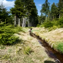
Blatenský vodní příkop, German Erbwassergraben (Hereditary water moat), is one of the unique water structures. It is an artificial water feeder leading from the nature reserve of the Boddar Peat through mountain terrain to the town of Horní Blatná in the Krušné Mountains. It originated in one of the most important epoch of Czech industrial history.
The moat was built in 1540-1544 by builder Stephan Lenk based on practical needs. In the 16th century, in the Hornoblaten tin field, the necessary hydropower sources were necessary to drive mining machinery and to process ore. The water was also used to transport construction and fuel wood. The construction of this water work has become a driving force for the development of mining activity throughout the area. During the same century, the moat became the sole property of Upper Blatna. The decisive moment was 1570, when Emperor Maxmilián II. issued a special decree guaranteeing protection of the water ditch and granting the city the right to collect water charges. This privilege gave the whole part of his title.
The moat stretches nearly 13 kilometres from the northern edge of the Boddar peat pit through the locality of Myslivna, Ryžně and Bludna to the north side of Blatensky Hill to Horní Blatná. It is located at an altitude of 975 to 945 metres and exceeds 32 metres. The coryto was originally dug up in the field and reinforced by stones, the banks built as mounds one metre high. The water flows with a slight slope of one meter per hundred meters. The original width was two metres, and today it is roughly half of the route. In order to keep the moat functional in harsh mountain conditions, spruce was planted around it and some sections were covered with branches in winter. The system plays with stops, raids and drain channels provided flow control. The maintenance was handled by permanent guards who kept the work operational for centuries.
Although the moat gradually ceased to serve its original purpose, its maintenance continued until 1945. After World War II, he was distracted and gradually disintegrated. It was almost destroyed in the early 1990s. The current reconstruction in 1995- 2001 led to the reconstruction of this historic building. The project was based on archival documentation from 1929 and was associated with a change in relation to the landscape - not only the restaurant, but also environmental protection.
Today, the moat is accessible by walking a 11,5 kilometer long educational path with 23 information boards. The trail starts about 1.5 kilometres west of God's Dar and is connected to the teaching trail of the Wolf Pit above the Upper Blatna. The reader here sees a link between the industrial past of Hornatina and the current relationship to nature.
Then and now
Drag the slider to compare how the landmark may have looked when it was built with the view today.
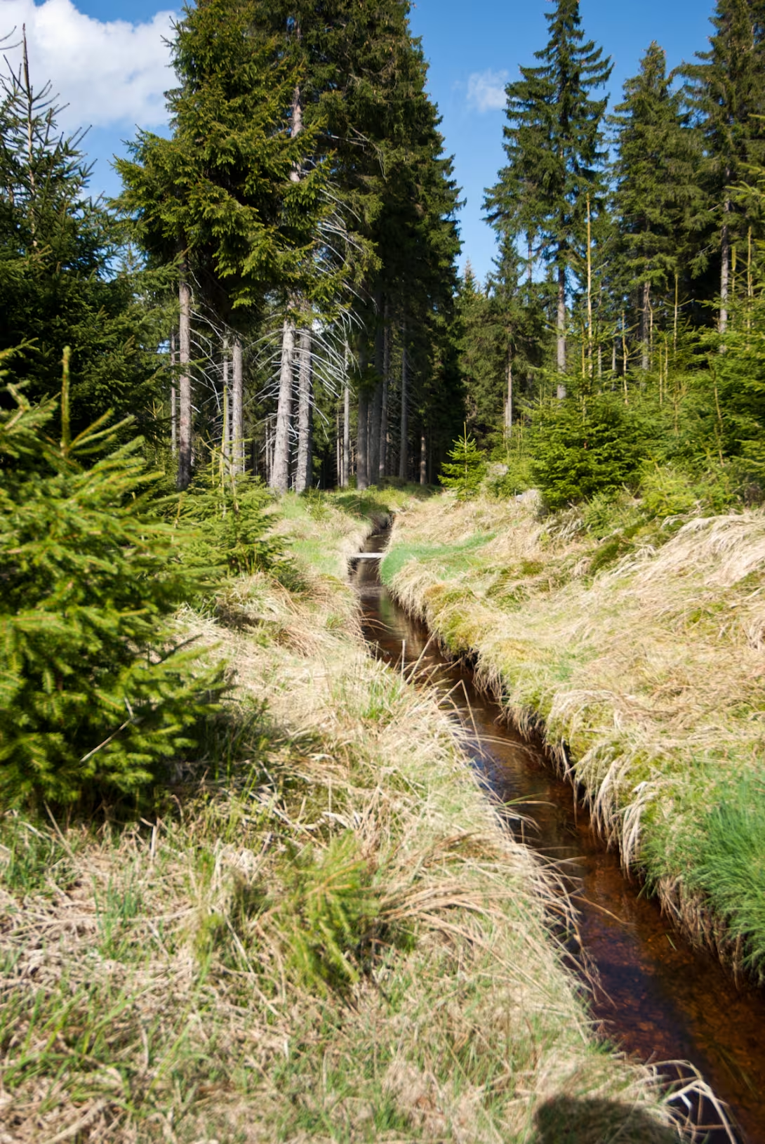

The historical appearance on the left is an AI-generated visualisation and serves as inspiration only.
Historical milestones
- 1540-1544
- Construction of water moat by builder Stephan Lenk.
- 1570
- Emperor Maxmilián II. granted the Upper Blatant Heritage right to collect water charges.
- 1980
- A technical monument.
- 2017
- Declaration of a national cultural monument.
Architectural development
The moat was dug in the field with a riverbed of reinforced stones and banks with filling points 1 metre high. It leads along layers with slight descent 1 meter per 100 meters. After modern reconstruction, the width of the trough from the original 2 metres has decreased to approximately 1 metre.
Historical events
In 1570, the city received a special decree from Emperor Maximilian II to protect the ditch and the inheritance right to collect water charges. In the years 1995-2001 the building underwent a total reconstruction.
Owners
Since the 16th century exclusive property of the city Horní Blatná.
Points of interest
- Blatenský vodní příkop is an artificial water binder from the Garden of God to Upper Blatna. - It was created in 1540-1544 based on the need for Hornoblaten tin regions. - Emperor Maxmilián II. in 1570 gave the city the hereditary right to collect water charges and protect the ditch. - The moat stretches nearly 13 kilometers from the Heavenly Basin to the Upper Blatna, with an altitude of 975 to 945 metres. - The current reconstruction took place in the years 1995- 2001 on the basis of archive documentation from 1929.
Guide
This guide is narrated by a synthetic voice generated by artificial intelligence.
Show guide text
This text was created by artificial intelligence and has not been editorially reviewed. It may contain inaccuracies.
Welcome to the Blaten Water Trench, the unique heritage of the Ernest Mountains. If you look around, you're going to notice this impressive structure that connects God's peat with Upper Blatna. In front of you is a long water binder whose history dates back to the 16th century.
Let's dive into its beginnings. In 1540-1544, this moat was built under the leadership of Stephan Lenk to provide the necessary energy for the Hornoblaten tin regions. It was a time when new methods were sought for effective ore mining and processing, and Blatenský vodní příkop was a key part of this innovation.
Look up at the building elements. Note the meticulous connection of stone blocks, which is indicative of the then builders' championship. Even though time did not escape without sequence on this work, its structure remained strong and functional for centuries.
The key personality associated with this monument is Emperor Maxmilián II., who in 1570 granted the Upper Blameless Heritage right to collect water charges. This step not only strengthened the protection of the trench, but also strengthened the economic base of the city.
The interesting thing is that this artificial water binder was not only important for mining tin ores. It was also used for the propulsion of waterproof machines and transport of building and fuel timber, which shows its multifunctional role in society at that time.
Now let's take a closer look. As you approach, you can feel the history and effort that has been put into this work. Notice how the moat rises and falls along the terrain, which shows incredible work planning and realization.
Let's move on and explore other parts of this fascinating water ditch. Every piece has a story that expects to be told.
I recommend taking the time to explore the surroundings and think about this important work. Blatenský vodní příkop is not only a technical monument but also a witness to the rich history of the region.
Thank you for your visit and I hope you enjoyed exploring this beautiful place. Let the next trip to the Ernest Mountains catch you even more!
Tips for visitors
The best time to visit the Blaten Water Trench is autumn and spring, when the landscape view is especially colorful and nature offers the most beauty. Sunshine days are ideal for exploring the natural beauty of the surrounding territory.
Parking can be found near the village Horní Blatná, where there is also a public transport stop. For those travelling by car, the location is well available and for more convenience you can check the current parking possibilities online.
When visiting, bring suitable clothes according to weather, shoes for dry hooves and supplies of drinking water. Do not forget the protective sunglasses and UV cream.
Photography is one of the most rewarding activities, especially in the morning light or in the evening when the colors of landscapes change and water reflects the sun's rays. Preferably choose places with an overview of the entire moat for beautiful panoramic images.
It is possible to visit in the vicinity of the Blaten Water Trench Natural reservation of the Bohemian Peat, where you can learn more about unique ecosystems and biodiversity. There is also the teaching trail of the Wolf Pit, which offers interesting information for the whole family.
Frequently asked questions
Is Blatenský vodní příkop open to the public?
Yes, Blatenský vodní příkop is open to the public. You can look at its structure and observe the water flow.
How do I get to the place by car / public transport?
The location is best accessible by car, but you can also use local bus connections. The nearest stop is 5 minutes walk from the site.
How much is the entrance fee and is it paid on the spot?
Admission is free. You can see the moat free of charge, but if you want more information about its history and function, you can visit the nearby information board.
Is the tour suitable for children and seniors?
Yes, Blatenský vodní příkop is also suitable for families with children. Children can enjoy watching the water flow and seniors can take on the history and function of the water work.
How long does the tour take?
The tour of the Blaten Water Trench is very fast. You can see it within 15-30 minutes, but you can also decide to stay longer and observe the water flow.
What are the opening times and booking is required?
Blatenský vodní příkop is available throughout the year, but the best time for visiting is from April to October. Reservation is not necessary.
What's interesting in the immediate vicinity?
In the immediate vicinity of the Blaten Water Trench there are several other historical monuments such as the nearby ruins of the castle. You can also visit the local park and observe the surrounding countryside.
For kids
Imagine going back to when our country was still a wilderness full of forests and rivers. Where would you like to be? Blaten water work! It was like a giant pond to protect people and animals from a barren land.
Who lived here? There were people from rural villages who lived here for a living in agriculture. They were real hunters and fishermen. They had their little houses made of wood and barns for animals. Where were their homes? Near the river to have access to the water.
Businesses nearby
Do you run a restaurant, accommodation, shop, museum, rental, wellness or other visitor service near this monument? Show yourself directly to the people heading to it — this is how they will see you in the app and on the web:
Nearby
Natural reserve of the Boddar Peat, village Horní Blatná and educational trail of the Wolf Pit.
Accommodation nearby
Trips and activities nearby
Guided tours, tickets and activities nearby from GetYourGuide
Affiliate link: if you buy from the partner, we may receive a commission. The price for you does not change.
Search tours and activities →Themed route
1. Municipality of Horní Blatná (Municipality) - The starting point of the road, which offers the atmosphere of the historic mining town. 2. Blatenský vodní příkop (Water Works) - The main destination of the trip and the unique technical monument used in the past to power the machines. 3. The Taught Path of the Wolf Pit - A Walk to uncover the secrets of local manufacturers and nature. 4. The nature reserve of the Garden of God (Nature reservation) - Final stop in a fascinating wetland landscape with typical flora.
Seasonal recommendations
Spring: In the spring season, Blatenský vodní příkop turns into a live flower pool when a diverse flora awakens after a long winter sleep. The sunny dawn and mild temperatures contribute to an unforgettable atmosphere full of hope and recovery. Soft clothes are suitable for visiting, because the weather can be variable. The best time to visit is in the early afternoon when the crowd is not yet burdened and nature is gaining its life.
Summer: In summer Blatenský vodní příkop is a popular place for relaxation under sunlight. The atmosphere becomes warm and friendly when people gather by the water on afternoon fairy tales or picnics. Due to the strong sun, it is recommended to wear a protective coat and glasses with UV filtration. The best time to visit is before noon, when the temperature is not so extreme and the approach is easier.
Autumn: In autumn Blatenský vodní příkop gets melancholic beauty full of golden leaves. Sunshine, which is projected into water and trees, creates a unique atmosphere of peace and quiet. When visiting, it is advisable to wear warmer clothes for colder night temperatures. The best time to walk is in the early afternoon when light is best and nature offers its greatest beauty.
Winter: In winter, Blatenský vodní příkop is transformed into a quiet haven where the city's rhythms slow down. The freezing dawn and the snow blanket bring to the atmosphere a sense of mystery and magic. When visiting it it is necessary to have warm clothes, including fur and hat, because the weather can be very cold. The best time to visit is on the middle of the day when it does not want to be exposed to ice air for too long.
Visualizations and artistic views


The visualisations are generated by artificial intelligence and serve as inspiration.
Photos from the area
Real photos taken near the monument


Zdroj a licence jsou uvedeny u každého snímku.
View from the area
This animation was generated by artificial intelligence from a real photograph of the surroundings. The motion and details are not real footage of the location.
Atmosphere of the place
This atmospheric visualisation of the place and period was generated by artificial intelligence. It is not real footage of the location.
Tips from visitors
No tips yet. Be the first!
Log in and add your tip.
Sources and literature
Fotografie: Lubor Ferenc / CC BY-SA 3.0, rozlišení zvýšeno umělou inteligencí — Wikimedia Commons. The author and licence also appear when you hover over the image.
Faktickým podkladem tohoto textu byl článek na Wikipedii, jehož autory jsou přispěvatelé Wikipedie. Článek je dostupný pod licencí CC BY-SA 4.0.
Location on the map


Příběhy a pověsti
Legendy, pověsti a příběhy spjaté s touto památkou
Fotografie návštěvníků
Zatím žádné fotografie. Buďte první, kdo přidá fotografii z návštěvy!
Přihlaste se a přidejte svou fotografii nebo hodnoťte.
Za ověřenou návštěvu v aplikaci získáte víc bodů — poznáme podle GPS, že jste na místě.
Reviews and comments